


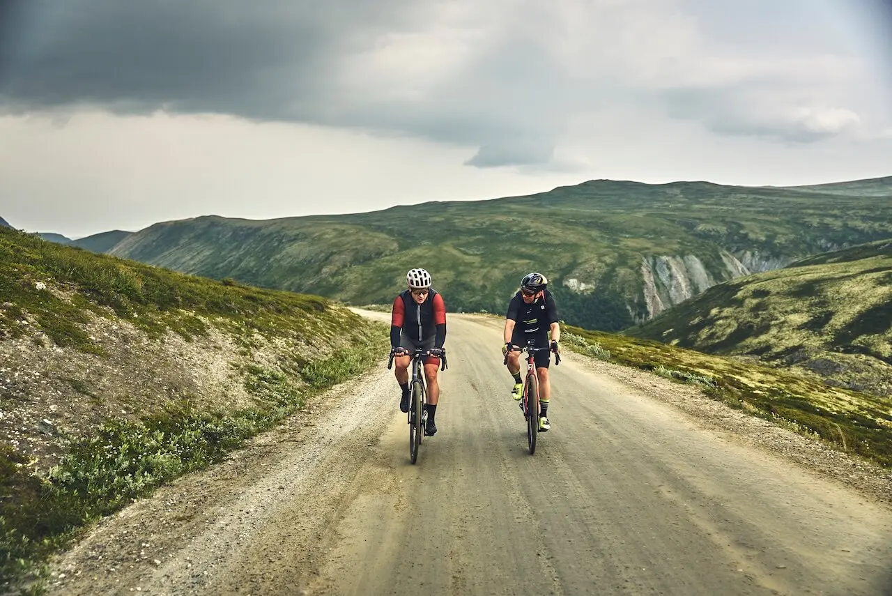

Tour de Dovre
La Nature Sauvage de la Norvège
Trois parcs nationaux se réunissent pour offrir une expérience de cyclisme sur gravier unique en Norvège.
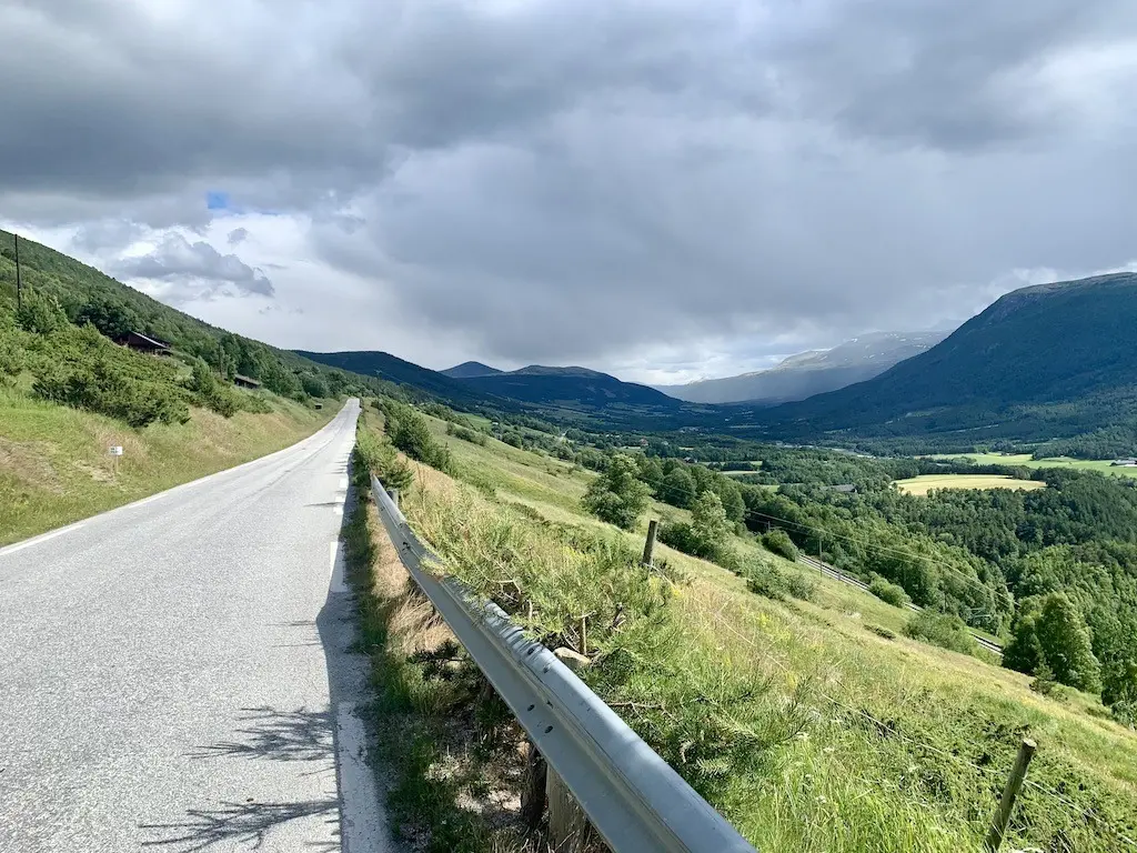
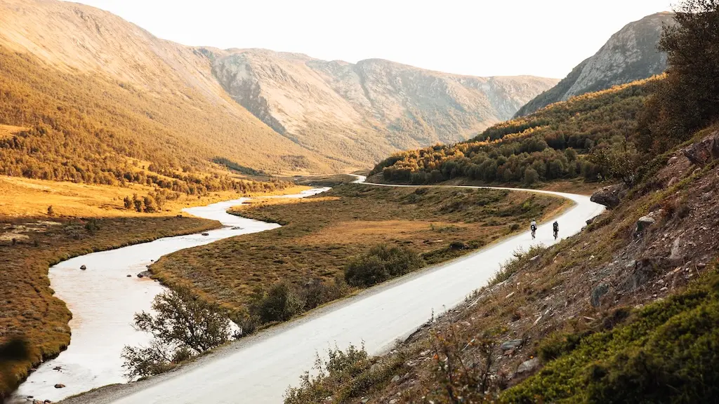
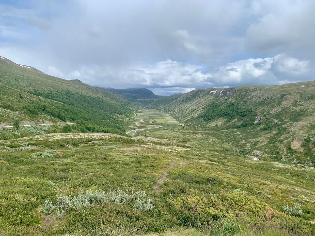
Une Vallée Alpin Verdoyante et Vivante
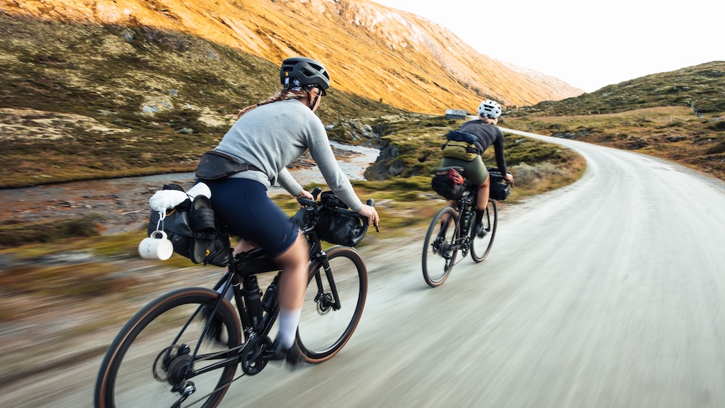
Embarquez pour une remarquable aventure à vélo le long du sentier de Dovrefjell, serpentant à travers le cœur de trois parcs nationaux spectaculaires : Rondane, Dovre et Dovrefjell. Traversez des paysages de montagne impressionnants, des paysages paisibles et la charmante vallée de Grimsdalen, célébrée comme l'une des plus belles régions agricoles de Norvège. Découvrez un côté plus tranquille et intact de la Norvège, loin des routes touristiques animées de la côte ouest.
L'itinéraire offre une flexibilité, vous permettant d'adapter votre voyage en fonction de la distance que vous souhaitez parcourir à vélo et de l'endroit où vous souhaitez passer la nuit. Que vous optiez pour une balade tranquille ou un coup de pouce électrique avec un vélo, le choix vous appartient. Le sentier du parc national entre Dombås et Hjerkinn est particulièrement adapté aux familles, offrant une expérience sûre et pittoresque. Pour un week-end d'évasion ou une exploration plus approfondie de Dovrefjell, vous pouvez combiner le vélo avec des activités uniques telles qu'un safari aux bœufs musqués, une balade à cheval sur des chevaux islandais, ou l'ascension de l'emblématique mont Snøhetta. Le long du sentier, vous trouverez de nombreuses occasions d'aventure et des endroits douillets pour manger et vous reposer, garantissant un voyage inoubliable en pleine nature.
Changements d'accès possibles à partir de 2026
Les autorités environnementales prévoient de nouvelles mesures de protection des rennes sauvages dans les régions de Dovre et de Rondane qui pourraient affecter des parties de la Tour de Dovre itinéraire à partir de 2026. Plusieurs chemins de gravier utilisés dans la boucle, dont Grimsdalsvegen et Haverdalsvegen, pourrait être soumis à des restrictions saisonnières ou à un accès cyclable limité, particulièrement pendant la période de vêlage des rennes au début de l'été. La majeure partie de l'itinéraire restera probablement ouverte aux cyclistes après 18 juin, mais avec des règles de camping plus strictes et des saisons d'exploitation plus courtes pour les refuges DNT. Cycle Norway mettra à jour cette page une fois que les réglementations finales seront confirmées par le conseil du parc national Dovrefjell et Rondane.
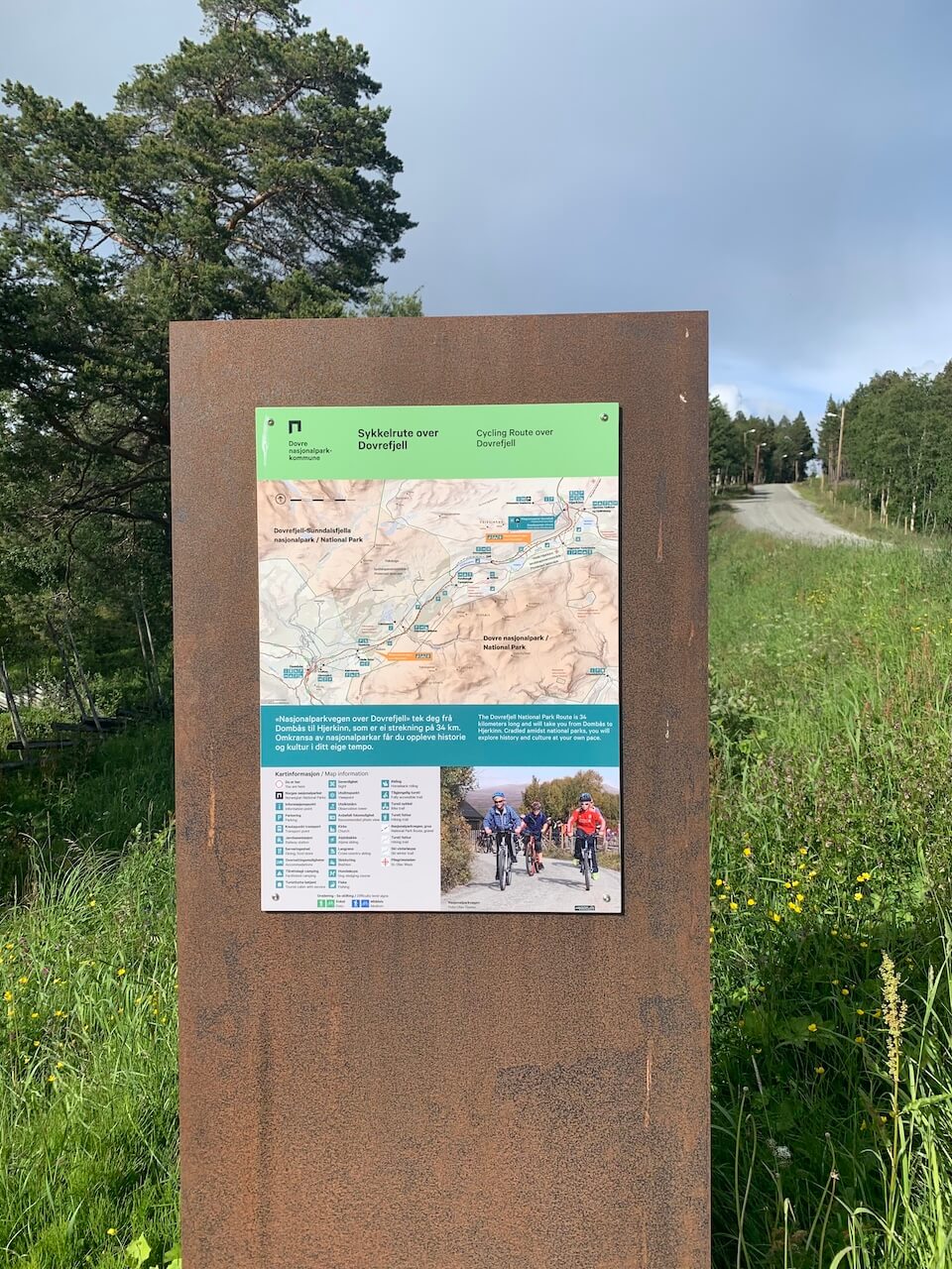
Carte
Dombås to Hjerkinn – 30km / 234m
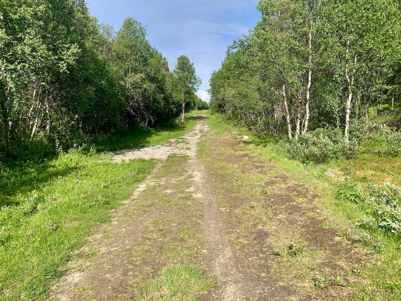
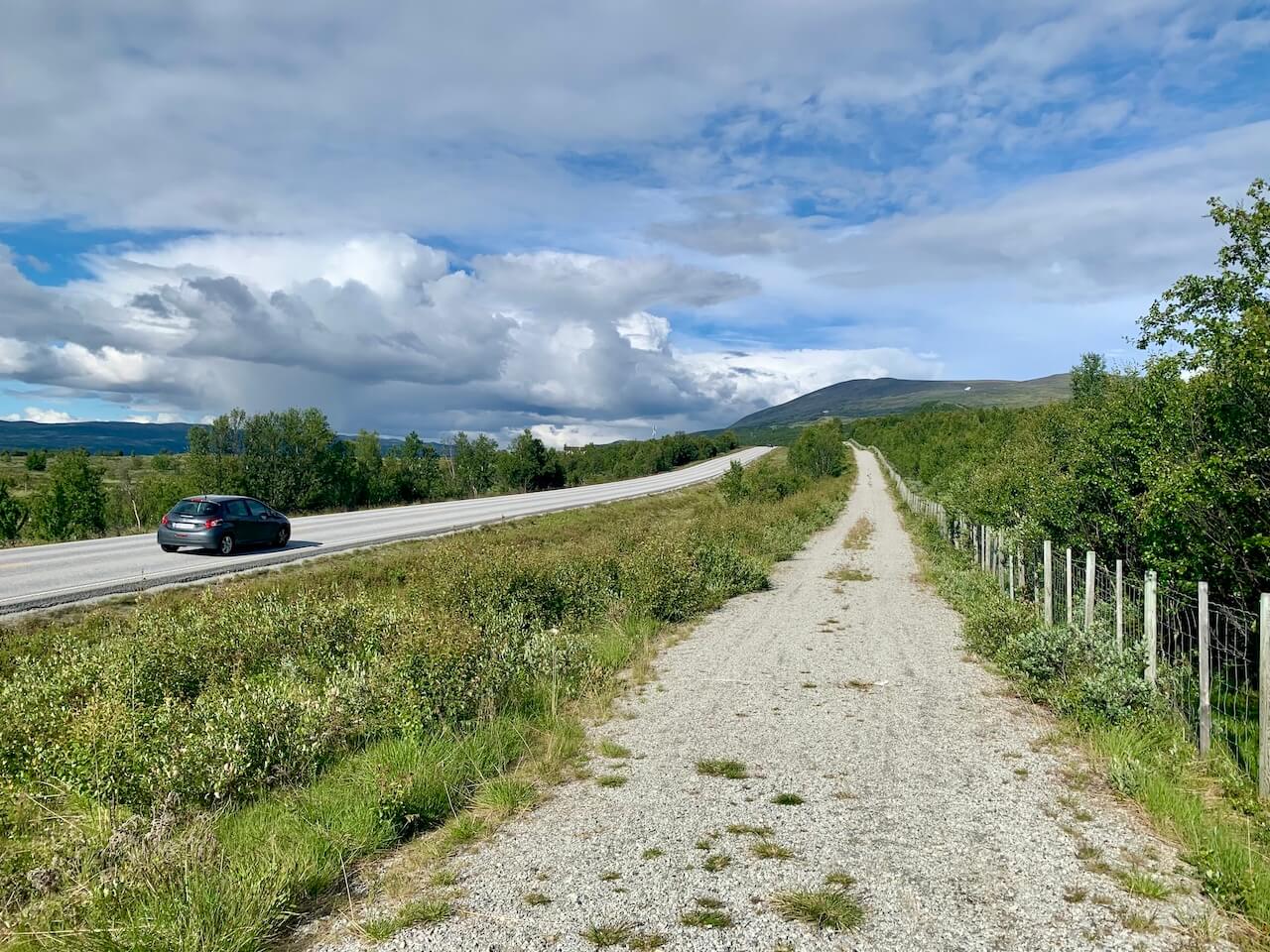
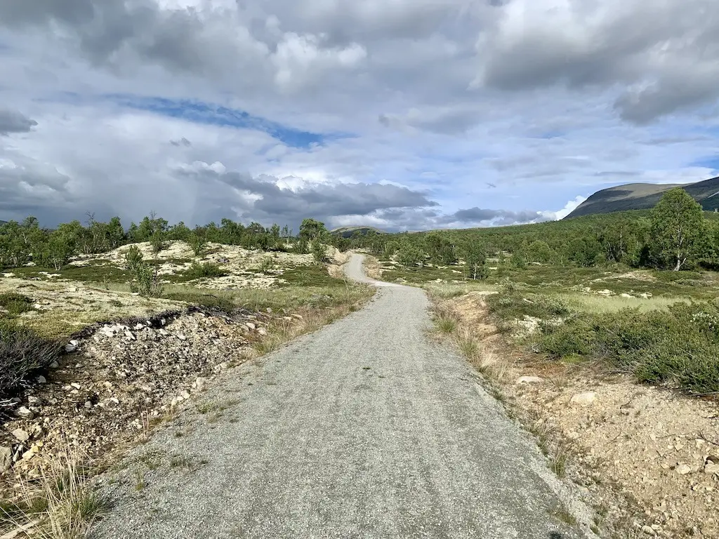
To begin your journey from Dombås town centre, follow the footpath leading up to Trolltun Gjestegård. This first part is tough to cycle and not the perfect way to introduce you to the route. After a small struggle on a poor grassy farm path, you will eventually reach a better surface where it flattens out. From there, you can join the National Park Trail (Nasjonalparkvegen), a dedicated hiking and cycling route that runs parallel to the main E6 road. This trail is free of motor traffic and features a well-maintained gravel surface, making it ideal for cycling. Along the route, you will find various accommodation and dining options, including the Furuhaugli Turisthytter.
Upon reaching Hjerkinn, continue cycling for a few hundred metres along County Road 29, where the route picks up again on Kvitdalsvegen, starting from Hjerkinn Fjellstue og Fjellridning (Hjerkinn Mountain Lodge and Mountain Riding).
Hjerkinn og Grimsdalen – 30km / 293m
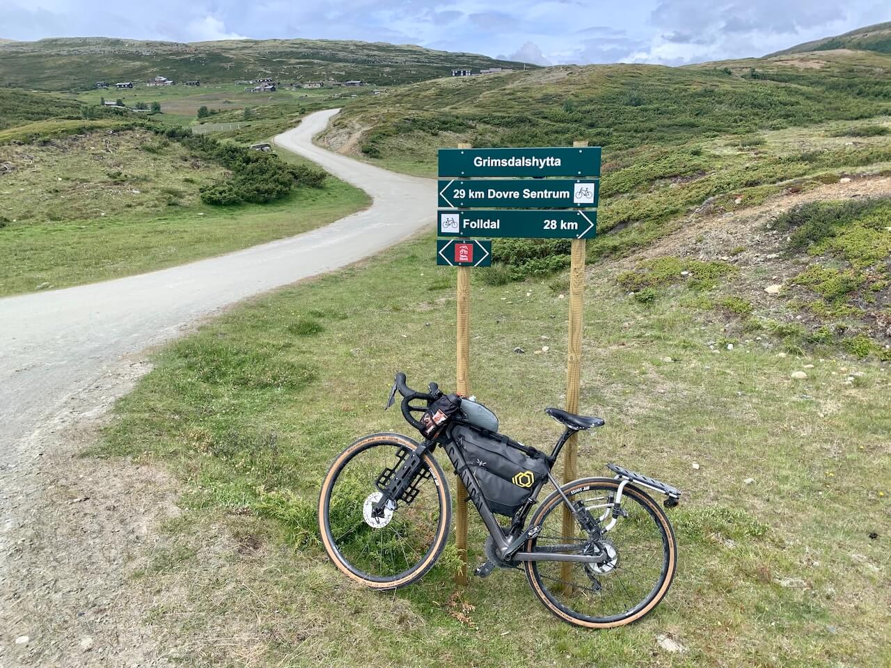
From Hjerkinn, we recommend taking the route via Kvitdalen, a unique alpine pasture valley located to the north. This scenic area offers exceptional natural experiences, with gravel roads and wide paths ideal for cycling. For those seeking a shorter route, you can opt to follow County Road 29.
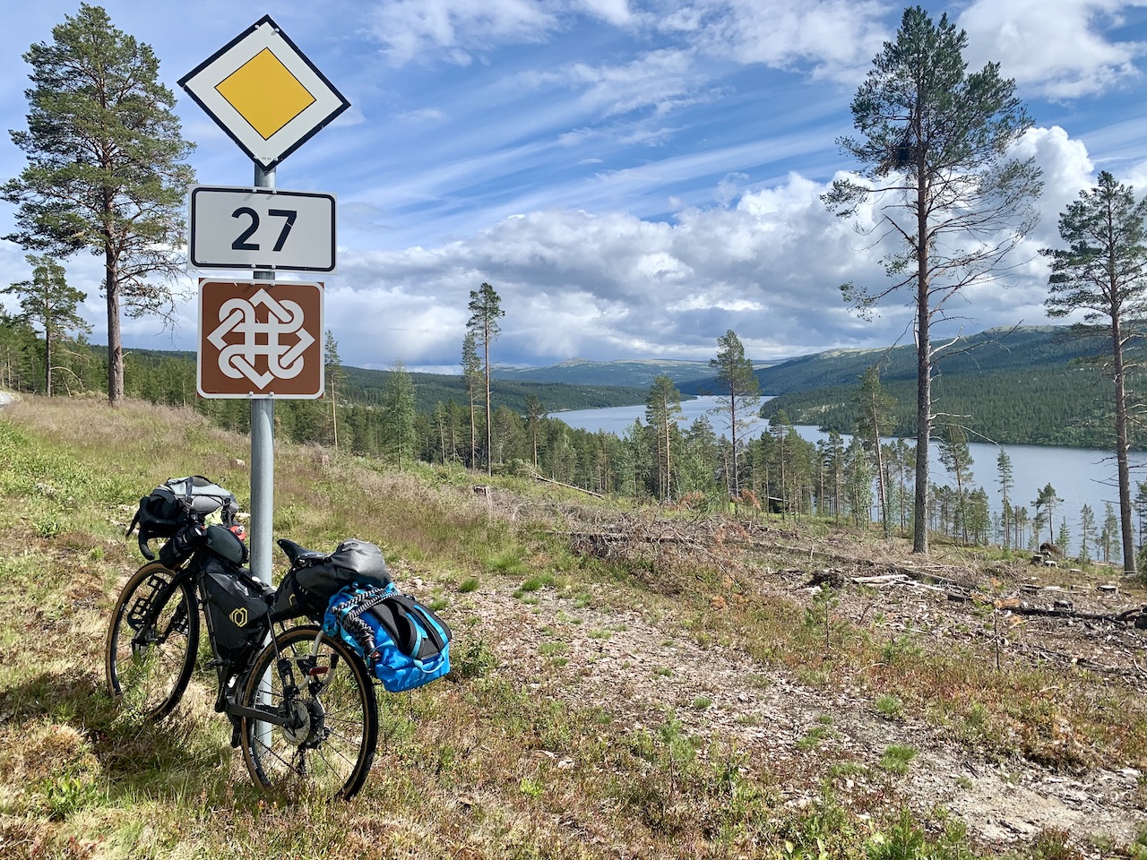
Regardless of your choice, you will need to continue along County Road 29 towards Folldal. While this paved road does have some traffic, it still offers beautiful views of the surrounding landscape, and there are plenty of opportunities to stop and enjoy the scenery. From Folldal, follow the paved National Tourist Route/County Road 27 towards Grimsdalsvegen where the gravel begins again and some gentle climbing up onto the alpine pastures
Grimsdalshytta to Dovre – 40km / 242m
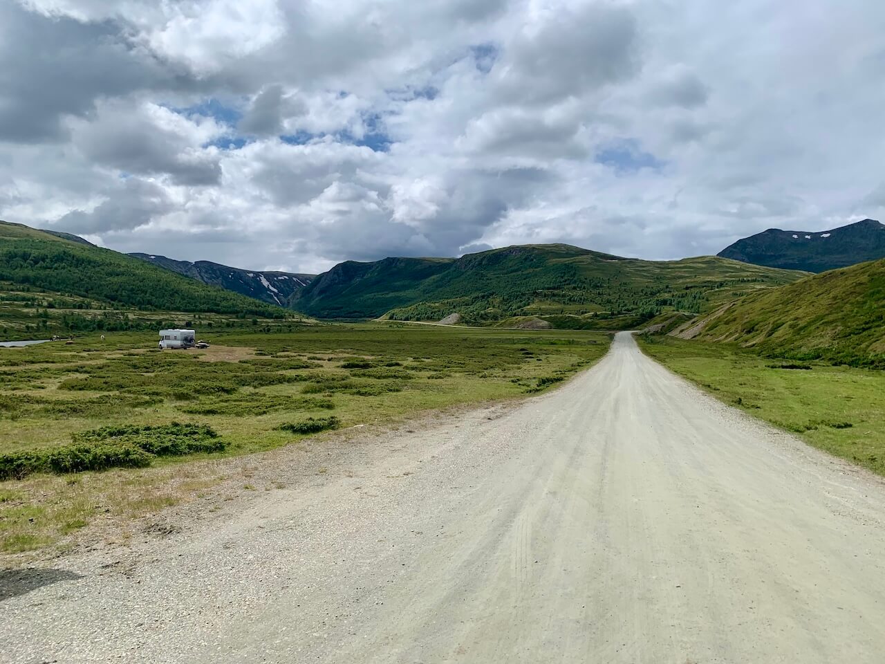
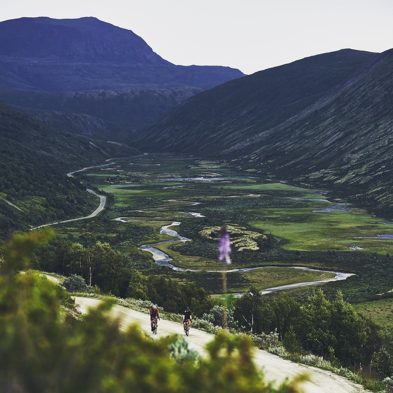
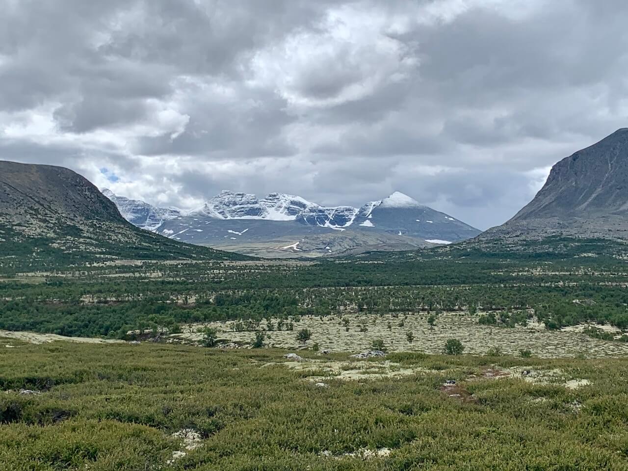
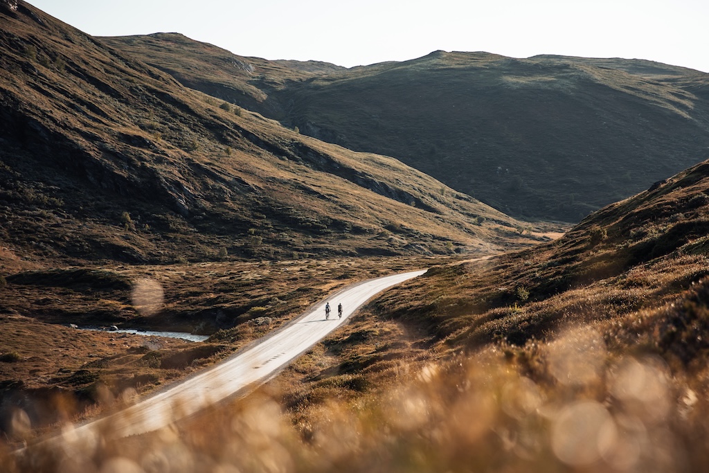
The journey through Grimsdalen is truly breathtaking. As you cycle along the gravel roads, you’ll be treated to panoramic views of the Rondane mountain range. Grimsdalen is an active alpine pasture valley, with the Grimsa River gracefully winding through the landscape. There are plenty of excellent spots for both short and long breaks along the way. Facilities, such as outdoor toilets, are available at Grimsdalshytta et Pundarvangen camping sites.
From the road barrier at Eftansåe, it’s a fast descent all the way to Dovre town centre. Take care descending, and watch out for livestock in the middle of the road. After reaching Dovre, follow the footpath to Toftemo, or if you prefer, you can cycle along Solsidevegen to Dombås.
From Dovre to Dombås 12km / 179m
You can cycle along Solsidevegen (County Road 491) from Dovre to Dombås, which is accessible by turning off just before reaching Dovre town centre from Grimsdalen. Follow this county road until it meets the E6, where a footpath will guide you for the final stretch into Dombås town centre.
Alternatively, you can start on Solsidevegen from Toftemo, or take Baksidevegen (County Road 497), which continues from Toftemo. Both are paved side roads running parallel to the E6, offering several scenic spots to enjoy along the way. Note that Baksidevegen includes a steep climb before you reach Dombås town centre.
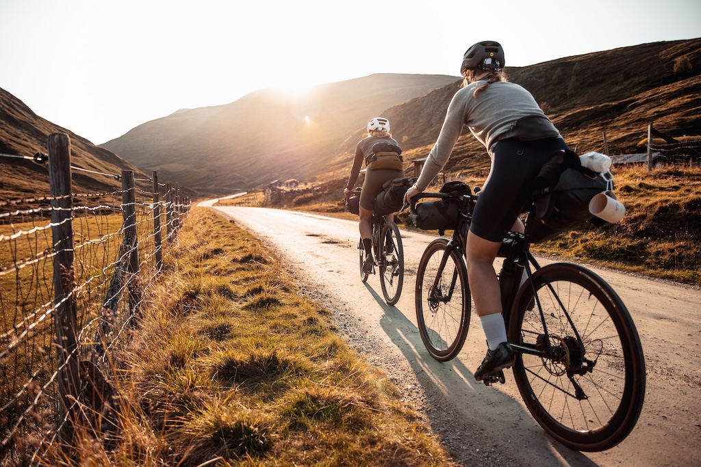
Galerie

I’ve cycled the Tour de Dovre several times, and it showcases a side of Norway that too few international visitors get to see. We locals cherish the authenticity of this region, where history, tradition, and nature blend seamlessly.
Difficulté de la route
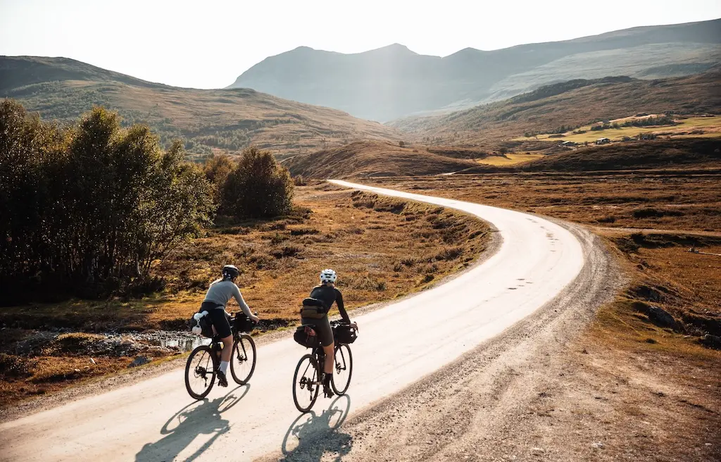
If you start the route clockwise toward Hjerkinn, the initial stretch is relatively flat, with the exception of a short climb out of Dombås. The real ascent begins as you enter the Grimsdalen alpine valley. This climb is long and gradual, with few steep sections, making it manageable for most fitness levels. However, weather conditions in this region can change rapidly. Strong winds and sudden downpours are common, which can significantly increase the difficulty of the ride.
The descent from the mountain is steep and fast but requires caution due to potholes and uneven road surfaces. Less experienced cyclists should approach this section carefully and stay alert to their surroundings. The final leg back to Dombås is fairly comfortable, especially if you choose the Solsidevegen road, which offers a smoother and easier ride.
This route is suitable for a wide range of cyclists, from beginners to seasoned riders. It’s also family-friendly, with many families, including those with young children, often seen cycling parts of the trail.
For further reading on this fantastic route, be sure to check out our blog post: Tour-de-dovre-a-journey-through-three-national-parks
Some photos for this page are kindly supplied by Fara Cycling
Cabin Detours
Télécharger GPXFor those looking to extend their journey, consider cycling two picturesque gravel roads (deadends) that lead to charming tourist cabins. These cabins offer both accommodation and meals, making them perfect for a restful stopover. Advance booking is highly recommended to secure your stay. From these cabins, you can embark on a variety of hiking trails that venture deep into Rondane National Park, offering spectacular views and opportunities to explore the region’s natural beauty.
Snøhetta Gravel Experience
Télécharger GPXDetour from Hjerkinn – One of Norway’s most iconic mountains (Snøhetta) is located in the remote and pristine Dovrefjell-Sunndalsfjella National Park, an area known for its strict conservation policies. This region serves as a breeding ground for wild reindeer during parts of the seasons. However, from June 1st to July 15th, cyclists have a limited window to explore the Snøheimvegen and Vålåsjøhøvegen gravel roads within the park. Outside of this period, cycling is prohibited, and electric bikes are not permitted at any time. Additionally, cycling is not allowed on the trail leading to the SNØHETTA viewpoint—visitors must park their bikes and walk the short distance to enjoy the view. If you’re in the area at this time, these are roads well worth experiencing!

If you enjoy hiking mountains, then Snøhetta (2286m), Norway’s highest free-standing mountain, should be on your list!
- Good Information brochures can be found here:
Seterveien
Télécharger GPX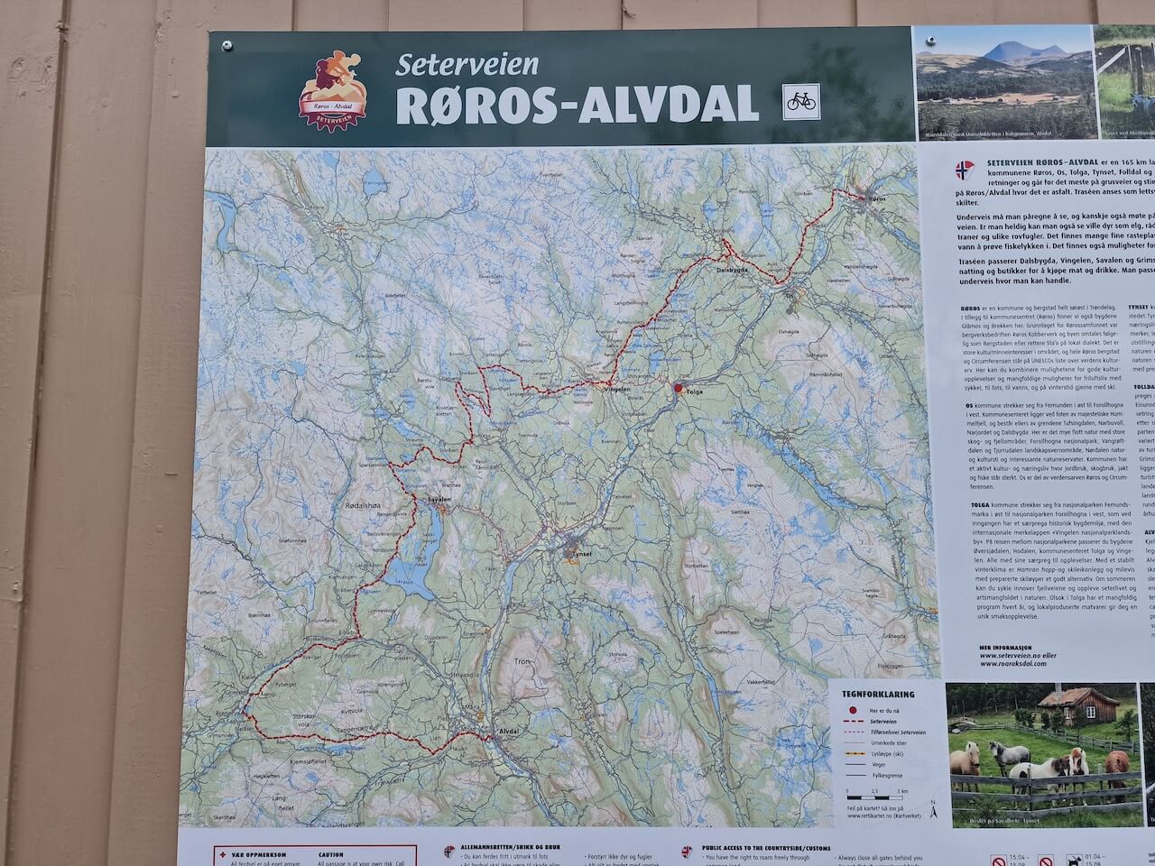
From Hjerkinn continue the journey on gravel following the famous Seterveien route (The Pasture Road). The route takes you through verdant valleys, lush forests, and open mountain plateaus, with expansive views of Norway’s tranquil rural heartland. The area is especially known for its idyllic summer farms and grazing areas, giving cyclists a glimpse into traditional Norwegian pastoral life. The route ends in Røros where trains can take you to Trondheim or Oslo (vier Hammar).
Combine ‘The Big 3’
Télécharger GPXAfter completing the Tour de Dovre loop from Dombås you can take a famous gravel mountain road (Slådalsveien) over to Vågåmo and then onwards on quiet gravel roads to Mjølkevegen and Rallarvegen, ending in Flåm. This allows you to complete ‘Norway’s big 3’ routes!

Points forts
- Grimsdalen Valley: Known as one of Norway’s most beautiful mountain valleys, Grimsdalen features flat, scenic gravel paths surrounded by cultural landscapes and active farmsteads. You’ll find dining and accommodations like Grimsdalshytta along the way
- Point de vue Snøhetta: This iconic viewpoint provides breathtaking views of the Dovrefjell-Sunndalsfjella National Park. You can take a detour to explore the area on foot, as bikes are not allowed on the hiking trail to the viewpoint
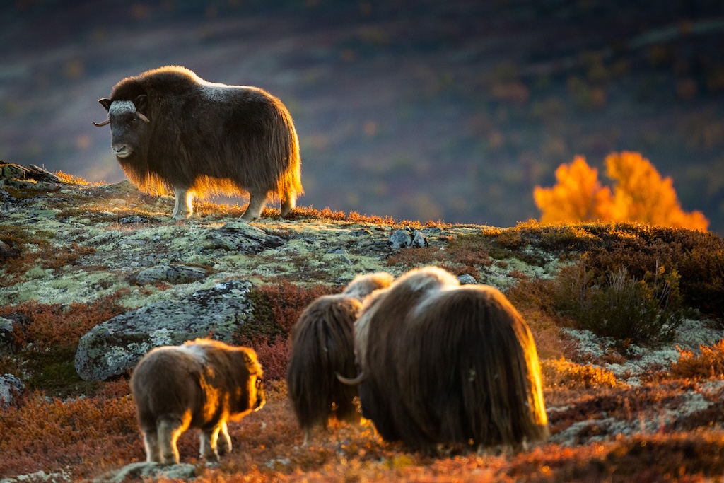
- Musk Ox Safaris: At Hjerkinn, you can join a guided musk ox safari to spot these unique animals in their natural habitat
- Horseback riding from Hjerkinn fjellstue & Fjellridning
- Folldal Mining Museum: This historic site offers a glimpse into the region’s mining history and is a popular stop along the way
- Scenic Cycling Paths: The route includes a newly built 32-kilometer cycling road between Dombås and Hjerkinn, free from motorized traffic. Most of the 130-kilometer loop is on gravel, with some asphalt stretches
- Cultural Experiences: The tour passes through areas like Haverdalen, where traditional farming methods are preserved, and offers opportunities to taste locally made sour cream and cheese
- Norway’s Smallest Brewery – Furuhaugli Nanobryggeri


À savoir
- Se rendre ici et en repartir :
- Dombås & Hjerkinn: Both are well-connected by the Oslo – Trondheim Rail line. The company that runs this line (SJ) has a poor bike storage system with limited space. You should book your tickets well in advance to ensure a space for your bike. If easier rent a bike on arrival (several options see below).
- Åndalsnes: Le célèbre Rauma train service goes from the tourist town of Åndalsnes to Dombås. Bikes are allowed onboard without pre-booking.
- Quand partir : The route can be best cycled from mid-June to September. If it’s been a mild winter, the road may be clear of snow by early June, but it can be damp and difficult to cycle on. Usually, parts of the road are repaired when it’s dry enough, as winter can damage sections.
- Where to Start: If you plan to cycle further east on one of the routes mentioned above, start in Hjerkinn. For all other options, it is best to start in the large town of Dombås and head clockwise.
- Parking:
- Dombås – you can park at Dombås ski lifts, right next to Trolltun.
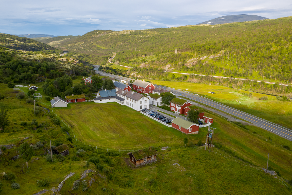
- Hjerkinn – At Hjerkinnhus Hotel or Hjerkinn Fjellstue og Fjellridning and at the train station (fees may be applicable).
- Nourriture et provisions : Dombås, Hjerkinn, Folldal, Dalholen, and Dovre are the five main areas with supermarkets (See POI map). Food is sold at some cabins and hotels along the way, such as Grimsdalshytta et Hjerkinn fjellstue & Fjellridning, but check opening times on websites.
- Eau: It should be very easy to find water along the route. There are fast-flowing streams and rivers throughout the journey but I would advise from filling water in farmland due to possible pesticide contamination. The several villages and towns you pass will have access to tap water.
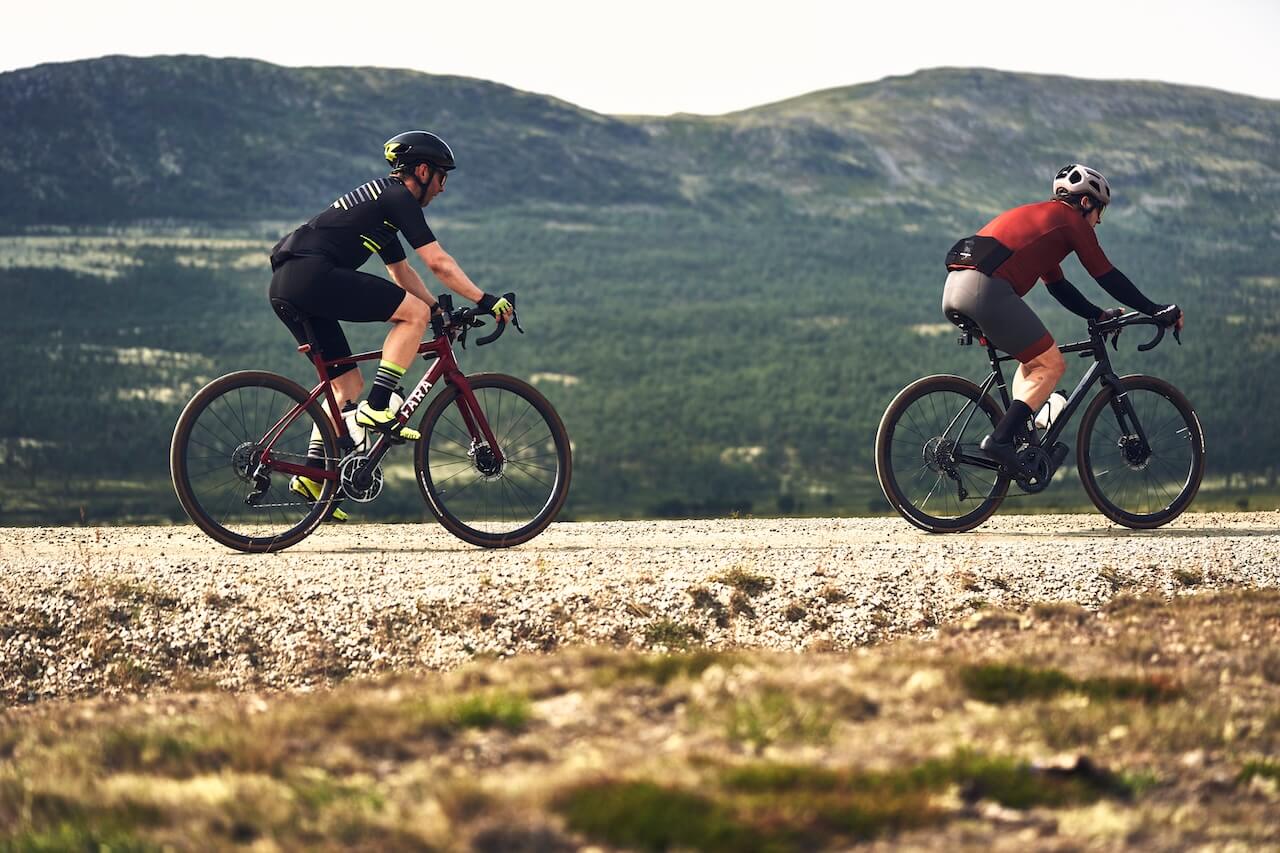
- Type de vélo : A Gravel, Touring, or Mountain bike is recommended for this route. I know people who have cycled with a road bike (26-28mm road tyres). I wouldn’t recommend it, but it is possible (mainly hard-packed gravel). There is some climbing on this route – the more gears, the better.
Bike Rental Locations:
The bike rental system for the route is very well set up and makes it easy to pick up in one location and drop off in another should you decide to cycle only part of the route. The main office is situated 100m from Dombås train station and offers Mountain and E-bikes to rent.
- Contact Information: Dovrefjell Adventures (see website for price)
-
- Address: Nordre Stasjonsveg 26, 2660 Dombås
- Phone: +4745 45 66 33
- Email: [email protected] ou [email protected]
- Web: https://www.dovrefjelladventures.no/en/rent-a-bike
- Bikes can be picked up or dropped at these Cabins/Hotels en route.
- Bike Shop/Workshop: Dombås has a sports shop with a bike mechanical workshop – Dombås Sport 1
- Full Tour De Dovre Cycling Package: Have everything booked and planned for you including luggage transport. This will be of course more expensive but very convenient.
- Toilet Access: There will be access to toilets in Dombås, Dovre, Snøheim Lookout, Hjerkinn, and all cabins and hotels along the route.
- E-bike Charging Options: You can charge your bike in Dombås (Cafe, Supermarket, & Gas station), Dovre (Cafe & Gas Station, Supermarket), Folldal (Supermarket & Cafe), Dalholen (Gas station & Small food shop), and all campsites, cabins and hotels along the route.
- Fishing Opportunities: There are many rivers to fish from with a paid licence (10 Euros for 1 day). Read more and order ici.
- Mobile Phone Coverage: Mobile coverage is available along most of the Tour de Dovre route. However, there are areas with limited or no signal, including Grimsdalen, Kvitdalen, and a few other short sections. Additionally, certain detours may lack mobile coverage entirely. It’s recommended to download offline maps and inform someone about your itinerary if you’re cycling through these remote areas.
- Use of a Drone: Drone use is allowed in certain locations along the Tour de Dovre for photography and filming. However, some sections of the route pass through protected landscapes where drone flying is prohibited without special permission. To ensure compliance, check regulations and permitted areas through the Civil Aviation Authority of Norway’s website. For detailed maps showing where drone flying is allowed, visit safetofly.no. Always respect local rules to preserve the natural environment and avoid penalties.
Hébergement
- Camping sauvage: The Tour de Dovre offers a truly remote and wild experience, with minimal infrastructure outside the towns and villages you pass through. This makes it ideal for peaceful wild camping at various points along the route. If you choose to camp near a mountain farm, be sure to follow all local regulations and guidelines (refer to the linked rules below). Alternatively, some mountain cabins allow wild camping nearby and provide access to their facilities for a fee, offering a balance of adventure and convenience. NOTE: Wild camping may be heavily restricted along the route in 2026. Please pay attention to any signs.
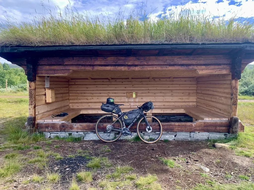
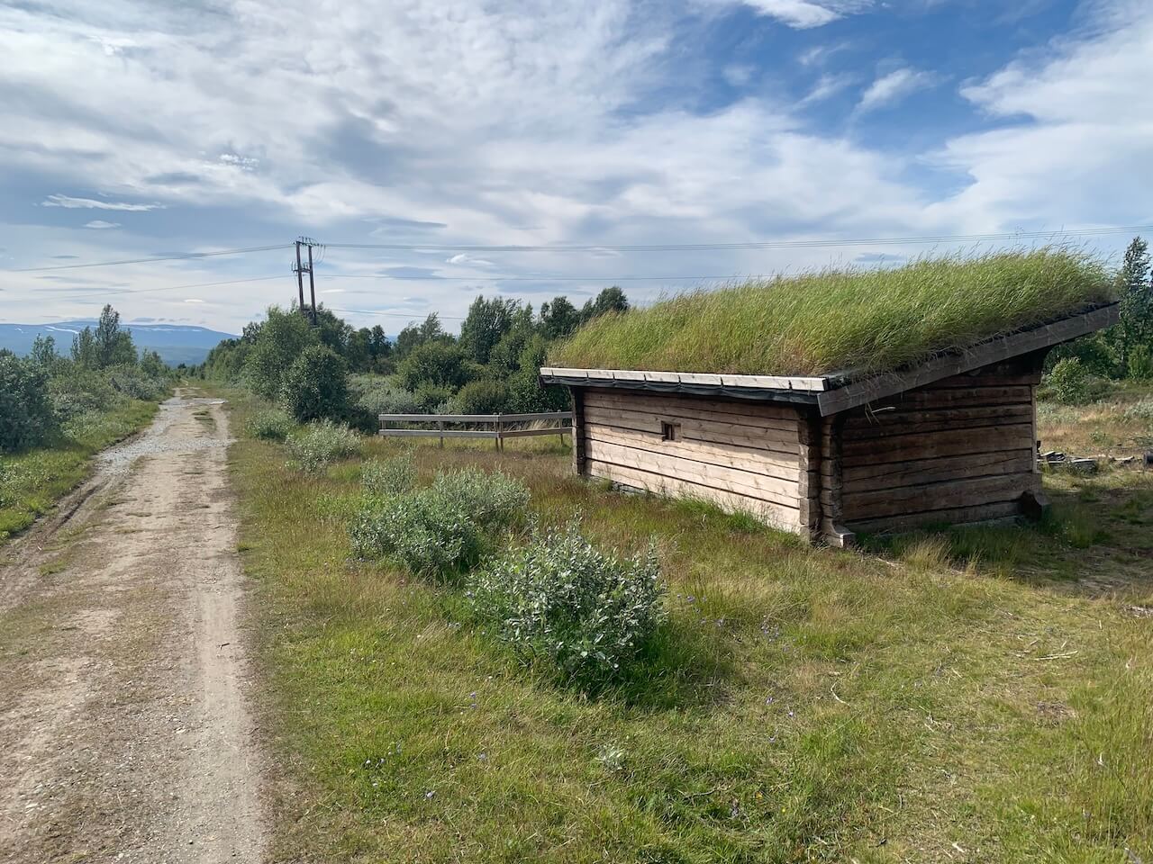
- Abris gratuits: There are several free shelters along the route. Please use the POI at the top of this page to see locations.
- Campsites: There are several campsites around the Dombås and Dovre area. There are also campsites at Hjerkinn and Dalholen. See the POI map at the top of this page to see locations. We recommend the Application Norcamp to discover all campsites in Norway.
- Airbnb: there are some Airbnbs in Dombås and other populated areas. but these are mainly guesthouses that advertise on all major accommodation platforms.
- Hotels and Mountain Cabins:
- There is plenty of accommodation all around this route. Dombås is a popular town for skiing and outdoor activities and offers all types of options:
- Others:
Vidéo
Transport
Trains:
- There are train stations at Dombås, Dovre, et Hjerkinn, which all run on the Oslo – Trondheim line, which goes to Oslo Gardermon Airport. You can book a ticket and bike space using entur.no. Note the bike capacity on this line is limited to 5 bikes and can get fully booked quickly.
- Åndalsnes: The renowned Rauma Railway connects the picturesque tourist town of Åndalsnes to Dombås, offering a convenient travel option for cyclists. Bikes are permitted on board without the need for pre-booking; however, space may be limited during busy periods. For those looking to extend their adventure and tackle the iconic Trollstigen climb after completing the Tour de Dovre, this train provides direct access to Åndalsnes, serving as the ideal gateway for your next cycling challenge.
Ferry: There are no ferries on this route
Bus From Dombås to Folldal you will find buses running on the main roads and easy to jump on at village/town if you have a mechanical, etc. Innlandstrafikk is the main bus company that is in operation in this area. You can discover their timetables and routes here. Many of the local buses will allow a bike on board (pay child fare). Some long-distance buses may refuse bikes.
Sécurité
Animals
- Livestock: This route is alive with livestock, so expect some close encounters with animals along the way. Cows may linger in the middle of the road, often unbothered by cyclists, while sheep can appear suddenly and dart across your tracks.
- Musk Ox: The region is renowned for its Musk-Ox sightings, though these magnificent animals tend to avoid human settlements and infrastructure. If you do encounter one, it is crucial to maintain a distance of at least 200 meters to ensure safety. Musk oxen can become highly aggressive if they feel threatened, especially when protecting their calves. Detailed safety guidelines and more information about these unique creatures can be trouvé ici.
- Moustiques will also be present during peak summer, especially around lakes and when wild camping.
- Reindeer: wild reindeer, golden eagles, and wolverines are all present in the national parks surrounding the route.
Tunnels
There are no tunnels on this route
Routes bondées
The Tour de Dovre is generally very safe for cycling, but riders should be aware of occasional tourist traffic on gravel roads, particularly in areas like Grimsdalen. The initial segment of the route runs alongside the E6 on a dedicated cycle path designed for safety. It is strongly recommended to remain on this purpose-built track and avoid cycling directly on the E6, as the main road has a high speed limit of 110 km/h and lacks a suitable shoulder for cyclists. Prioritizing the designated cycle paths ensures a safer and far more enjoyable ride.
Le temps
The weather conditions along the Tour de Dovre cycling route can be unpredictable and challenging at times due to its location in Norway’s highland terrain. The area can experience sudden weather changes, including strong winds, localized rain showers, and rapid temperature shifts. Always be prepared for both sunny and cold, wet conditions, even during summer. Snow can linger on higher-altitude sections into late spring/early summer, and autumn may bring frost. Open sections like the Dovrefjell plateau are particularly prone to strong winds. These can significantly increase the difficulty, especially on uphill sections or descents.
Lectures complémentaires
Conditions d'utilisation
Garder à l'esprit

Tous les itinéraires de cyclisme publiés sur CYCLENORWAY.com sont simplement une ressource de planification à utiliser comme source d'inspiration en conjonction avec votre propre diligence raisonnable. Toutes les directives d'itinéraires ont été préparées dans le cadre d'une recherche diligente. Cependant, nous ne pouvons jamais assurer avec certitude l'exactitude complète des itinéraires. Le cyclisme en Norvège est généralement très sûr. Néanmoins, si vous choisissez de parcourir cet itinéraire, vous le faites à vos propres risques.
-

Vérifier les conditions météorologiques
Nous vous conseillons de vérifier les conditions météorologiques le long de votre itinéraire et de surveiller les fermetures de routes ou de chemins.
-

Télécharger correctement les fichiers GPX
Découvrez cette vidéo utile pour voir comment les itinéraires peuvent être téléchargés sur votre appareil mobile et votre ordinateur de cyclisme.
-

Ne dépasse pas ton niveau
Faire du vélo sur de longues distances est difficile, et vous ne devriez pas tenter des parcours qui dépassent votre niveau.
-
Camping sauvage
Respectez toutes les règles et réglementations lorsque vous campez en pleine nature.
-
Découvrir des inexactitudes ?
Si vous découvrez des inexactitudes sur cette page, veuillez nous en informer afin que nous puissions les corriger.
Connexion des itinéraires
Rallarvegen
Un voyage sur le plus haut plateau montagneux d'Europe du Nord – Des glaciers vous attendent !
- 79 km
- 85% non pavé
- 1-2 jours
- 6/10 difficulté
Route Historique de Gravier de Montagne

Mjølkevegen
Des centaines de kilomètres de routes de gravier bien tassé s'étendent sur de hauts plateaux de montagne, offrant des vues imprenables à 360 degrés.
- 225 km
- 80% non pavé
- 2-5 jours
- 7/10 difficulté
Lait, Vaches et Gravel Épique
Le Chemin de Compostelle
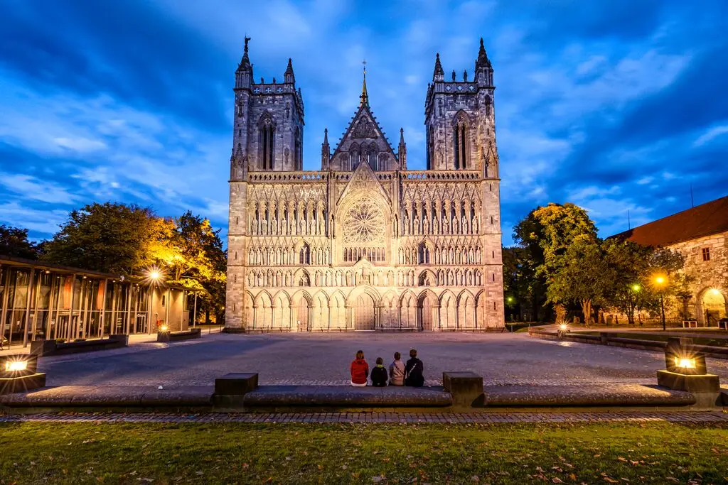
Il s'agit moins d'un itinéraire à vélo que d'un voyage dans le passé, où vous suivez les traces du grand roi viking de Norvège, Olaf II. L'itinéraire vous mène dans la vallée historique de Gudbrandsdalsleden et se termine à la cathédrale de Nidaros à Trondheim, vieille de 1000 ans.
- 798 km
- <10% non pavé
- 5-13 jours
- 5.5/10 difficulté
Suivez le roi viking