The old Copenhagen-Alta post road deep in the arctic tundra is a must for the intrepid bikepacker looking for wild gravel roads on the edge of Northern Europe.
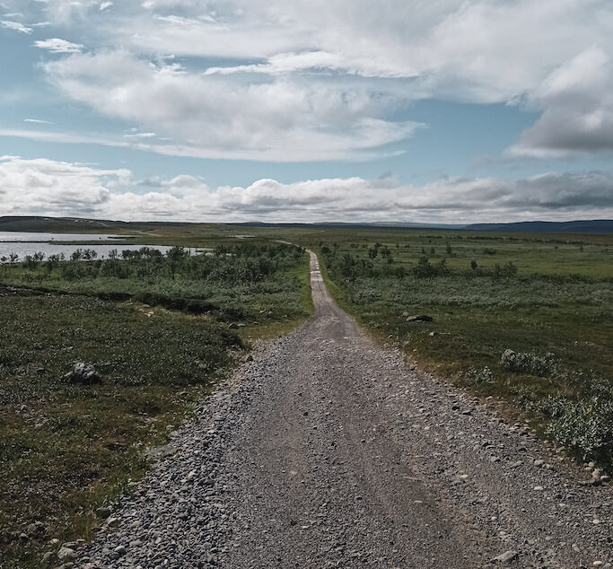
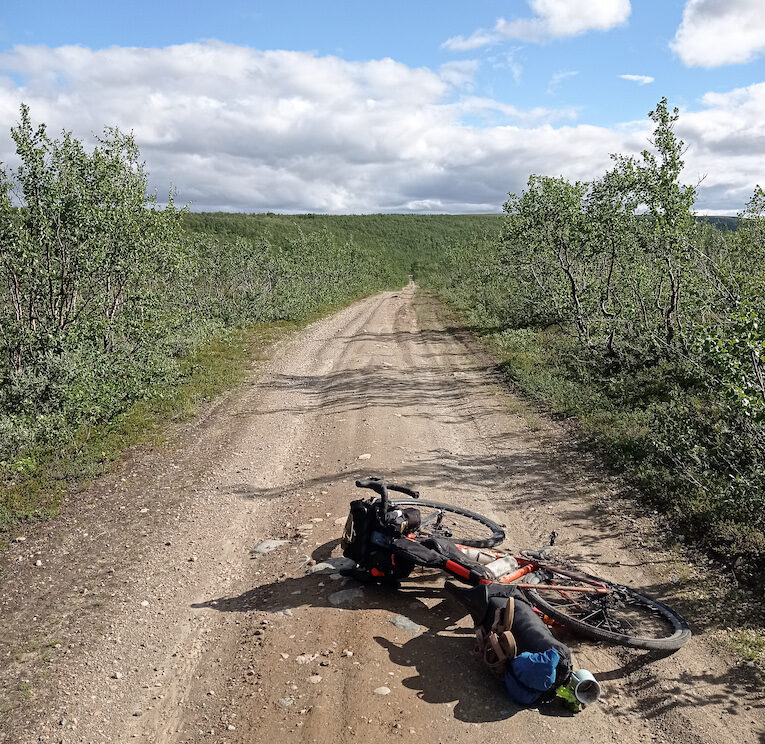
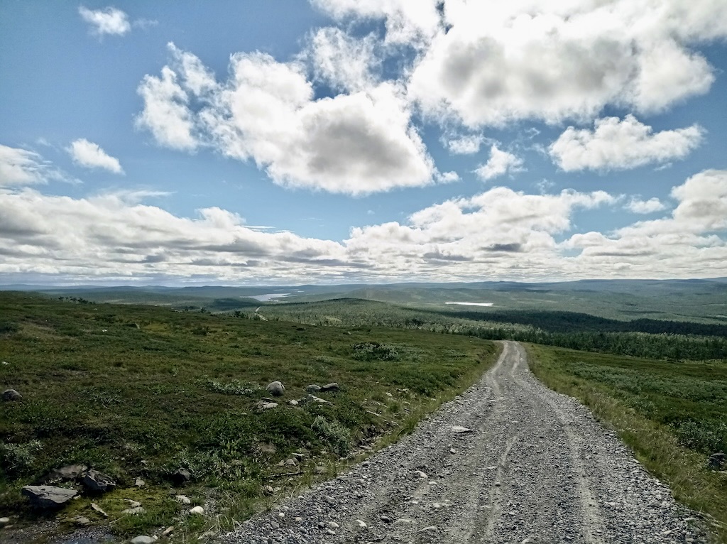
Providing you a great break from the hustle and the bustle of the big lorry roads in the north, the last stretch of the old Copenhagen-Alta post road takes you south from Alta to Kautokeino and further towards the Finnish border (or in the opposite direction). Picture a fine and friendly gravel road that lingers through open, rolling, and gentle Lapland terrain with views spanning far over the open Finnmark plateau.
The road was built in 1798 as part of the (then) newly established, and Finnmarks first land-based postal system connecting Torneå – Karesuando – Lepåpäjärvi – Kautokeino – Gargia and Alta. Nowadays, the road is mostly used by reindeer herders to access their lands, meaning it’s a wide and good 4×4 gravel road, however, with next to no traffic. You’ll be biking through a few of these herding areas, where it’s important you show respect to the local reindeer tradition – but might get a peek into the indigenous cultural traditions of the Sami.
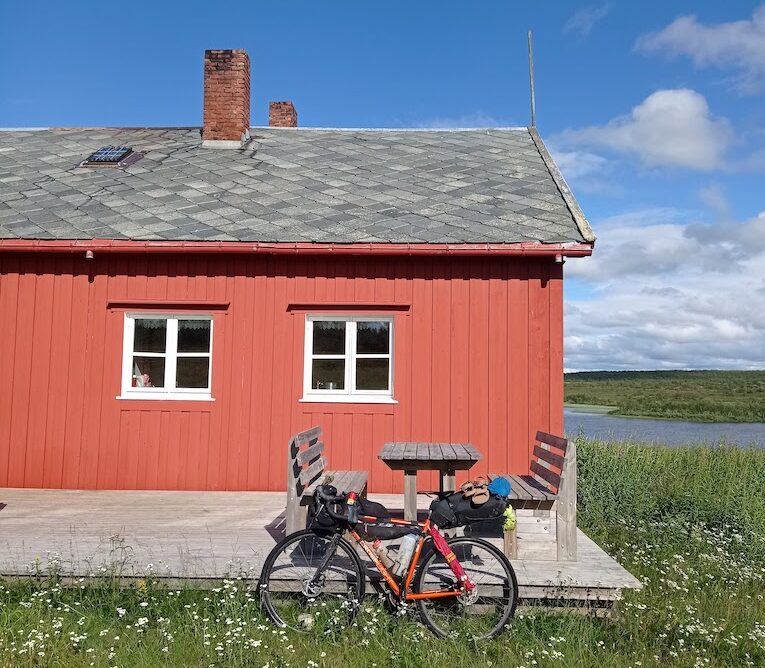
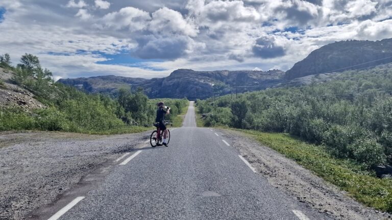
If you’re heading south, the route will take you along a gravel path west of Alta before you cross the E45 and follow a paved stretch towards Gargia Lodge. The lodge is a historical part of the route, being established in 1845 to provide accommodation for the post workers traveling north and south along the road. You can still book accommodation or stop for a Norwegian lunch at their restaurant when passing by.
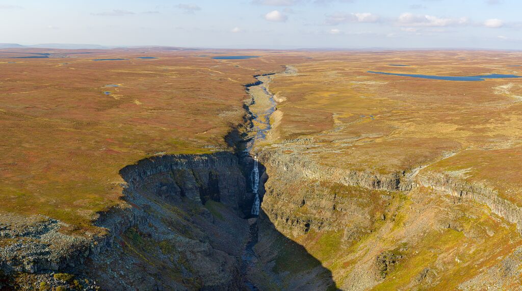
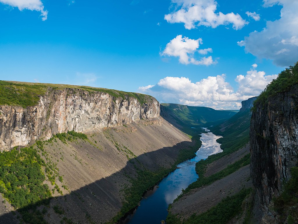
From the lodge forward, the surface changes into gravel and follows a 4×4 trail climbing slowly upwards towards the Finnmark plateau. Soon you’ll pass by the Alta Canyon “parkinglot” (small patches along the road where people leave their cars), from where you could follow a path to experience the Alta Canyon, Northern Europe´s largest canyon. Further along at the end of the canyon, you can access the Alta Dam and power plant, Norway’s highest concrete arch dam. The dam was built in the 1980s during highly controversial circumstances due to the project affecting Sami people’s reindeer herding areas and salmon migration in the Alta River.
Continuing on, when leaving the Alta Canyon crossroad behind you’ll not only leave behind most of the other tourists but also the feeling of infrastructure and proximity to civilization. Soon enough, the Finnmark plateau will open up and you’ll most likely only be accompanied by flocks of Reindeer and the occasional group of herders. You’ll come across at least two gates, fencing off reindeer areas – make sure you leave the gates as they were, open or closed!
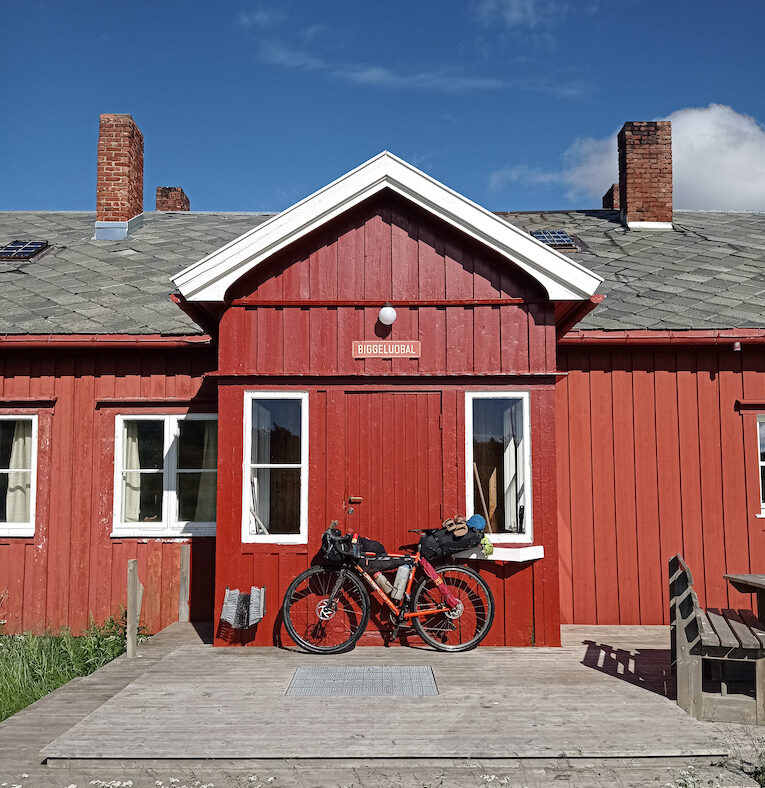
23 km further in, the route passes Suolovuopmi Lodge, another historical lodge founded in 1843 providing accommodation and food for far away travelers – 200 years of activity and counting. Here, you’ll cross the E45 once more and continue deeper into Finnmark along the same 4×4 track.
Committing to the next stretch, is exactly that, a commitment. As a bikepacker you’ve already accepted the risk of facing a problem and being in need of help. Up until now, this has not really been a rational risk, considering how densely populated the Norwegian west coast is. However, the route will now take you 10 – 20 km away from the only paved and trafficked road in the area (E45), and the next sign of civilization will be the city of Kautokeino, some 70 km further south (not entirely true, 15 km if you can take a left and follow a road out to Máze, a small town without accommodation or food shops). Make sure you are equipped with the tools and the knowledge would you face a mechanical or rough weather on your way.
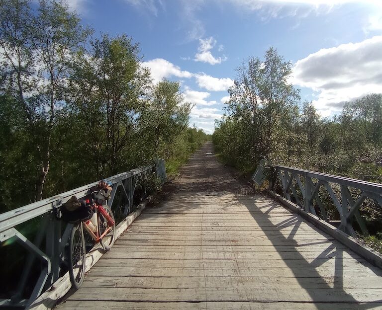
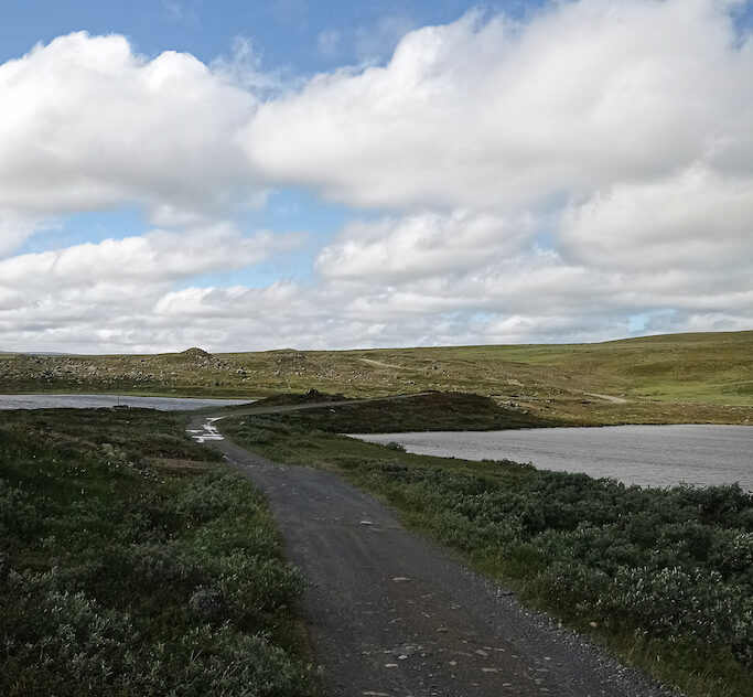
Gallery
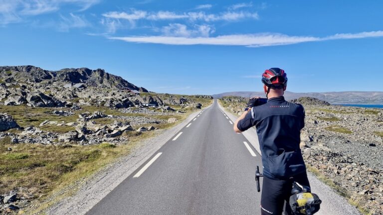
The silence, the rugged but fragile arctic flora, the perfect gravel road, the vast views, and rolling hills bathed in the midnight sun make this the true Arctic post road. Enjoy!
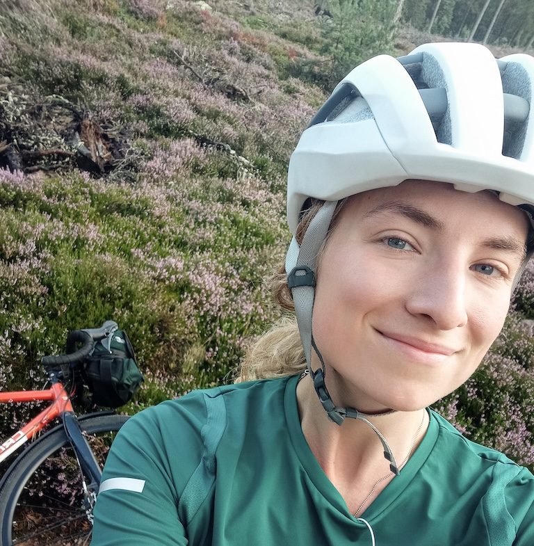
Karen Ekman, Finnish Bikepacker
Don’t let this scare you off though, you will not really be able to say you’ve experienced the Arctic without biking through Finnmark. It’s amazing in there – the silence, the rugged but fragile arctic flora and fauna, the perfect gravel road, the vast views and rolling hills bathing in the midnight sun, or moody in classic arctic weather. This is the true Arctic post road, enjoy!
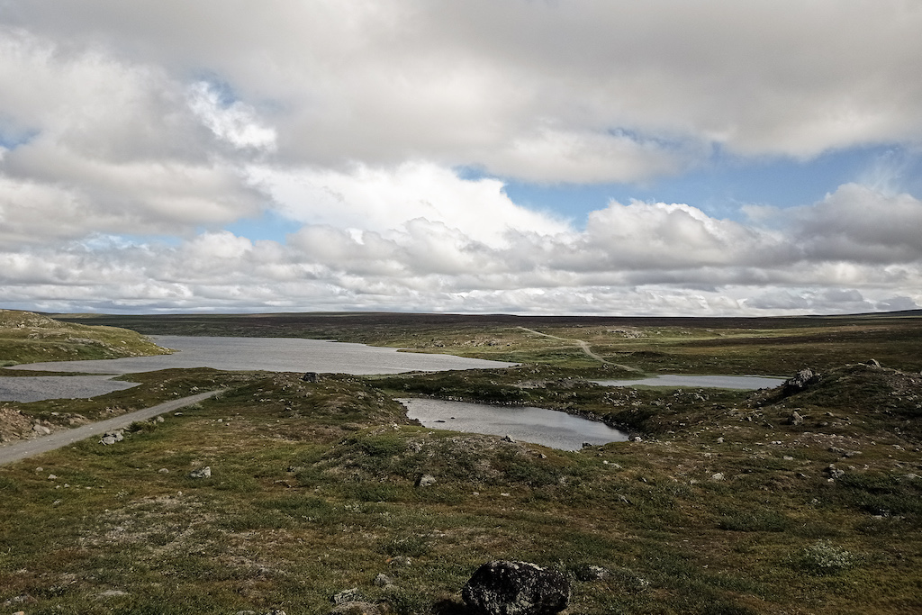
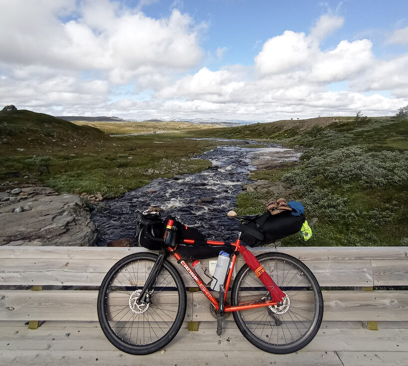
The next 70 km continues along the same 4×4 gravel road with plenty of possibilities for camping, lakes, and streams to refill water, and peace and quiet to gear down and bike at your own pace. Make sure to soak it all in, after reaching Kautokeino and crossing the Finnish border the open views will be intruded by forests surrounding you basically all the way down to the south of Finland.
Remember once you reach Kautokeino you can join onto Cycle Route 8 (Finnmarksruta) which goes all the way to the russsian border.
Difficulty of Route
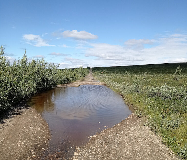
We have given this route a difficulty of 5 out 10. There is a long climb after 25km that goes on for some kilometers. After that, there are only small ups and downs on rough gravel track. The road can be covered in large pools of water in places and in bad weather the route will be a lot harder than 5 out 10. We advise you to check weather forecast before setting off and ensure you have the right gear to handle any conditions.
Grocery stores in Kautokeino & Alta, lodge cafés along the way at the Suolovuopmi fjellstue and Gargia Lodge
Water: plenty of opportunities to find water from streams and ponds along the route. You may want to filter still-standing water, but running streams should be safe to drink in uncultivated areas.
Bike type: as long as there haven’t been any recent very heavy rains the road is suitable for any bikepacking rig, light and compact gravel set-ups to slightly heavier touring bikes. 40m tires are recommended.
E-bike: the only possibility to charge the bike between Alta and Kautokeino would be at either the Gargia Lodge (27km from Alta) or at the Suolovuopmi fjellstue (55 km from Alta)
Public Toilets: no public facilities between Kautokeino and Alta, either visit the lodges along the way but be prepared to do your needs in nature. Follow the rules and leave no traces.
Reindeer and wild animal: You will be biking through the home of the reindeer and the workplace of their herders, remember not to disturb either of them. More information behind this link: https://www.nationalparks.fi/reindeerhusbandryarea
Expect mosquitoes: mosquitoes can be expected throughout the summer, on dry and warm summer days. Clegs (horseflys) as well. Bring insect repellent (however, it will not suffice to keep them away), preferably a mosquito net hat if you plan to camp along the route. The owner at the Alta River campsite (after having asked if I really need to bike into this area mid-July) handed me a bunch of rubber bands to tighten the sleeves of my jacket, so the insects wouldn’t get into my clothes. He also advised me, for a worst-case scenario, to bathe in mud (cover the skin with mud) so that the smell of sweat wouldn’t attract the insects. Pro tip: wish for a bit of wind when you bike through the area and keep yourself moving to stay ahead of the mossy cloud.
The weather: tends to calm down towards the night, and there’s plenty of light during the midnight sun months – consider doing an overnighter in the saddle.
Accommodation
Wildcamping: there are many beautiful spots along the route great for camping. Thanks to the All Mans Right in Norway (and Finland), camping is allowed and free of charge all along the route, however, respect the fragile arctic nature and leave no trace. The route has no wind shelters, so a tent would be preferable considering the weather may do anything.
Lodges: there are two lodges along the route, they may be busy during the season so it’s recommended to book ahead.
Gargia Lodge (27 km from Alta)
Suolovuopmi fjellstue (55km from Alta, 73 km from Kautokeino)
Campsites & Cabins: Kautokeino camping, Alta River camping
Campsite Kautokeino
Alta Strand Camping & Appartment
Hotels & Hostels:
Kautokeino offers a few hotels and hostels, as well as some Airbnb’s, be sure to book ahead as there are not many of them.
Alta has a good variety of hotels
Video
Transport
This is a short stretch and best to be planned into a longer bike-packing route, however, can be biked as one route linking Alta in Norway to Äkäslompolo in Finland (see more of the whole route description from bikeland.fi)
Bus – there is a bus between Tromsø and Alta that takes 6.5 hours where you can bring a bike
Train – the postroad continues from Kautokeino, crossing the Finnish border and all the way to Äkäslompolo, from where it’s only a 30km ride out to the train station in Kolari.
There train from Kolari goes all the way down to Helsinki.
Busy roads – the E45 is a fairly busy road with quite big lorries accompanying you, however, is wide and with plenty of space for the cars to pass by. If and when you need to continue on a paved road after you’ve reached Kautokeino, do consider biking in the nighttime, the midnight sun provides plenty of light and the road is much calmer.
Mosquitoes – do take them seriously. Bring the net to cover your head, the repellent will not suffice to keep them away.
Weather – The weather in Lapland is unpredictable, so it’s good to be prepared for anything. Temperature drops may occur even in the middle of the summer and can be accompanied by rain and wind, so do make sure your day and night gear is sufficient to withstand zero degrees Celsius, rainy, and windy nights if you get caught in a storm.
Further Reading
Clothes List
Public Transport
Gear list
Opening & closure of roads
Accomodation
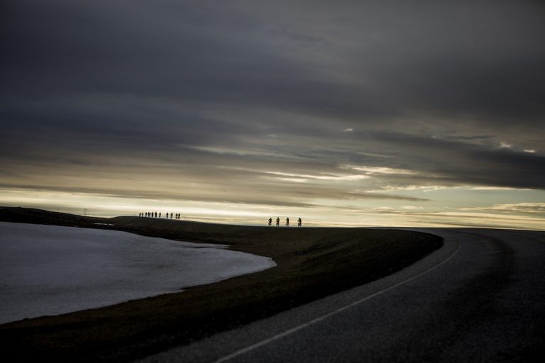
Finnmark too has a certain mystique. Being about the same distance from Oslo as Istanbul, in some ways, it’s basically the last stop before the North Pole. The undoubted highlight of the journey is simply cycling the wild expanse of Europe’s last great wilderness. It will feel very lonely up here but isn’t that a reason to cycle it? The cycling heat maps of the world are full of well-ridden roads. Here you will join a small group of cyclists seeking something extraordinary. Passing wild herds of reindeer and perhaps not seeing another human for many hours is why you came – right? The ride comes to an end in the town of Kirkenes which has Russian road signs. This will indicate you have reached the boundaries of the Western world!
Finnmark too has a certain mystique. Being about the same distance from Oslo as Istanbul, in some ways, it’s basically the last stop before the North Pole. The undoubted highlight of the journey is simply cycling the wild expanse of Europe’s last great wilderness. It will feel very lonely up here but isn’t that a reason to cycle it? The cycling heat maps of the world are full of well-ridden roads. Here you will join a small group of cyclists seeking something extraordinary. Passing wild herds of reindeer and perhaps not seeing another human for many hours is why you came – right? The ride comes to an end in the town of Kirkenes which has Russian road signs. This will indicate you have reached the boundaries of the Western world!
All cycling routes published on CYCLENORWAY.com are simply a planning resource to be used as a point of inspiration in conjunction with your own due-diligence. All route guidelines were prepared under diligent research. However, we can never for certain insure the complete accuracy of the routes. Cycling in Norway is in general very safe. Nevertheless, should you choose to cycle this route you do so at your own risk.
Check weather conditions
We advise that you check weather conditions along the route and look out for land/road closures.
The remote and barren Arctic tundra is perhaps not everyone’s cup of tea. But for those that embrace it, there are treasures to be savored at the end of the western world.
The remote and barren Arctic tundra is perhaps not everyone’s cup of tea. But for those that embrace it, there are treasures to be savored at the end of the western world.