


80 km
Distance
2646m
Dénivelé positif
1-2
Jours
60%
Non pavé
8/10
Difficulté
35-45
Types Idéaux
Mille mètres
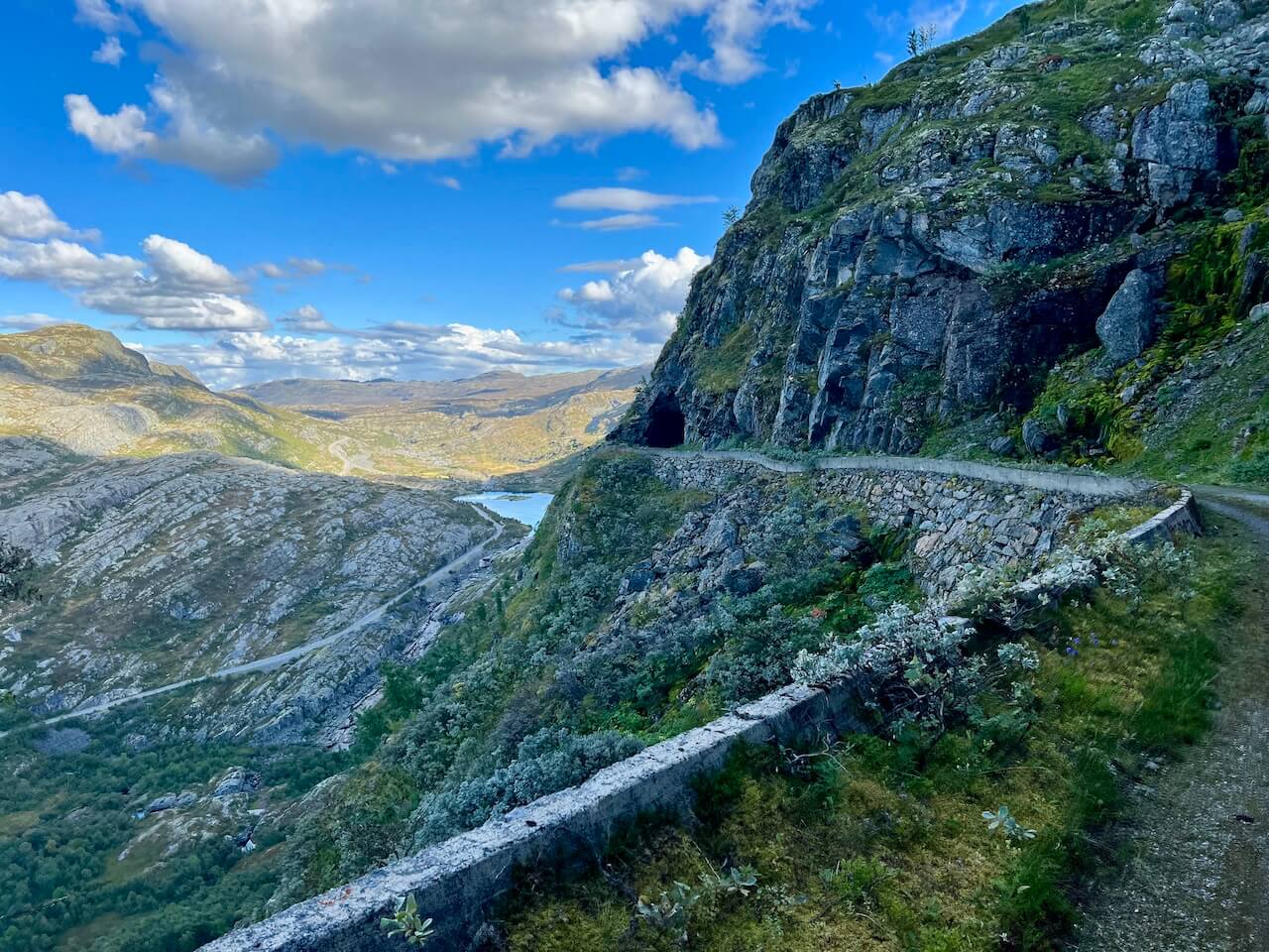
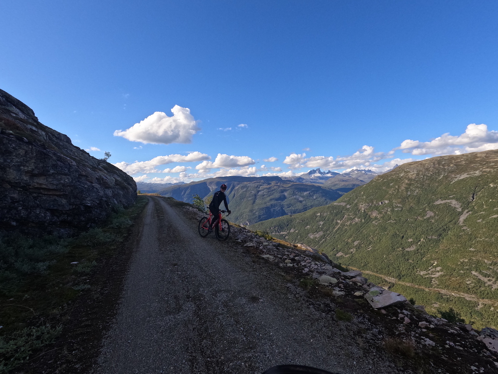
La route connue sous le nom de Mille mètres (“ La route des mille mètres ”) a été initialement construite dans les années 1930 et 1940, à l'époque de la grande ère du développement hydroélectrique à Årdal. Creusée à flanc de montagne avec des moyens mécaniques limités, elle constituait un lien vital pour les ouvriers et les matériaux se dirigeant vers les installations du barrage sur le haut plateau. Sa construction fut un exploit d'ingénierie, avec des pentes raides et des virages exposés qui témoignent encore de la détermination de l'époque. Bien qu'elle ait commencé comme une route industrielle pour l'hydroélectricité, elle se dresse aujourd'hui à la fois comme un monument historique et comme l'une des routes cyclables les plus remarquables de la région.
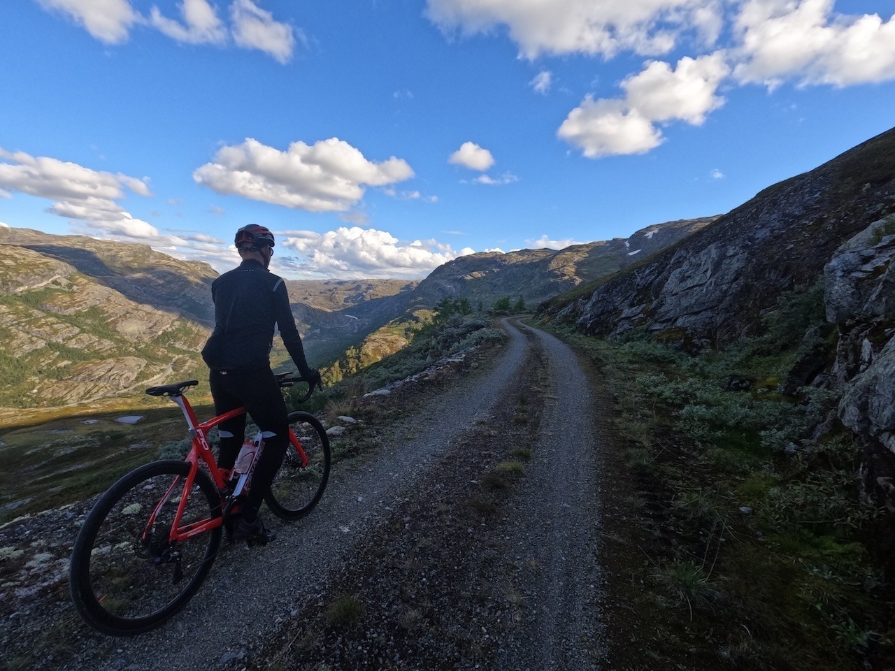
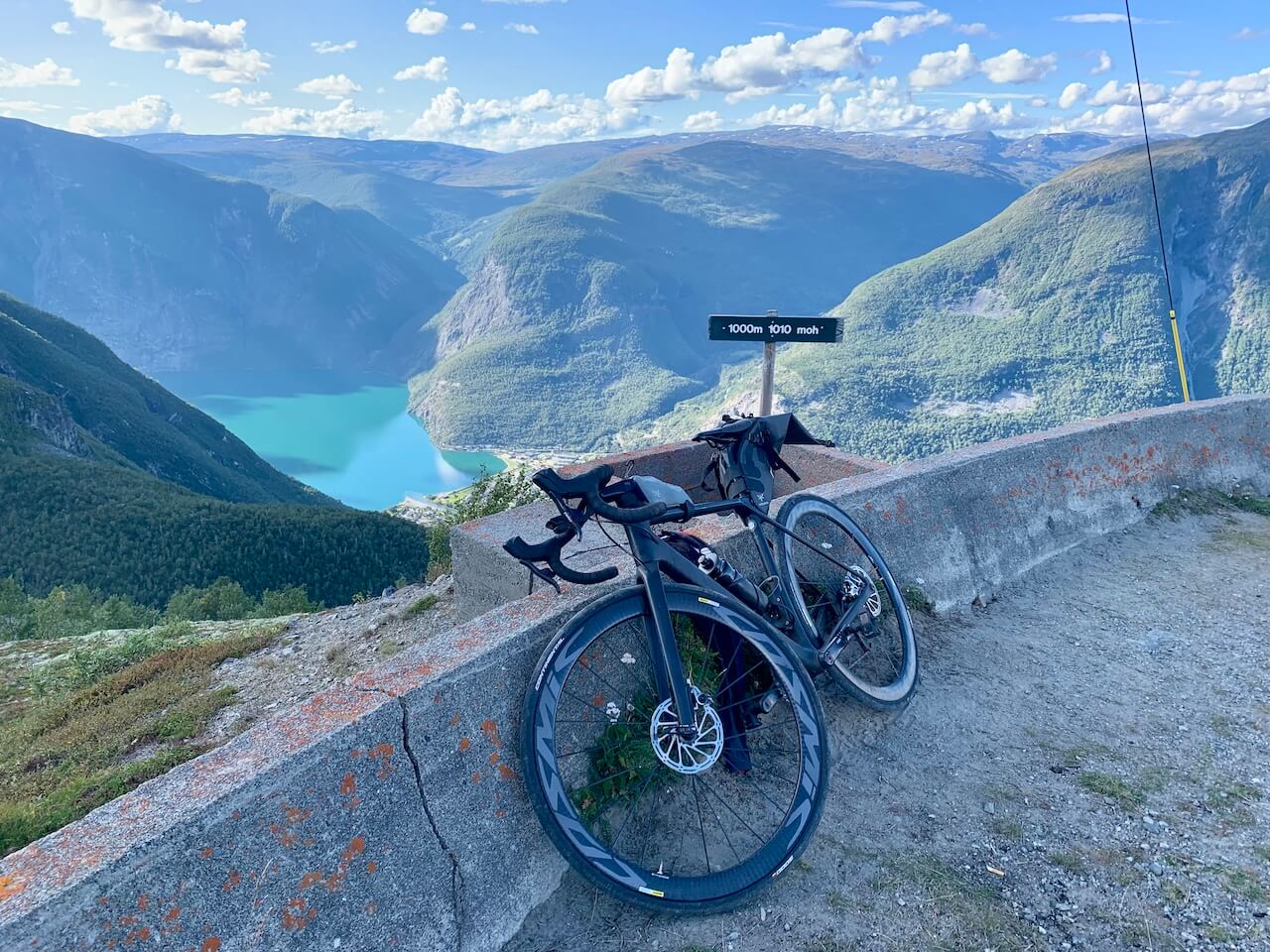
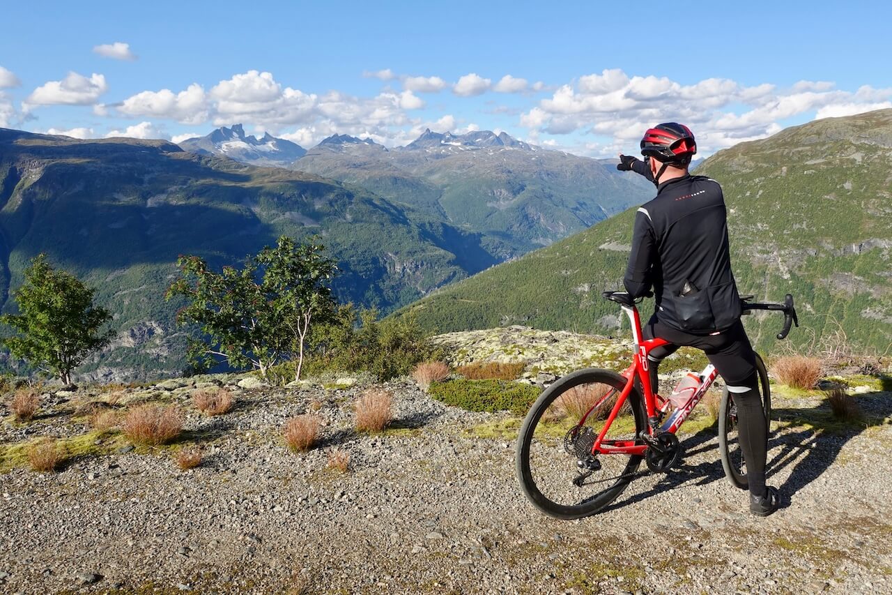
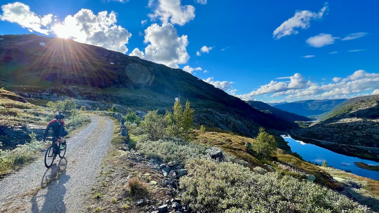
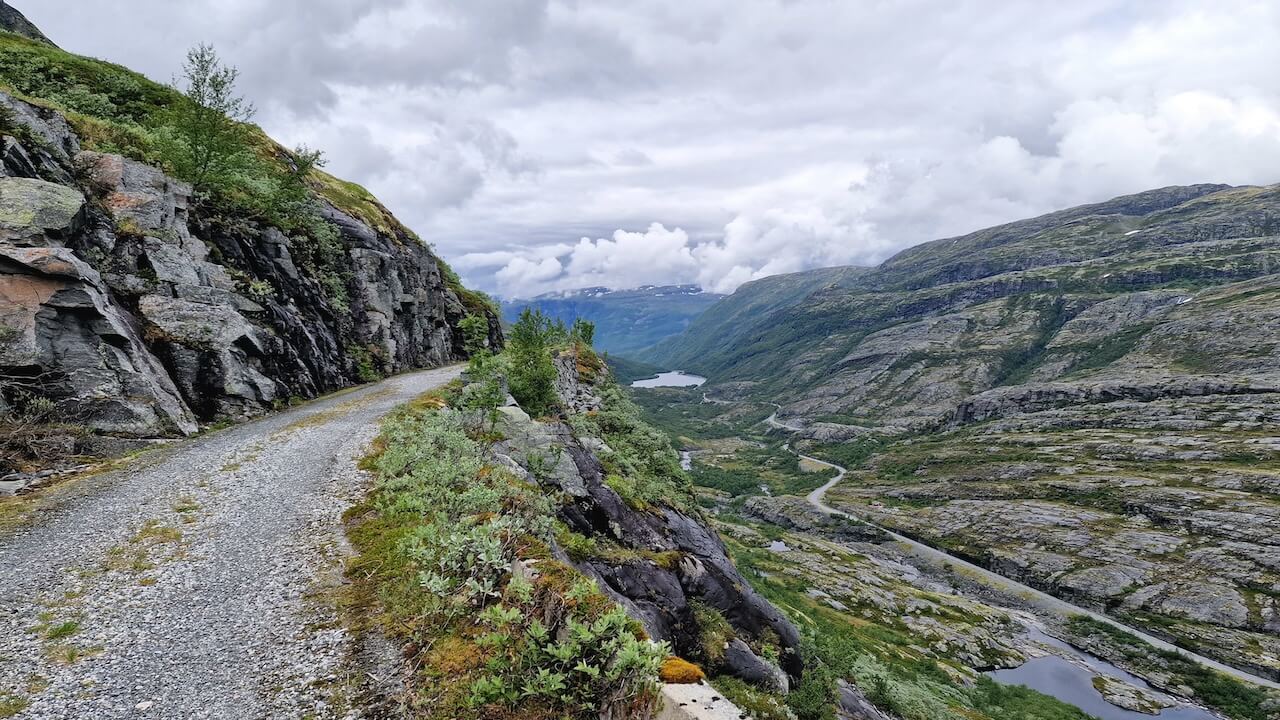
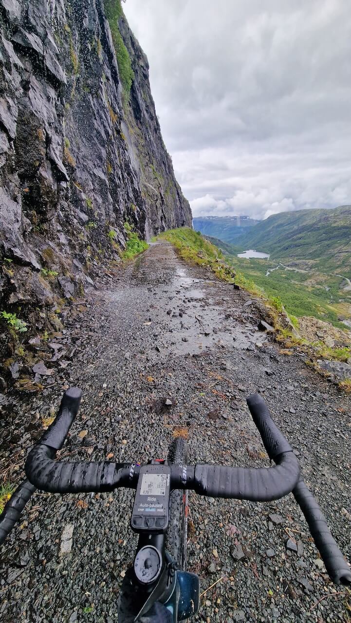
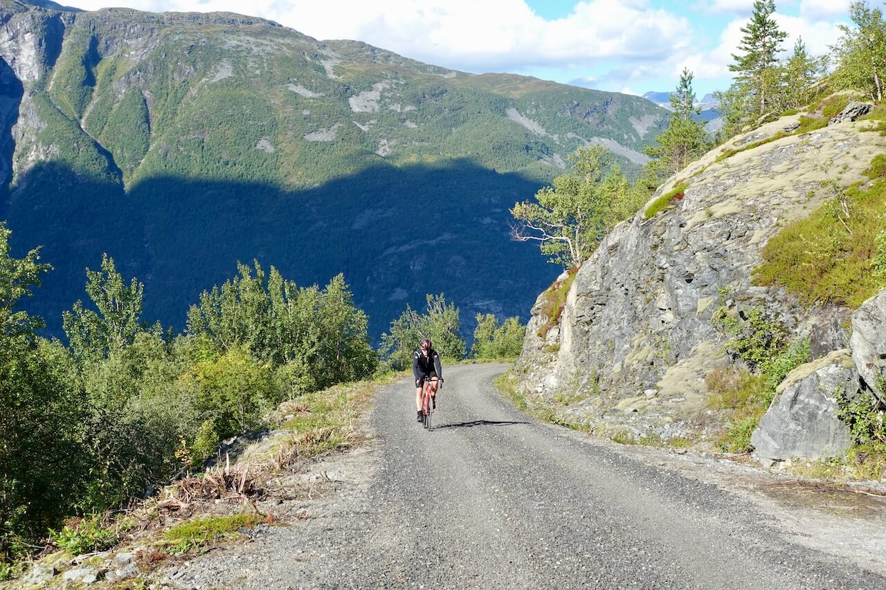
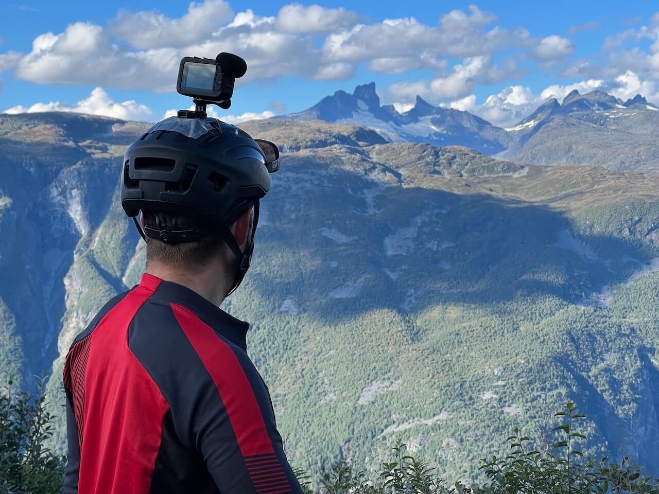
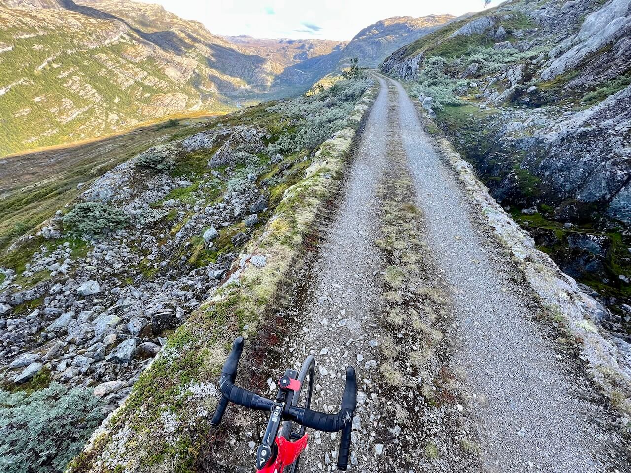
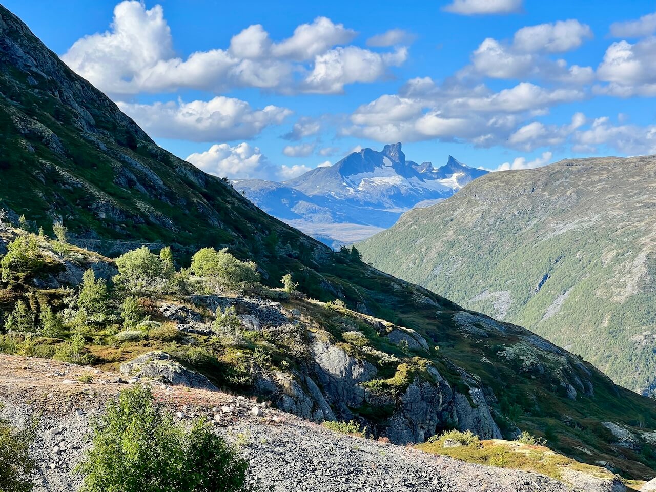
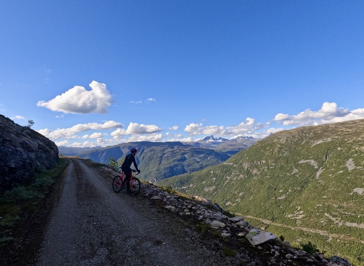
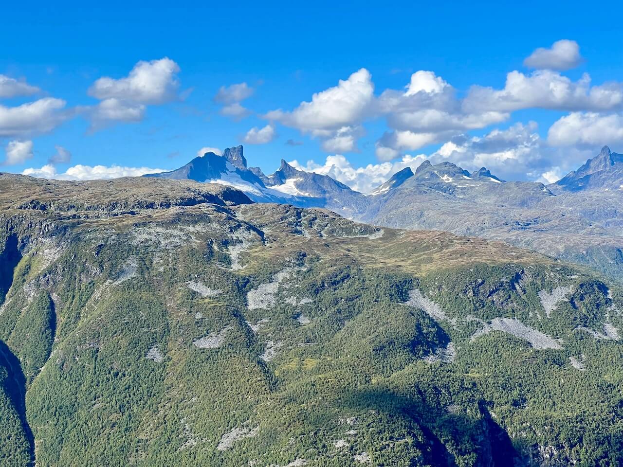
Au départ près d'Øvre Årdal, la route de gravier monte sans relâche à travers 42 virages en épingle serrés jusqu’à atteindre environ 1 000 mètres d’altitude. Du sommet, vous serez récompensé par une vue spectaculaire sur le fjord, le village en contrebas et les hauts sommets du Jotunheimen au loin. L'itinéraire longe ensuite le bord de la crête avant de descendre en serpentant à travers une vallée isolée pour rejoindre la route principale, où vous pouvez soit redescendre vers Øvre Årdal, soit continuer vers l'est. Avec son histoire, ses paysages et le sentiment de satisfaction qu'il procure, le Tusenmeteren est souvent qualifié de le plus beau tronçon de gravier de Norvège, une course qui récompense chaque effort que vous y consacrez.
Carte routière
Quand ?
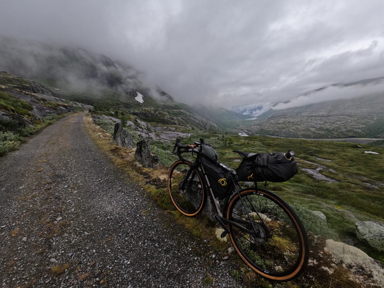
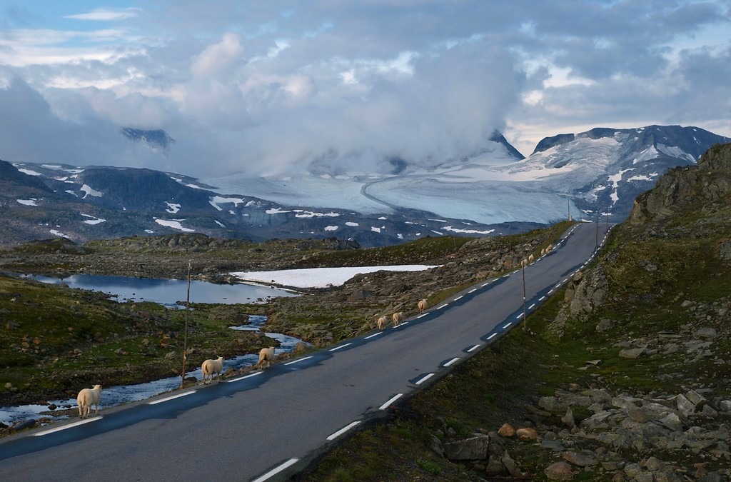
Les conditions d'enneigement varient d'une année à l'autre, il est donc difficile de prédire exactement quand le sentier sera dégagé. La période la plus sûre est généralement mi-juillet à septembre. Tenter de le faire en juin signifie souvent traverser de grands champs de neige, ce qui peut être dangereux compte tenu des falaises abruptes que suit la route.
Y arriver
– Oslo → Tyinkrysset : Prends Bus Valdresekspressen du terminal de bus d'Oslo en direction de Fagernes/Øvre Årdal. Certains départs vont jusqu'à Øvre Årdal en été. Sinon, descendez à Carrefour de Tyinkrysset et prenez le bus local jusqu'à Øvre Årdal. Les autocars longue distance (Nor-Way/Valdresekspressen) acceptent les vélos si réservés à l'avance. Ils facturent des frais élevés et l'espace est limité à deux vélos. Réservez toujours lors de l'achat de votre billet.
– Bergen → Lærdal/Årdal: Prends Bateau express de Sognefjord (Norled) de Bergen à Sogndal (vélos autorisés, mais réservation à l'avance). De Sogndal, prenez le bus local pour Øvre Årdal (il circule plusieurs fois par jour). Alternative : Des bus longue distance circulent également de Bergen à Lærdal/Sogndal avec des correspondances pour Øvre Årdal (réservation de vélo obligatoire).
Utiliser Entur.no pour les bus locaux
Dangers
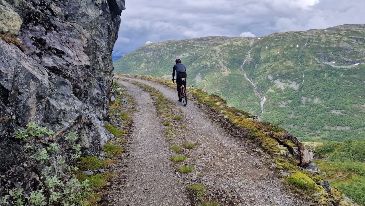
– La montée jusqu'à 1000 mètres est difficile, et la route n'est pas dans le meilleur état par endroits. Si vous descendez, faites attention, il est facile de tomber de vélo dans les virages serrés.
– Il y a un tunnel noir de jais sur la crête du plateau, qui nécessite de bonnes lampes pour s'y aventurer.
– En début de saison, la neige peut bloquer la route, et la traverser peut être dangereuse avec des falaises abruptes à côté du sentier.
Location de vélos
- Visitez Årdal / Bulder & Brak – Location de vélos Merida à Øvre Årdal (700 NOK/jour, casque et antivol inclus).
- Les Aventures de Bulder et Brak – VTT / vélos hybrides avec option de transport de vélo jusqu'à la route du point de vue à 1000 m d'altitude.

“Il faut beaucoup pour impressionner un Norvégien dans son propre pays, mais cette route m'a laissé sans voix”
Recommandations locales
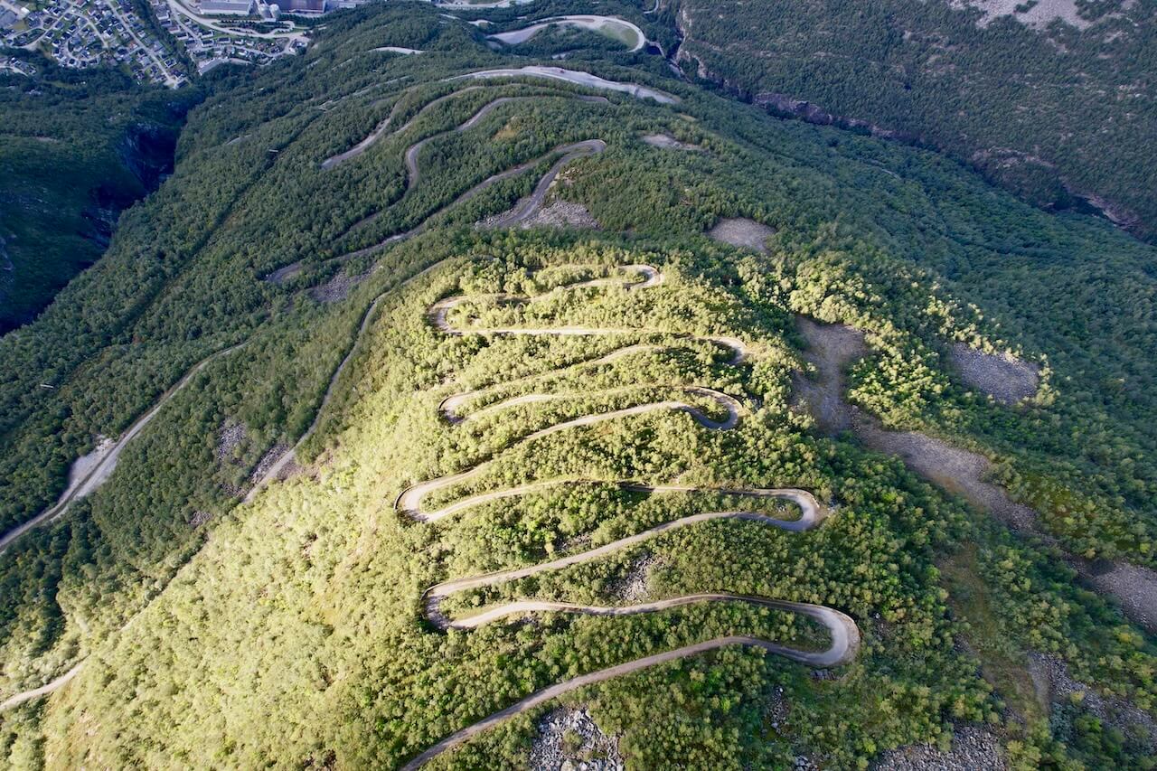
42 virages serrés jusqu'au sommet
Cette route centenaire est difficile à gravir, mais la récompense en vaut la peine : un petit panneau au sommet et une vue imprenable sur Øvre Årdal et le fjord en contrebas.
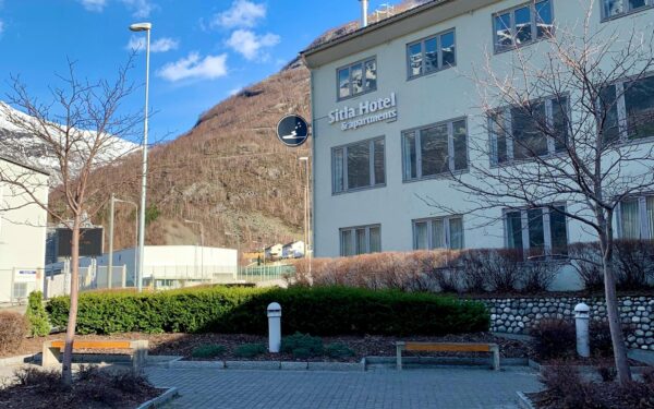
Hôtel & Appartements Sitla
L'hébergement dans cette région isolée est limité. Le Sitla Hotel & Apartments, situé au centre d'Øvre Årdal, est le meilleur choix si vous souhaitez un toit fiable au-dessus de votre tête.
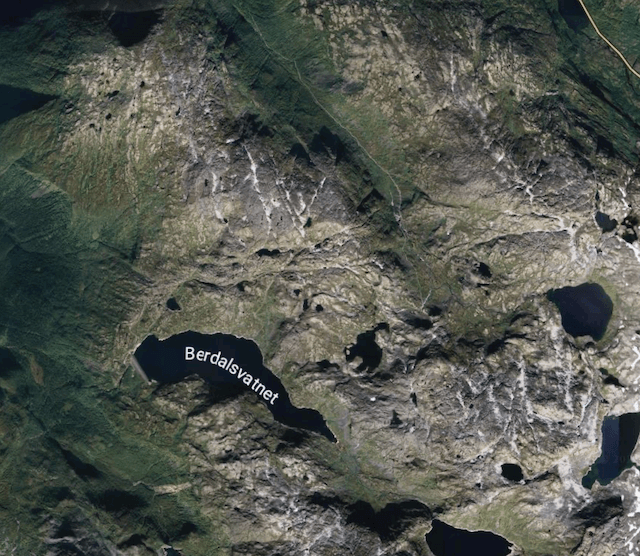
Détourner le barrage hydroélectrique
Si vous voulez plus de distance, prenez la route peu utilisée qui bifurque à droite des lacets en direction du barrage hydroélectrique. C'est un détour isolé, qui se termine en cul-de-sac, mais qui fait un aller-retour de 30 km que peu de cyclistes empruntent jamais. Voir le schéma de l'itinéraire pour plus de détails.
Liens utiles
Booking.com – pour les options d'hébergement dans toute la Norvège
Application Entur – pour planifier des trajets en transports en commun en Norvège
Ferry – itinéraires, horaires et informations par Statens Vegvesen
Étiquette du camping sauvage important à savoir
Lectures complémentaires
Garder à l'esprit
Tous les itinéraires cyclables publiés sur CYCLENORWAY.com sont destinés à des fins de planification et d'inspiration, à utiliser parallèlement à vos propres recherches et à votre jugement. Les itinéraires sont créés grâce à des recherches approfondies, mais chaque cycliste a des capacités, des attentes et une tolérance au risque différentes. Certains itinéraires de gravier difficiles peuvent inclure des sections où il faut porter le vélo, des sentiers boueux ou humides, des terrains techniques, des montées abruptes, des descentes ou des zones isolées qui peuvent ne pas convenir à tout le monde. Les logiciels de cartographie d'itinéraires, ainsi que les conditions, peuvent également changer ou contenir des inexactitudes. Le cyclisme en Norvège est généralement très sûr. Néanmoins, si vous choisissez d'emprunter ces itinéraires, vous le faites à vos propres risques. Si vous avez des doutes sur un itinéraire particulier, laissez un commentaire ci-dessous et nous vous conseillerons.


Laisser un commentaire