


The High Voltage Route
Norway’s Hidden Gravel Link
Follow the forgotten gravel roads once built for servicing power lines, leading you up to their hidden source.
The Electric Frontier
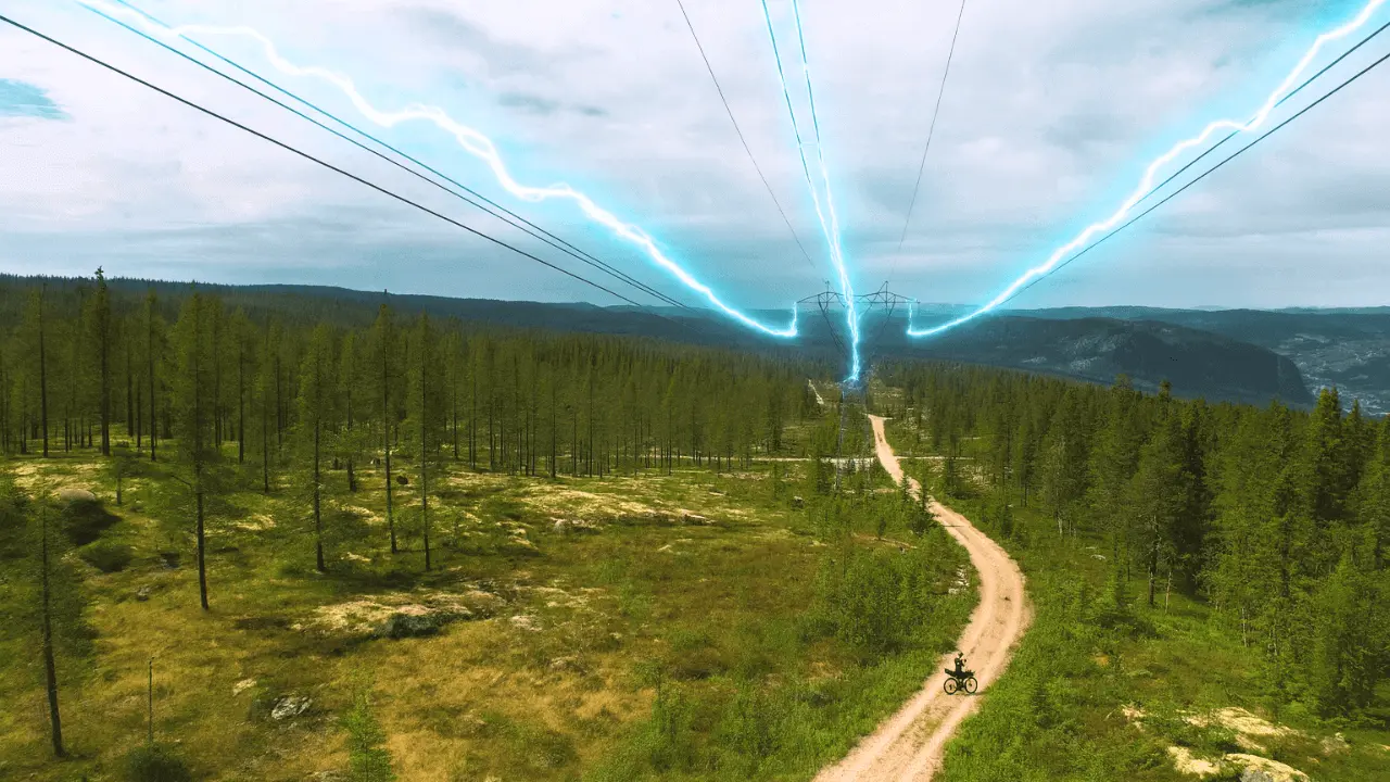
Electric pylons aren’t exactly the highlight of any landscape. Most of the time, they’re just steel skeletons marching across valleys, dragging cables toward some factory or city on the edge of nowhere. Normally, I’d avoid them. But in Norway, they tell a different story. Here, those same steel towers don’t guide you to industry – they guide you into the wild. They lead you up into the heart of the mountains, across high plateaus where no roads should exist, yet somehow do. They trace a path to remote hydropower stations perched over 1000 metres above sea level, and they quietly tell the tale of one of Norway’s greatest feats of modern engineering.
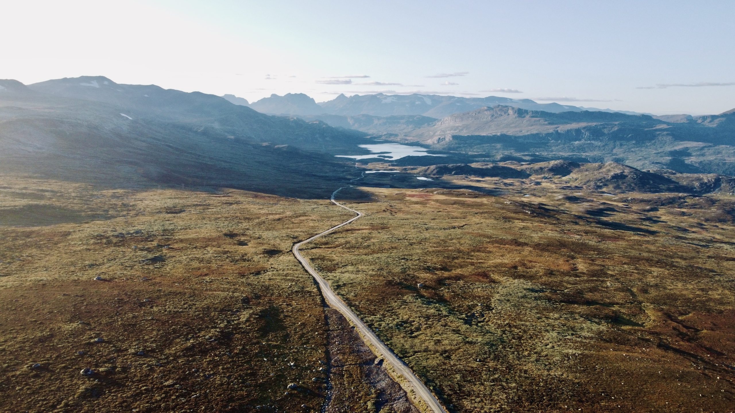
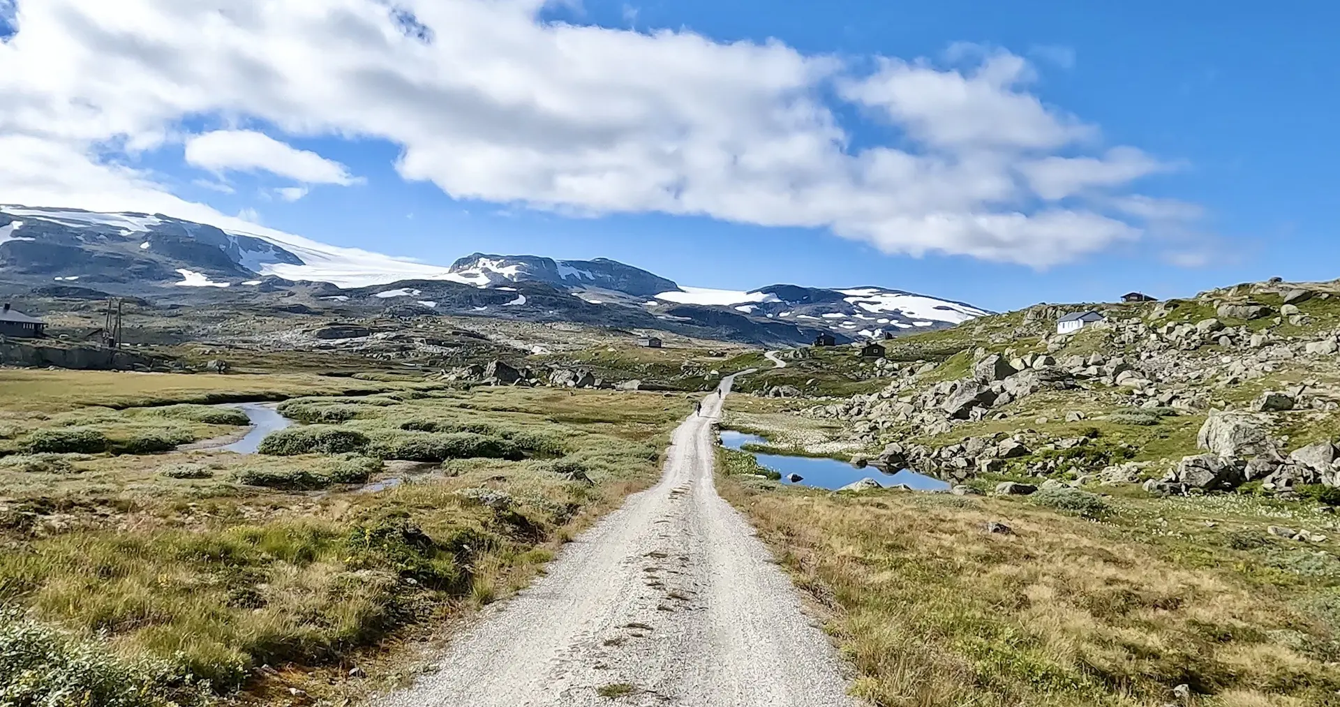
If you’re after a rugged, rewarding gravel adventure that weaves together Norway’s hydropower legacy, mountain culture, and raw natural beauty, the High Voltage Route is worth your attention. This demanding three-day, 250 km loop climbs into the dramatic highlands of Hallingdal – a region shaped as much by nature as by the infrastructure built to harness it. The route follows service roads originally carved out for dam and power line maintenance. Today, they offer cyclists rare access to remote terrain even locals don’t see. Expect long climbs, high-altitude exposure, and remote stretches where you might not see another soul for hours.
Beyond the scenery, the loop is also a clever way to connect two of Norway’s most famous cycling routes – Rallarvegen et Voie Lactée – but with a far more adventurous twist. It’s not a detour for the faint of heart, but for those with the legs and mindset for real bikepacking, it might be the highlight of your entire trip. Steel towers never looked so good.
Carte routière
Débloquez la carte complète de l'itinéraire POI
Rejoignez Cycle Norway pour accéder au contenu de la page complète.
Débloquez le contenu intégral
Devenez membre pour avoir un accès complet à :
- Détails des sections de l'étape et options de déviation
- Fichiers GPX et cartes interactives des POI
- Options de transport et logistique
- Recommandations d'hébergement
- Conseils de sécurité, points forts et plus encore
Pas prêt à rejoindre pour l'instant ?
Inscrivez-vous à notre lettre d'information et bénéficiez de ressources de planification gratuites :
-
Liste des bagages

PDF -
Carte de gravier
Aperçu -
Code cyclable
en Norvège
-
Itinéraires sélectionnés à la main
Testé par des experts locaux
-
Fichiers GPX et cartes
Pour une navigation facile
-

Informations fiables
Mis à jour régulièrement
-

Soutenir le voyage durable
Voyagez de manière responsable en Norvège
Connexion des itinéraires

Voie Lactée
Des centaines de kilomètres de routes de gravier bien tassé s'étendent sur de hauts plateaux de montagne, offrant des vues imprenables à 360 degrés.
- 225 km
- 80% non pavé
- 2-5 jours
- 7/10 difficulté
Lait, Vaches et Gravel Épique
Numedal & Mjølkevegen
Si vous voulez un mélange de forêt et de montagne, de gravier et de pavé, de chaud et de froid, et de stérile et de luxuriant, faites-en le tour !
- 594m
- 40% non pavé
- 3-8 jours
- 7/10 difficulté
Voyager dans le temps
Hallingdal & Rallarvegen
C'est un paradis du bikepacking où la nature, le gravier et la route se combinent pour vous offrir une expérience unique.
- 581 km
- 25% non pavé
- 3-8 jours
- 8/10 difficulté
La route de gravier la plus célèbre de Norvège