


The High Voltage Route
Norway’s Hidden Gravel Link
Follow the forgotten gravel roads once built for servicing power lines, leading you up to their hidden source.
The Electric Frontier
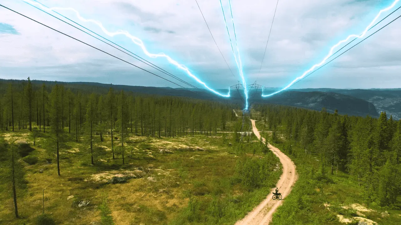
Electric pylons aren’t exactly the highlight of any landscape. Most of the time, they’re just steel skeletons marching across valleys, dragging cables toward some factory or city on the edge of nowhere. Normally, I’d avoid them. But in Norway, they tell a different story. Here, those same steel towers don’t guide you to industry – they guide you into the wild. They lead you up into the heart of the mountains, across high plateaus where no roads should exist, yet somehow do. They trace a path to remote hydropower stations perched over 1000 metres above sea level, and they quietly tell the tale of one of Norway’s greatest feats of modern engineering.
If you’re after a rugged, rewarding gravel adventure that weaves together Norway’s hydropower legacy, mountain culture, and raw natural beauty, the High Voltage Route is worth your attention. This demanding three-day, 250 km loop climbs into the dramatic highlands of Hallingdal – a region shaped as much by nature as by the infrastructure built to harness it. The route follows service roads originally carved out for dam and power line maintenance. Today, they offer cyclists rare access to remote terrain even locals don’t see. Expect long climbs, high-altitude exposure, and remote stretches where you might not see another soul for hours.
Beyond the scenery, the loop is also a clever way to connect two of Norway’s most famous cycling routes – Rallarvegen und Milchstraße – but with a far more adventurous twist. It’s not a detour for the faint of heart, but for those with the legs and mindset for real bikepacking, it might be the highlight of your entire trip. Steel towers never looked so good.
Routenplan
Schalte die vollständige POI-Routenkarte frei
Treten Sie Cycle Norway bei, um auf den vollen Seiteninhalt zuzugreifen.
Entsperren Sie den vollständigen Inhalt
Mitglied werden, um vollen Zugriff zu erhalten auf:
- Detaillierte Etappenabschnitte & Umleitungsoptionen
- GPX-Dateien und interaktive POI-Karten
- Transportoptionen & Logistik
- Unterkunftsempfehlungen
- Sicherheitstipps, Highlights & mehr
Noch nicht bereit beizutreten?
Melden Sie sich für unseren Newsletter an und erhalten Sie kostenlose Planungsmaterialien:
-
Packliste

PDF -
Schotterkarte
Vorschau -
Fahrradcode
in Norwegen
-
Handverlesene Routen
Geprüft von lokalen Experten
-
GPX-Dateien & Karten
Zur einfachen Navigation
-

Vertrauenswürdige Informationen
Regelmäßig aktualisiert
-

Nachhaltiges Reisen unterstützen
Umweltfreundlich reisen in Norwegen
Verbindungsrouten

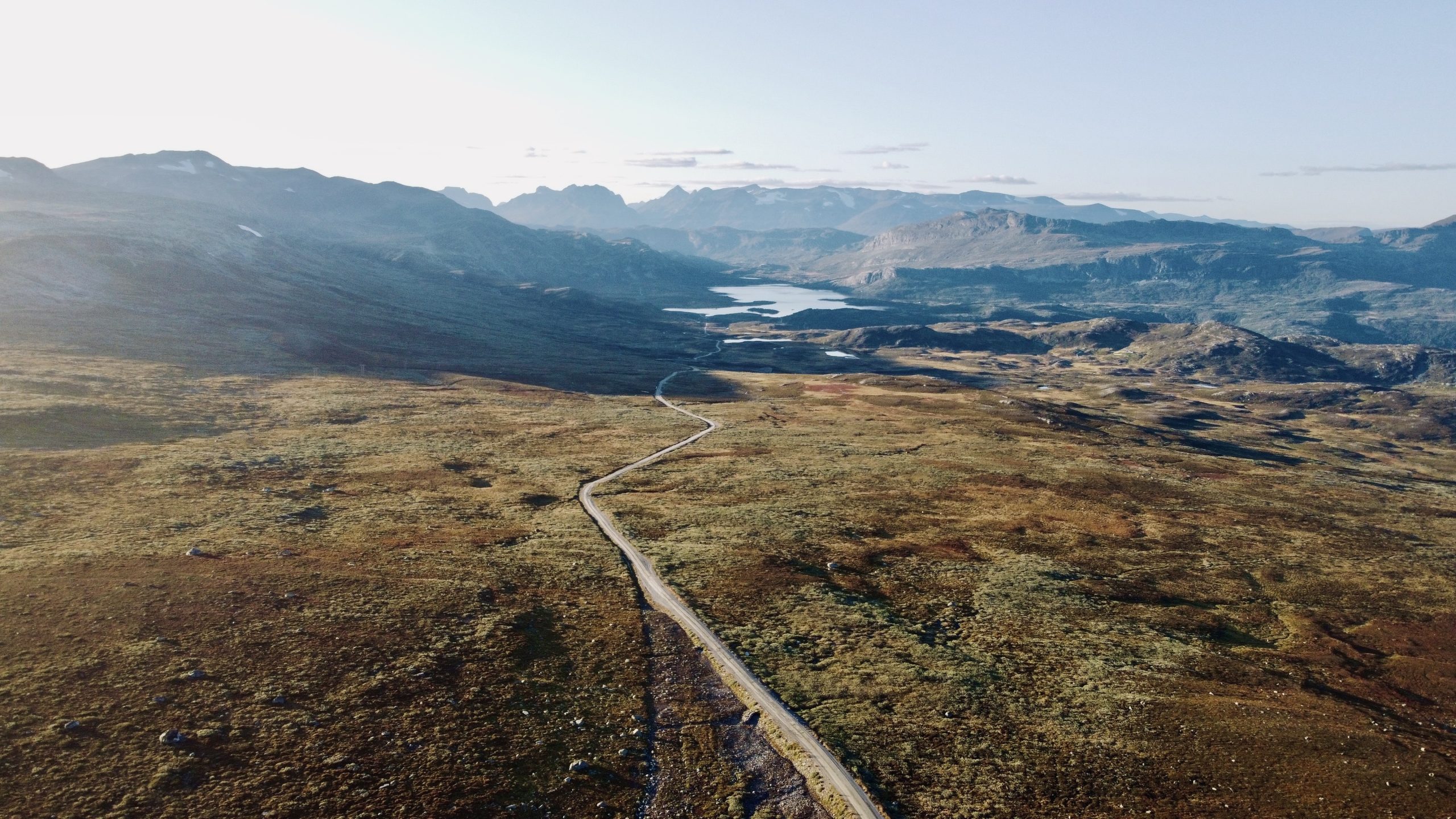
Milchstraße
Hunderte von Kilometern dichter Schotterstraßen erstrecken sich über hohe Bergplateaus und bieten atemberaubende 360-Grad-Ausblicke.
- 225 km
- 80% unbefestigt
- 2-5 Tage
- 7/10 Schwierigkeit
Milch, Kühe & Epische Schotterstraßen
Numedal & Mjølkevegen
Wenn du eine Mischung aus Wald und Bergen, Schotter und Asphalt, Wärme und Kälte sowie karger und üppiger Natur suchst, dann fahr diese Strecke!
- 594m
- 40% unbefestigt
- 3-8 Tage
- 7/10 Schwierigkeit
Eine Reise in die Vergangenheit
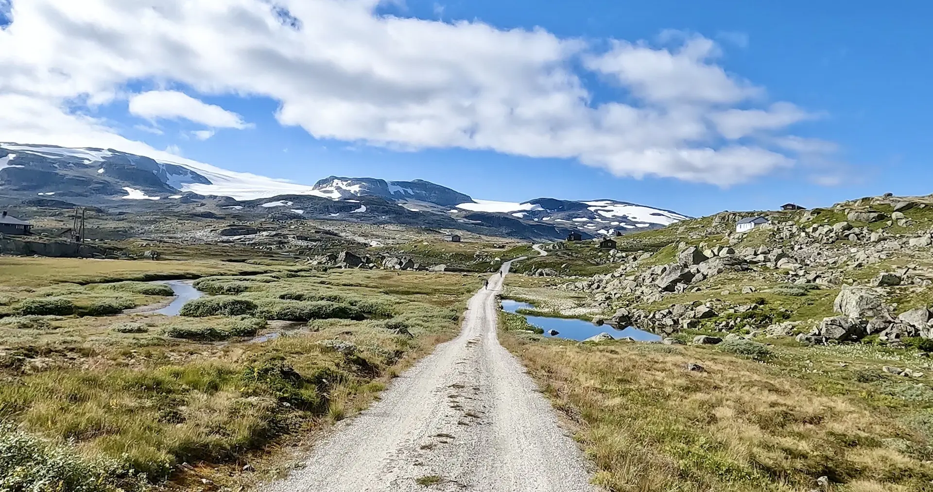
Hallingdal & Rallarvegen
Dies ist ein Paradies für Bikepacking, in dem Natur, Schotterwege und Asphaltstraßen zusammenkommen, um dir ein Erlebnis zu bieten, das seinesgleichen sucht.
- 581 km
- 25% unbefestigt
- 3-8 Tage
- 8/10 Schwierigkeit
Norwegens berühmteste Schotterstraße