Mjølkevegen

Norway’s Premium Gravel Route
Hundreds of kilometers of hard-packed gravel roads stretch across high mountain plains, offering stunning 360-degree views.

When

Mid June - September

Written by

Matthew Tolley

Distance

225km

Days

2-4

High point

1315m

Difficulty

6/10

Unpaved

80%

Total Ascent

4000m

Ferries

(1)

Tunnels

The Milk Way

The Mjølkevegen, or “Milk Road,” gets its name from the historic routes used to transport milk from the high mountain summer farms down into the valleys. For generations, these roads were vital for moving dairy products, and today, the tradition continues as cattle are still driven to graze on these rich, high-altitude pastures once the winter snows have melted. As you cycle the route, you’ll likely encounter cows, sheep, and goats roaming freely across the landscape.


You pass plenty of small cabins and traditional farms that have been part of this rural landscape for centuries. Between the high pastures, the route dips into lush valleys, passing through one popular ski town before climbing back up to the next plateau, offering both a glimpse into the country’s rural past and stunning natural beauty.

.

Map

Gravel Paradise Over Mountain Plains

The first thing to decide is where to start: Gol or Vinstra? Both starting points involve a similar amount of elevation gain, each kicking off with around 800 meters of climbing. However, starting from Vinstra makes the ascent up the challenging Slettefjellet mountain a bit more manageable compared to tackling it from the Gol side. If you’re booking last minute and relying on train access, Gol might be a better bet for available bike spaces. For this guide, I’ll start in Vinstra, set in the scenic Gudbrandsdalen valley.


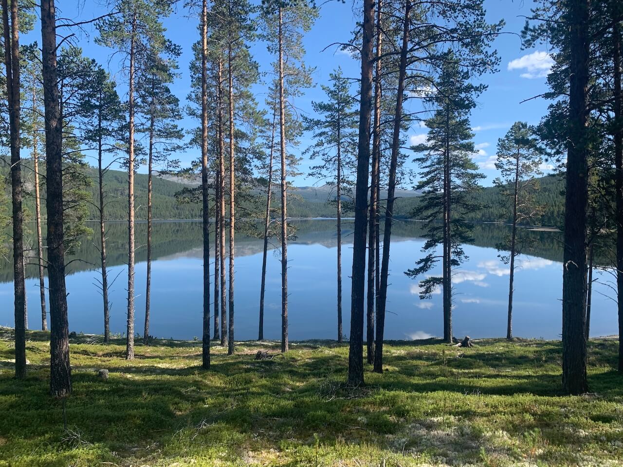
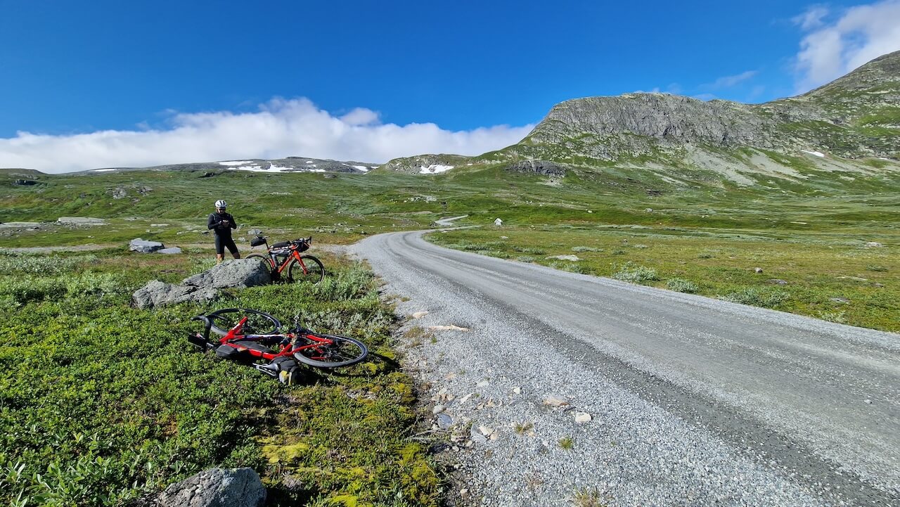
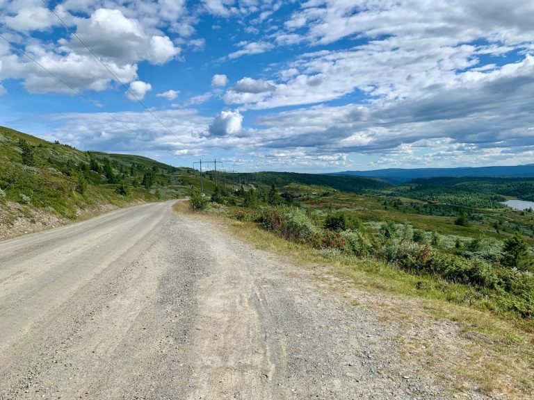
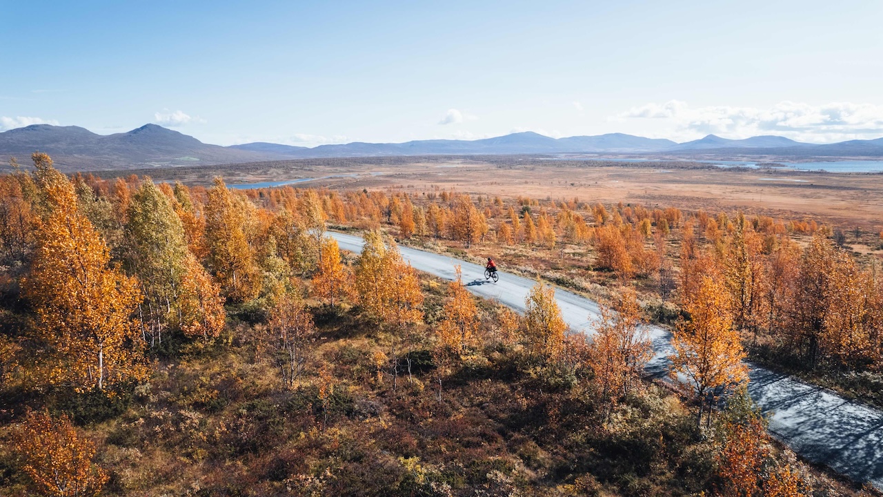
The adventure for most will begin at Vinstra Station, where riders cross a pedestrian bridge over the river and head past the E6 highway. From here, the Mjølkevegen route wastes no time, with a climb along the paved Fv243 road toward Fefor. As you rise, the valley spreads out behind you, a view that fades as the road shifts to gravel around the 15km mark, giving way to a forested landscape. Small lakes along the path invite a cool swim, and picnic benches provide perfect spots for a rest.


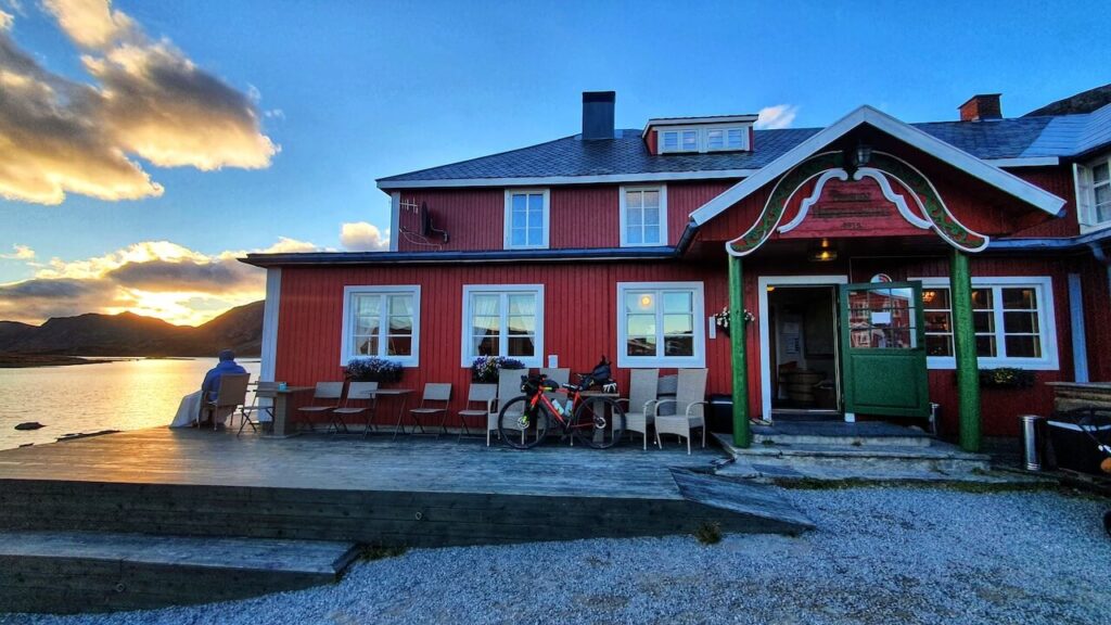
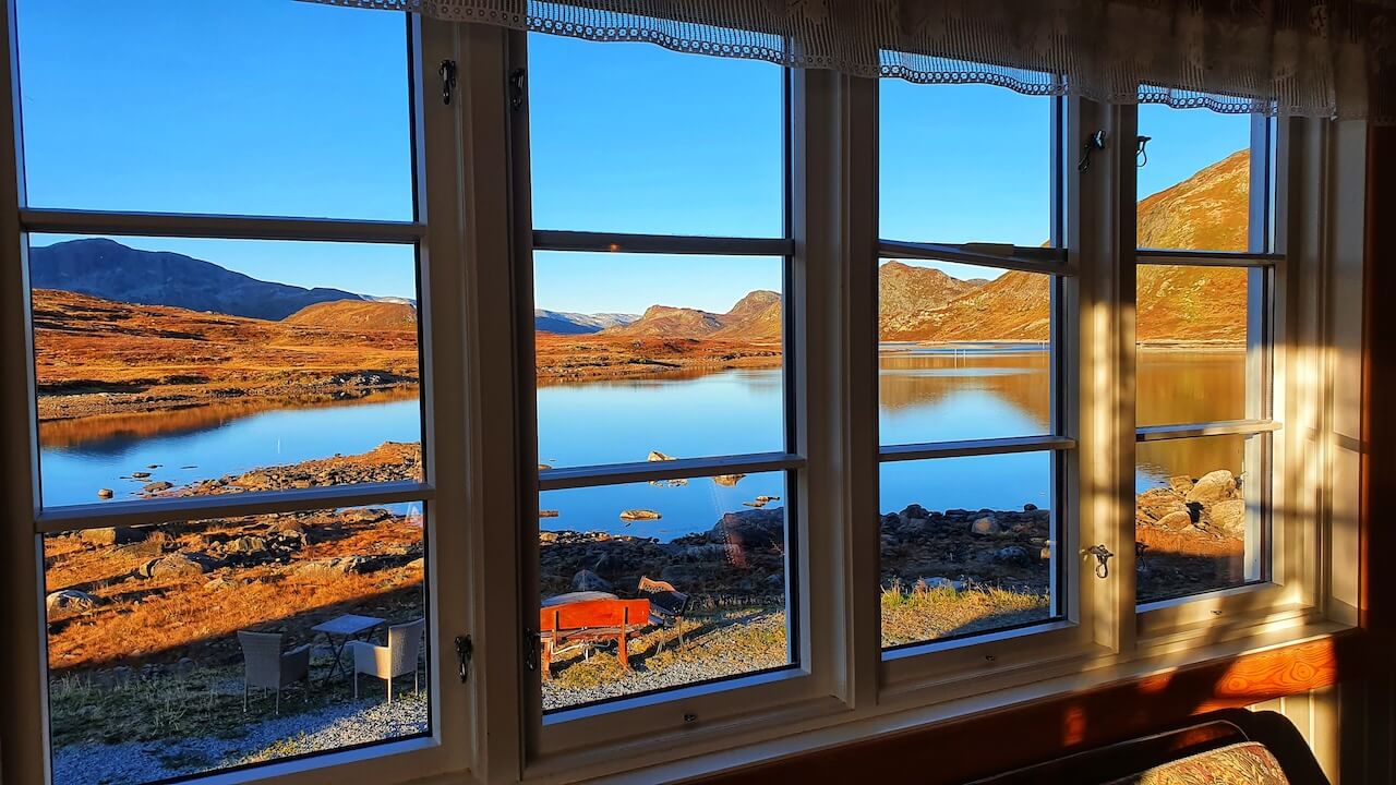
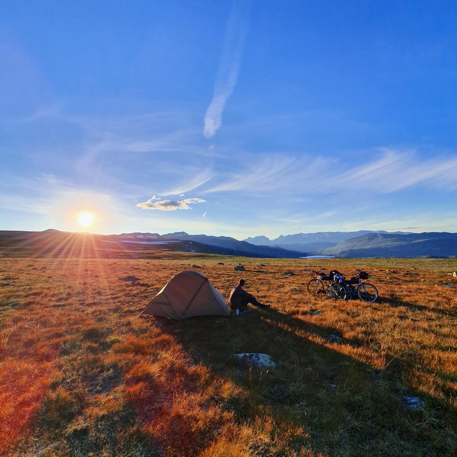
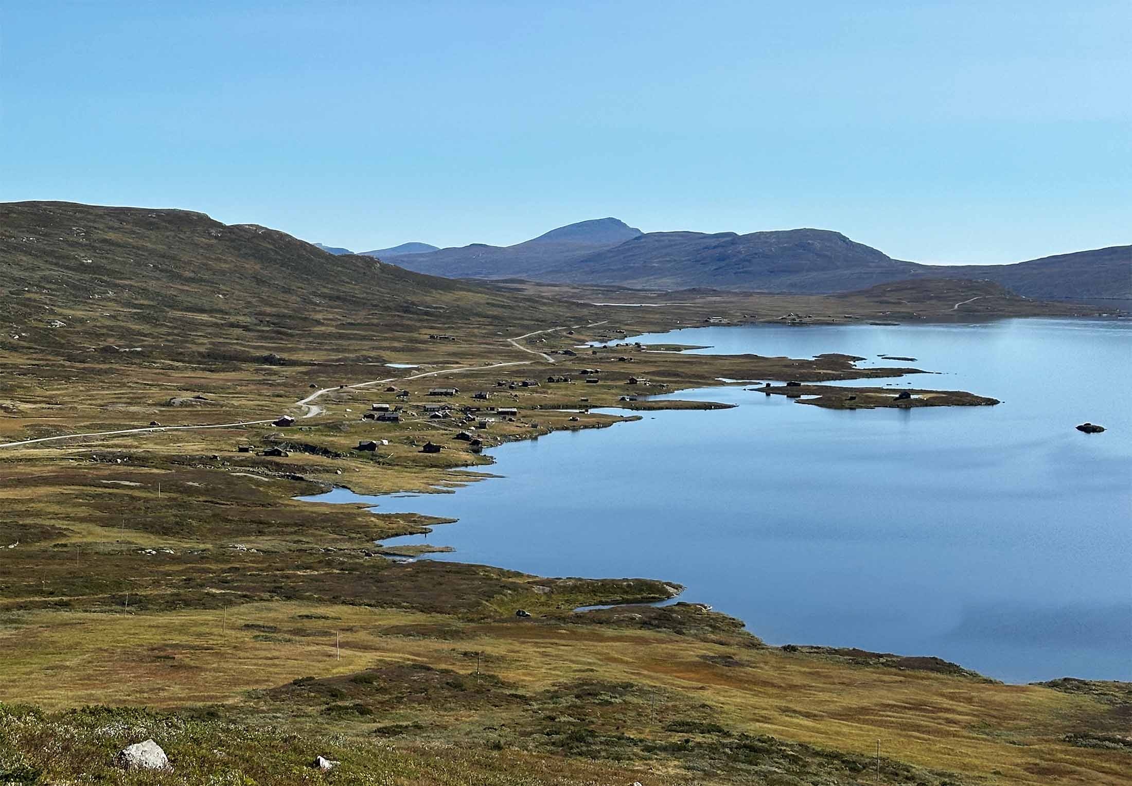
After the steepest climb, about 16km in, the route begins to gently roll through fields and small villages, peaking at 900m. This is a great area to camp if you’re aiming for a scenic evening stop. The path then descends toward Ruten, where snow-capped peaks appear in the distance. You can find overnight options at Ruten Fjellstue or Dalsetter Fjellhotel, or head to Olstappen Lake for idyllic wild camping right by the water (mosquitoes may be about in peak summer).


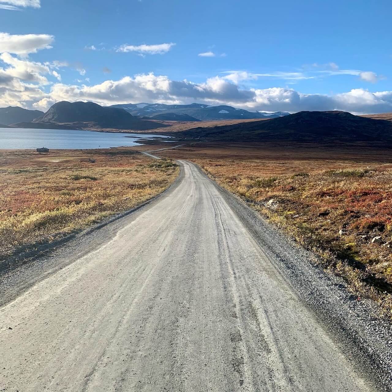
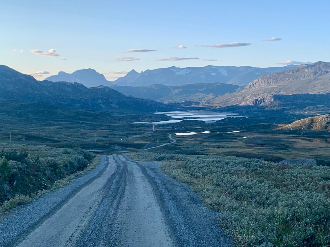
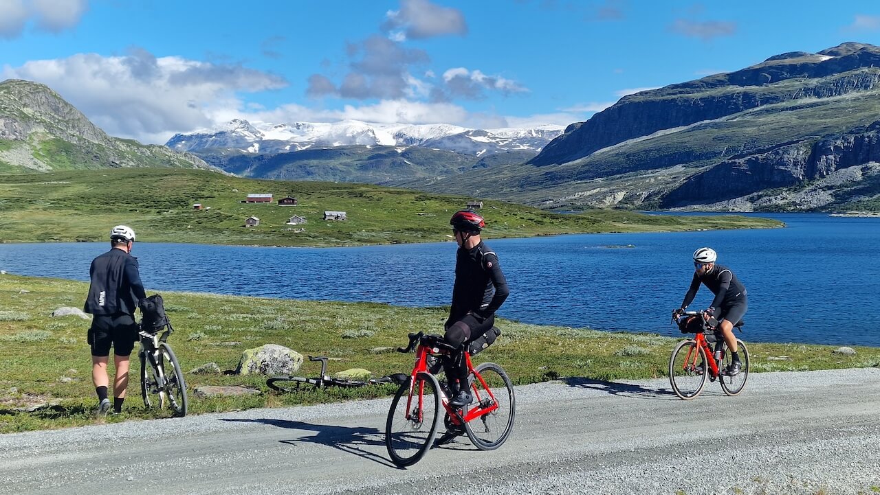
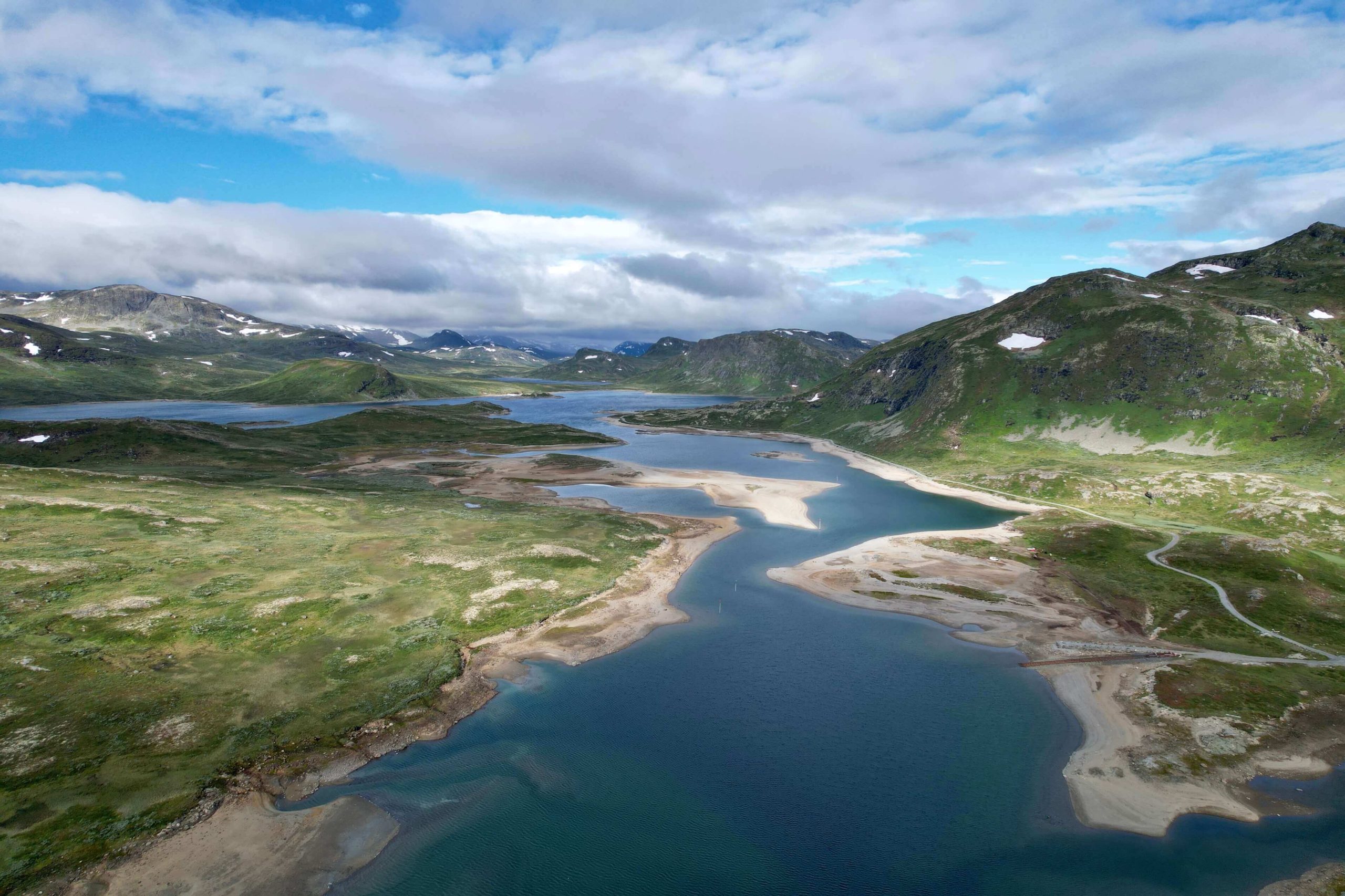
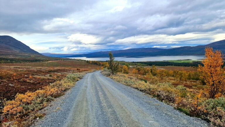
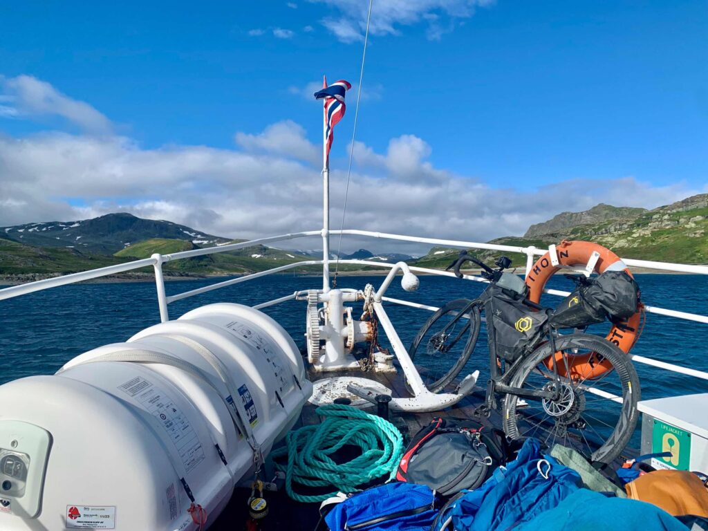
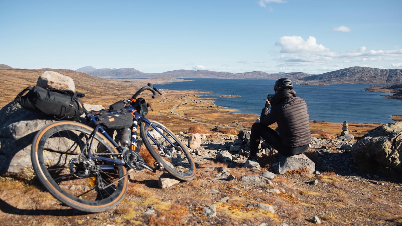
Just after Ruten, Mjølkevegen signs direct you along a scenic gravel path that hugs Olstappen Lake. With tranquil views and swimming spots (I was tempted to linger here)! The gravel track then heads uphill on to the famous Jotunheimvegen, a quiet toll road offering stunning plateau views and scattered wood cabins with grass roofs. After 50km of epicness, you finally reach Bygdin mountain cabin, where you can refuel at a café or spend the night in the historic lodge. An alternate route includes a boat ride across Bygdin Lake, though that skips the gorgeous Slettefjell climb, one of the route’s highlights.


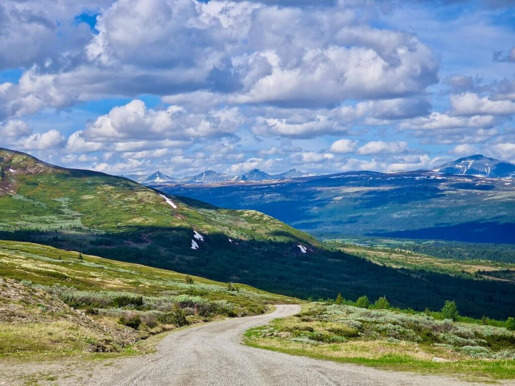
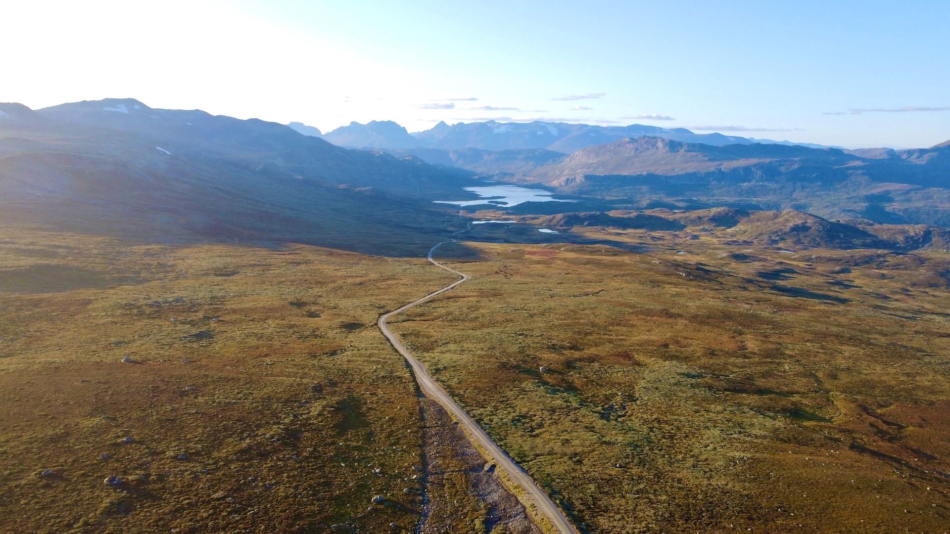
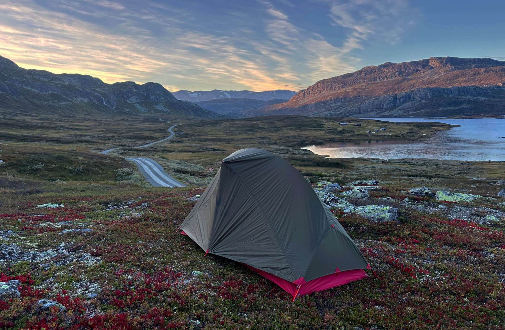
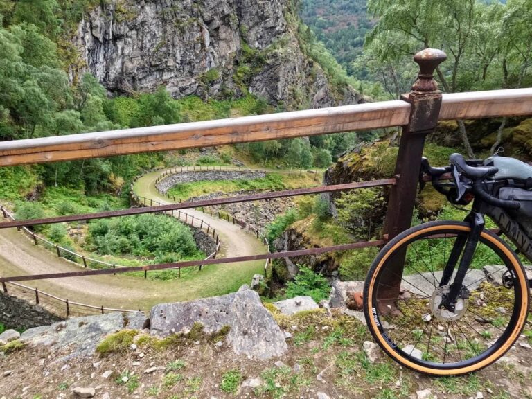
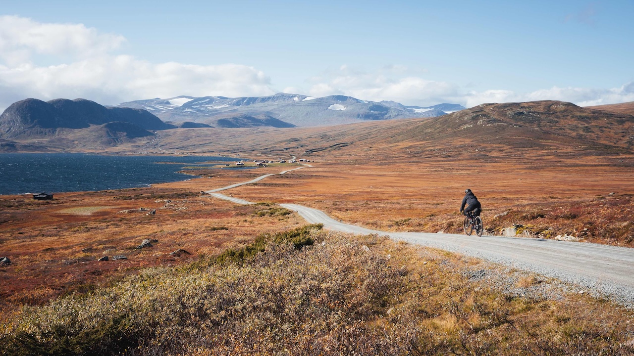
Beyond Bygdin, the paved Scenic Route Valdresflye takes you around Bitihorn mountain and leads to a swift descent into Beitostølen, where you’ll find restaurants, shops, and plenty of accommodations. After Beitostølen, you quickly hit back onto the gravel roads with the mighty Slettefjellvegen climb offering spectacular views.


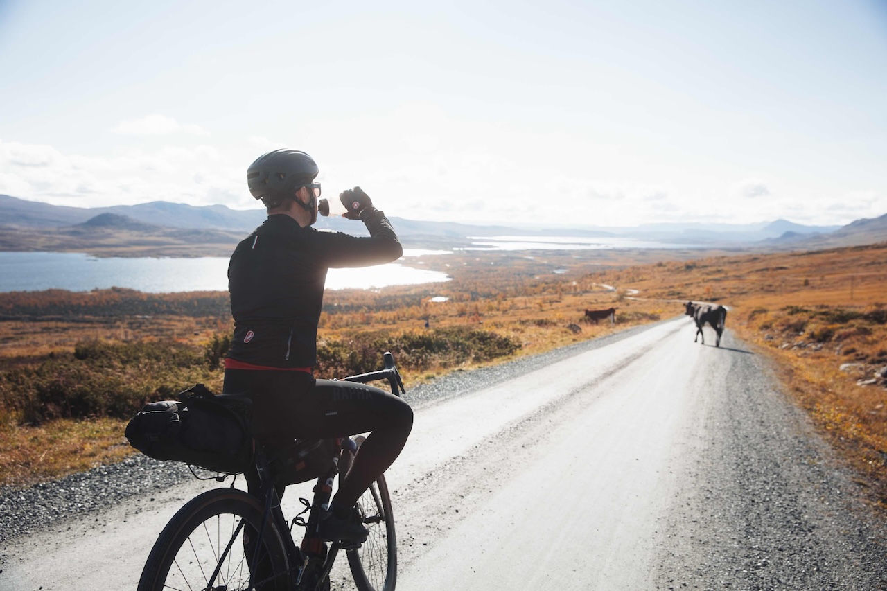
Reaching the plateau at 1315m, you’re rewarded with a sweeping and fast descent to Ryfoss (take care heading down), where you can grab a meal before tackling the next climb toward Syndisfjellet. At the top  stop by Syndinstøga cabin for a treat of waffles and a hot beverage, then continue through flat open terrain and some single track to Vaset.


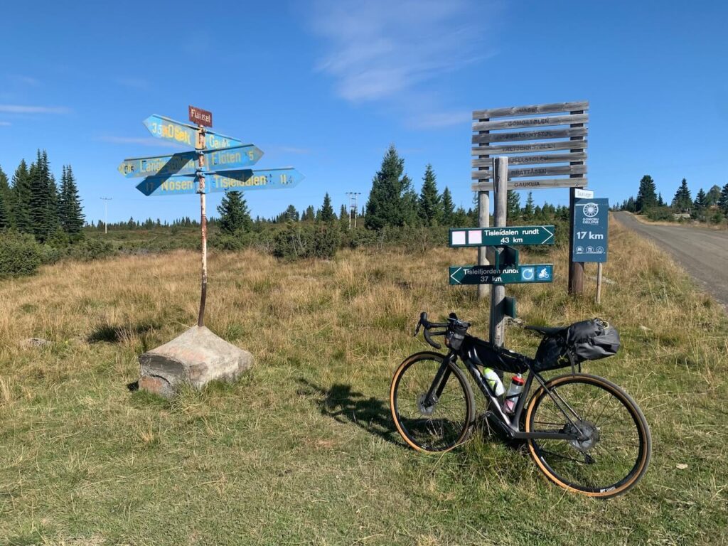
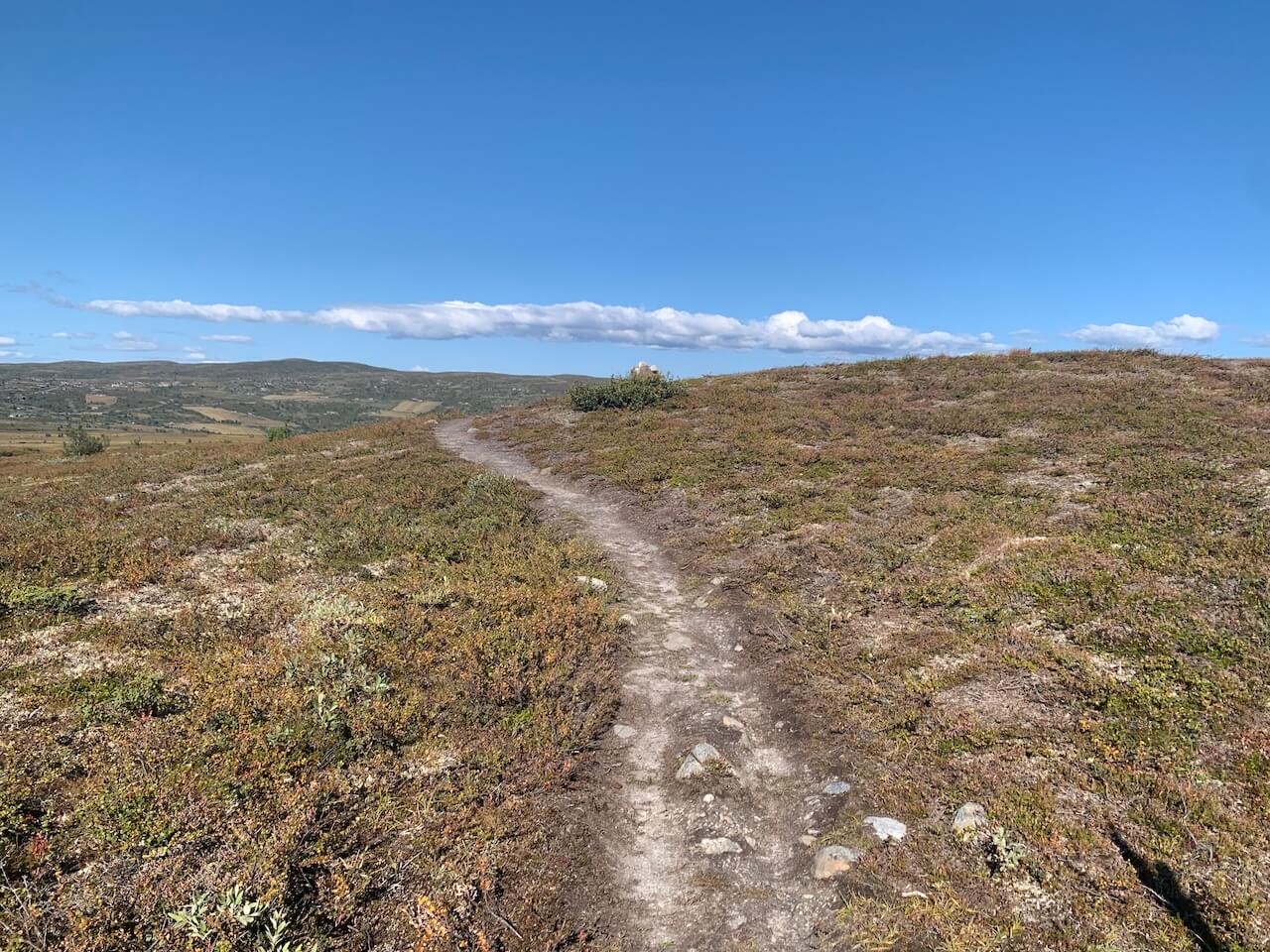
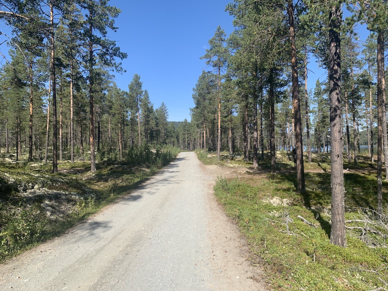
In Vaset, a short paved section leads to gravel roads across a scenic plateau dotted with lakes and reservoirs. After passing the Golsfjellet ski area, the trail veers onto a narrow path through serene pine forests, offering lovely rest stops. Passing the Storefjell ski area, the route descends on gravel, returning briefly to the tarmac before following a gravel trail along a river into Gol.


Gol, a small tourist town, marks the route’s end. After over 230km of mountain tranquillity, its modern contrast, with cafes, restaurants, and shops along the high street is a weird reminder that the journey has sadly ended. Gol offers many options for accommodation, including campgrounds that line the valley and the train station has several departures to Oslo or Bergen each day. Ensure you book in advance with a bike.


If you’re looking to extend your adventure, Gol offers several exciting routes in all directions (see maps below). You can cycle the peaceful forest gravel roads to Geilo and then hop on the train to Haugastøl, where the renowned Rallarvegen mountain road begins. Another option is to complete the loop by cycling the remote roads to Lillehammer and then following the famous Peer Gynt Vegen gravel road back to Vinstra. Lastly, National Cycle Route 5 continues from Gol to the coastal town of Larvik through Norway’s historic and long medieval valley. You can discover more about this route here!

Gallery

Difficulty of Route

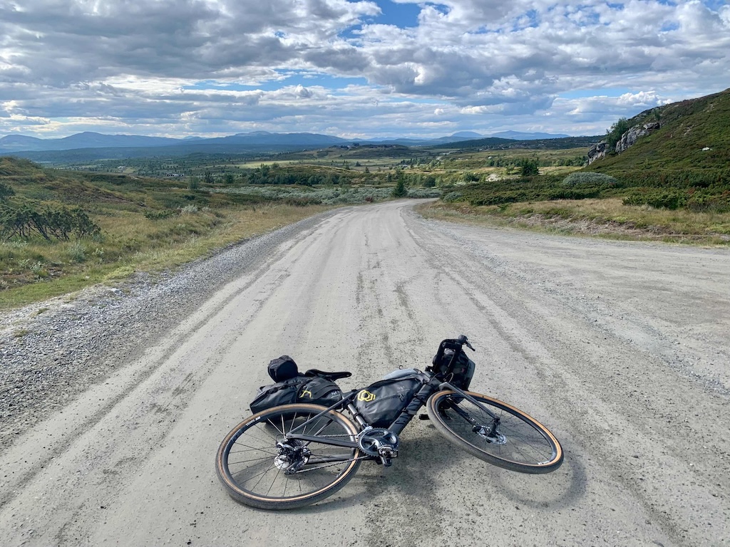
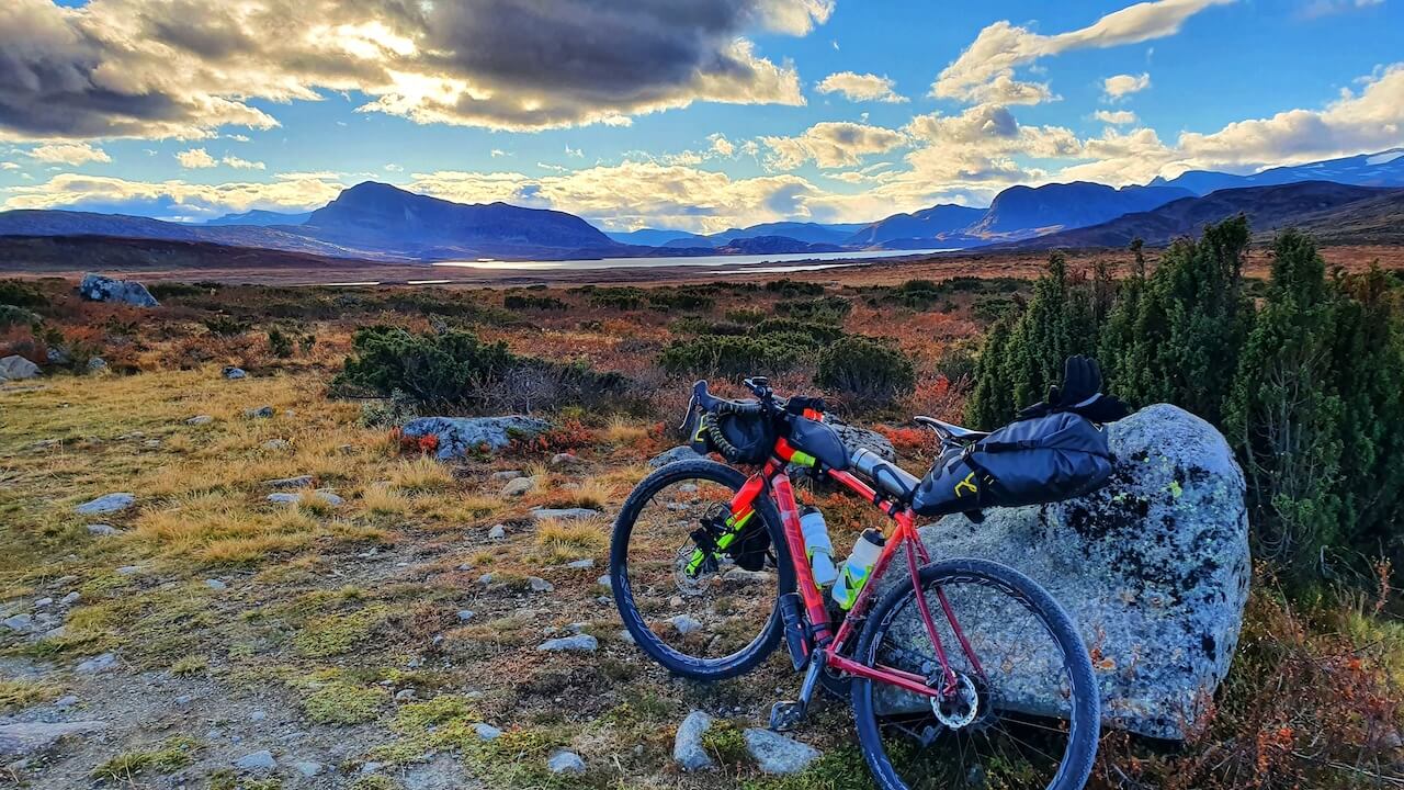
This route mostly follows wide, hard-packed gravel roads with minimal traffic and are generally in good condition, though recent repairs may affect surface quality in spots. The route kicks off with a tough yet manageable 800m climb before levelling out into long, comfortable stretches. The most challenging section is the Slettefjellet climb—manageable when heading south toward Gol, but a serious test (with gradients averaging over 10%) going north toward Vinstra. For those wanting an alternative, you can bypass the mountain using paved roads or take an extended route with a scenic boat ride to Bygdin Mountain cabin (see main route map).


The route can be tailored to match your desired pace with small loop routes available that cycle the flat plateau region (see maps below). For resupply, small supermarkets are available about every 30–50km (except on the Jotunheimvegen stretch, where distances extend to 60km). Cafés and restaurants are found in towns and larger villages, and fresh mountain water is easily accessible from rivers. Norway’s transit system makes logistics simple, with train stations in Vinstra and Gol offering direct connections to Oslo, and access from Bergen and Trondheim if needed.

———————————–

Guest Blog: Mjølkevegen: A Weekend of Gravel, Grit, and Glory

Imagine yourself in the shoes of someone who’s ridden this route. Check out our friend Gjermund’s creative and captivating blog post about his weekend adventure on Mjølkevegen!

mjølkevegen bikepacking

Mjølkevegen POI's

This is the official route. You will notice there are plenty of mountain cabins for accommodation and food shops scattered along the route.

Bypass Slettefjellet ⛰️

If you fancy an alternative to the climb up Slettefjellet you can take a lovely boat journey along one of Norway's most beautiful mountain lakes. Please check the timetable and plan accordingly. See the smaller loop version here.

Mjølkevegen Loop

If you want to end up where you started, this is a great option to extend the route with more remote gravel roads. This includes the wonderful Peer Gynt Vegen (photo), which takes you to Lillehammer (Starting in Gol).

Short and Easy Routes

There are plenty of short loops in the southern part on flat areas of Valdres (ideal for children). In the North section, you have two shorter loops that include the tough climb up Slettefjellet. More information about all these routes here

Mjølkevegen & Rallarvegen

If you want to combine the two most popular cycling routes in Norway you can cycle Gol - Geilo on quiet gravel roads through forest scenery. However, Haugastøl (Start or End of Rallarvegen) - Geilo is on the main road 7 (22km) which is not a pleasant experience at times with tourist traffic and supply trucks passing you. You have an option to bypass this section by train but you must book in advance (entur.no)

700km of Gravel

Røros - Grimsdal - Mjølkevegen - Rallarvegen: This is a further extension of the above route. It was put together by Martin Storli, a local who cycled this 700km epic gravel route that combines all of Norway's most famous gravel areas.  Note, that the road/route turns into a hiking area in one small area of the east with some creeks and streams to cross.

Peer Gynt Seterveg

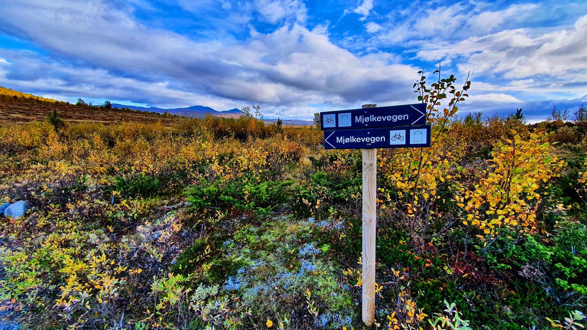
If you start or end in Vinstra there is a fantastic mountain gravel day ride as an add-on that follows the historic 'Milk Way'. Peer Gynt Seterveg was originally an old transport route to the historic mining town of Røros,  transporting milk from mountain farms in Valdres. See more here

Peer Gynt Seterveg

Highlights

Must know

  • Getting Here and Away: You can reach Gol using the Oslo-Bergen train line. Vinstra train station is on the Oslo – Trondheim line. Book using the Entur app. See Transport section for more info.
  • When to go: You can ride the first stage in late May but Jotunheimvegen doesn’t usually open until around 20th June. However, in 2024 it opens in late May and thus you should check with Bygin Mountain Cabin who will have the latest info. Note, If you ride it at the right time in September you’ll get amazing autumn colors.
  • Food & Supplies: There are plenty of food shops along most parts of the route. Jotunheimvegen is the most remote part so ensure you have enough snacks to get through 50-60km. Note, expect prices to be high for mountain cabins selling food.
  • Water: It should be straightforward to find water along the route. Cabins, supermarkets, public toilets, etc, are scattered all along the route. You’ll also have fast-flowing streams in the remote areas to keep you topped up.
  • Bike Type:  We would recommend a gravel, touring, or MTB bike with a tyre size of 35-40mm for Mjølkevegen but it’s possible with 30-32mm. With plenty of climbing, you should have enough gear. I used an 11-36 cassette.
  • E-Bike Charging:
    • The Filefjell Tourist office/Intersport store at Tyinkrysset – inside or, if closed, outside on the wall close to the garbage containers. You may borrow Shimano, Bosch and Yamaha chargers.
    • The Beitostølen Tourist office at Velkomstsenteret in the centre of Beitostølen.
    • Slettefjellkiosken: 6 contacts for charging of e-bikes. Fee NOK 20 kr per charge.
    • At Gol: In the tourist office
    • At all Mjølkevegen-accommodations along the route.
  • Many businesses are closed on Sunday: stock up on food on Saturday evening.
  • Public Toilets: All mountain cabins will have clean toilets you can use and there is one really good public toilet in Beitostølen with a free bike wash stand outside (see POI Map for location). Gol and Vinstra train stations will have toilets if the station waiting rooms are open.
  • Bike Rental Gol 
  • Bike Rental Others
  • Bag Transport Service: This is one of the few places in Norway where bag transport between hotels is readily available. Contact companies such as Discover Norway, which offers fully package tours in Mjølkevegen. Other companies include this one here.

Accommodation

  • Airbnb: There are options along the route mainly in the towns.

Video

Transport

  • Trains: There are train stations at the start and finish lines in  Gol, and Vinstra. However, there are no train lines close to the route as you cycle it.
    • The Oslo-Bergen line (Gol Stop) has a full carriage for bikes and is usually easy to get a spot on short notice.
    • The Oslo – Trondheim (Vinstra Stop) has limited capacity and can be fully booked up if booked at short notice.
    • Tip: If you’re heading to Vinstra, and notice the trains that day have no space for bikes. You can cycle down to Lillehammer (around 75km). There are several route options,  for example, National Cycle Route 7 or vier Peer Gynt Vegen (see Mjølkevegen Loop Map above). At Lillehammer, there are regional trains to Oslo that don’t require advanced bike bookings and are usually easy to bring your bike onboard.

Full information about Norway’s Public Transport can be found here


  • Ferries: 
    • One on this route, which is optional along Bygdin Lake. The M/B Bitihorn is a historic boat that has operated since 1912, taking passengers on a stunning journey across Lake Bygdin in Norway. Known as one of Northern Europe’s highest boat services, it runs between Bygdin and Eidsbugarden, with a midpoint stop at Torfinnsbu. This journey provides breathtaking views of Jotunheimen’s towering peaks, serene lake waters, and picturesque mountain landscapes. Recommend booking a ticket in advance. (Bike welcome at an addional price).
    • In 2024, M/B Bitihorn will run from 28.06. – 01.09, and the weekends 06.–08.09., 13.–15.09 (check website for 2025 dates)


  • Buses:
    • For Vinstra, Innlandstrafikk is the main bus company that is in operation. This is a good map of where you can catch a local bus if required. Many of the local buses will allow a bike on board (child fare). Some long-distance buses may refuse bikes.
    • Valdresekspressen runs up to eight times daily from Oslo to Fagernes, with connecting services to Beitostølen (Gjendesheim in summer) and Årdal via Tyinkrysset. Departures are also from the DFDS/Stena Line and Color Line ferry terminals as well as Sandvika station. A bike can be booked during the online booking process (270kr).
    • Øst-Vest Xpressen runs once a day between Lillehammer and Bergen via Fagernes and Tyinkrysset (corresponds with Valdresekspressen at Fagernes). A bike can be booked during the online booking process (270kr).

Safety

Animals

This route is alive with livestock, so expect some close encounters with animals along the way. Cows may linger in the middle of the road, often unbothered by cyclists, while sheep can appear suddenly and dart across the tracks. Goats, too, have a habit of congregating in the road, which can be hazardous when descending at speed. Staying alert in these areas is essential to avoid surprises.

Mosquitoes will also be present during peak summer, especially around lakes and when wild camping.


Tunnels

There are no tunnels on this route

Busy Roads
  • Road 51 (Valdresflye): Only a short section on Road 51 may have some (but not many) cars and campervans passing you. Overall, this is a very convenient route for traffic, and you will find yourself on empty roads in many sections.

The Weather

You may have warm and sunny weather on Mjølkevegen, but you must prepare for cold and possibly wet weather over the mountain passes and plateaus. High winds are also common in unprotected areas. Water/windproof gear is essential if the weather is unsettled. Gloves should also be in your bag even in peak summer. The mountain region can get very cold at night if wild camping.

Further Reading

Clothes List

Public Transport

Gear list

Opening & closure of roads

Accomodation

Finnmark too has a certain mystique. Being about the same distance from Oslo as Istanbul, in some ways, it’s basically the last stop before the North Pole. The undoubted highlight of the journey is simply cycling the wild expanse of Europe’s last great wilderness. It will feel very lonely up here but isn’t that a reason to cycle it? The cycling heat maps of the world are full of well-ridden roads. Here you will join a small group of cyclists seeking something extraordinary. Passing wild herds of reindeer and perhaps not seeing another human for many hours is why you came – right? The ride comes to an end in the town of Kirkenes which has Russian road signs. This will indicate you have reached the boundaries of the Western world!

Transport

Finnmark too has a certain mystique. Being about the same distance from Oslo as Istanbul, in some ways, it’s basically the last stop before the North Pole. The undoubted highlight of the journey is simply cycling the wild expanse of Europe’s last great wilderness. It will feel very lonely up here but isn’t that a reason to cycle it? The cycling heat maps of the world are full of well-ridden roads. Here you will join a small group of cyclists seeking something extraordinary. Passing wild herds of reindeer and perhaps not seeing another human for many hours is why you came – right? The ride comes to an end in the town of Kirkenes which has Russian road signs. This will indicate you have reached the boundaries of the Western world!

Terms of use

Keep in mind

All cycling routes published on CYCLENORWAY.com are simply a planning resource to be used as a point of inspiration in conjunction with your own due-diligence. All route guidelines were prepared under diligent research. However, we can never for certain insure the complete accuracy of the routes. Cycling in Norway is in general very safe. Nevertheless, should you choose to cycle this route you do so at your own risk.


Check weather conditions

We advise that you check weather conditions along the route and look out for land/road closures. 

Check out this helpful video to see how the routes can be uploaded onto your mobile device and cycling computer.

Cycling long distance is tough, and you should not attempt routes that are beyond your level. 

Follow all rules and regulations when wild camping. 

If you discover any inaccuracies on this page, please let us know so we can correct them.

More routes in the area

Peer Gynt Vegen

The Peer Gynt Road is a 60-kilometre-long tourist mountain road, named after the folkloric character Per Gynt. It is a toll road (free for cyclists) and offers scenic views of the Jotunheimen region.

Peer Gynt Vegen

The Peer Gynt Road is a 60-kilometre-long tourist mountain road, named after the folkloric character Per Gynt. It is a toll road (free for cyclists) and offers scenic views of the Jotunheimen region.
Jotunheim Gravel Explorer

Jotunheimen Gravel Loop

Norway’s highest mountain passes meet gravel and paved roads on one of the best cycling loops on the planet. Every kilometer has breathtaking scenery. If you can handle several long climbs this is for you!
Jotunheim Gravel Explorer

Jotunheimen Gravel Loop

Norway’s highest mountain passes meet gravel and paved roads on one of the best cycling loops on the planet. Every kilometer has breathtaking scenery. If you can handle several long climbs this is for you!

Hallingdal & Rallarvegen

This is a bikepacking paradise where nature, gravel, and road combine to give you an experience unlike everything else.

Hallingdal & Rallarvegen

This is a bikepacking paradise where nature, gravel, and road combine to give you an experience unlike everything else.

Leave your thoughts below

Stay up to date with the latest from Norway’s cycling scene.

Subscribe To Our Monthly Newsletter

non-intrusive, offering informative news, blog posts, videos, and more.