


60 km
Distance
1319M
Dénivelé positif
1
Jours
35%
Non pavé
7/10
Difficulté
32-40mm
Types Idéaux
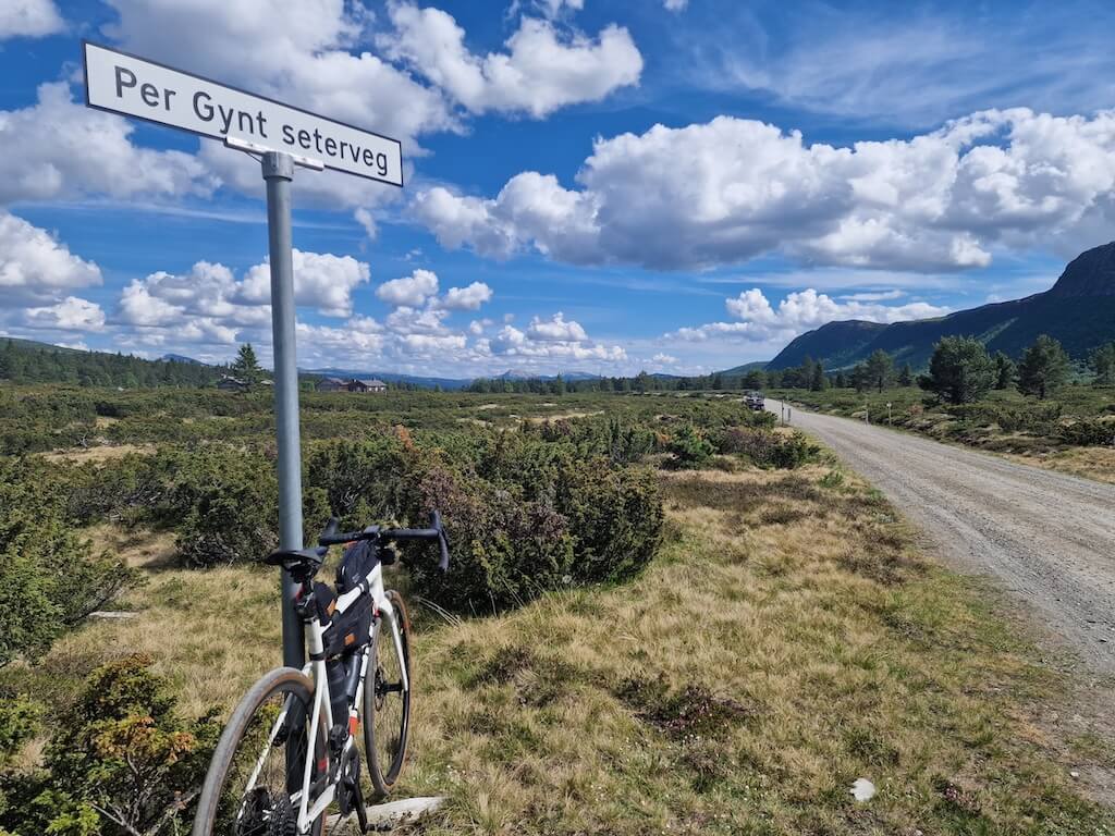
Boucle du sentier Peer Gynt
Peer Gynt Seterveg (Mountain Farm Road) is a historic 60 km gravel loop that starts and ends in the town of Vinstra, located in the heart of the Gudbrandsdalen Valley. Named after the renowned playwright Henrik Ibsen (1828-1906), who visited Gudbrandsdalen in the mid-19th century and was inspired by local tales of a legendary figure from the area, the road has a rich cultural background.
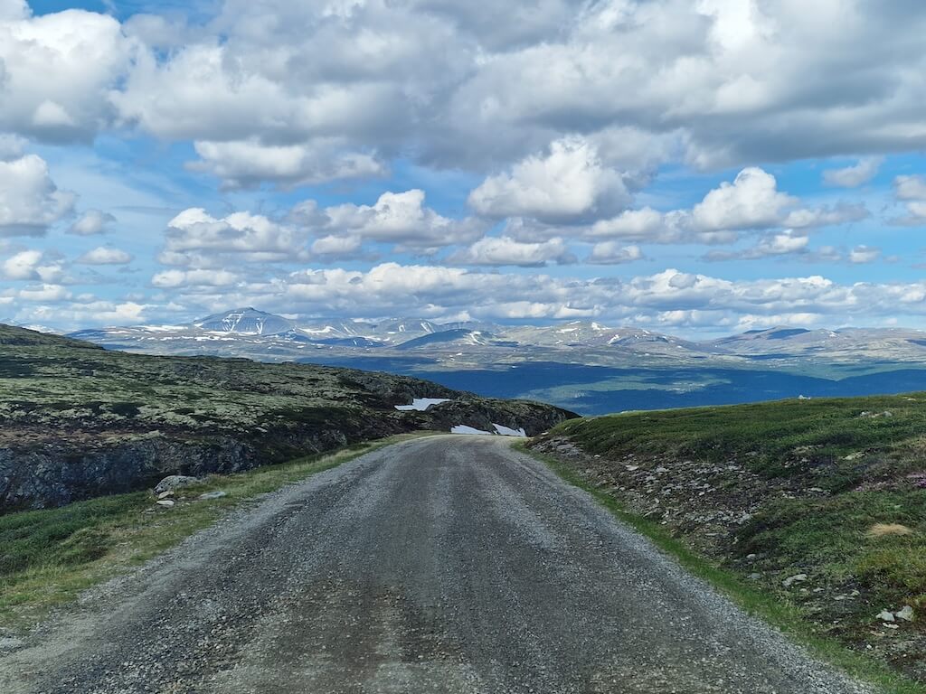
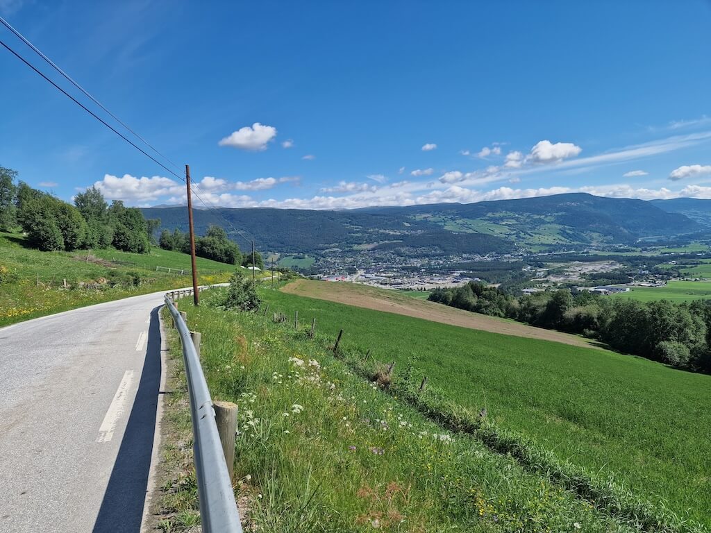
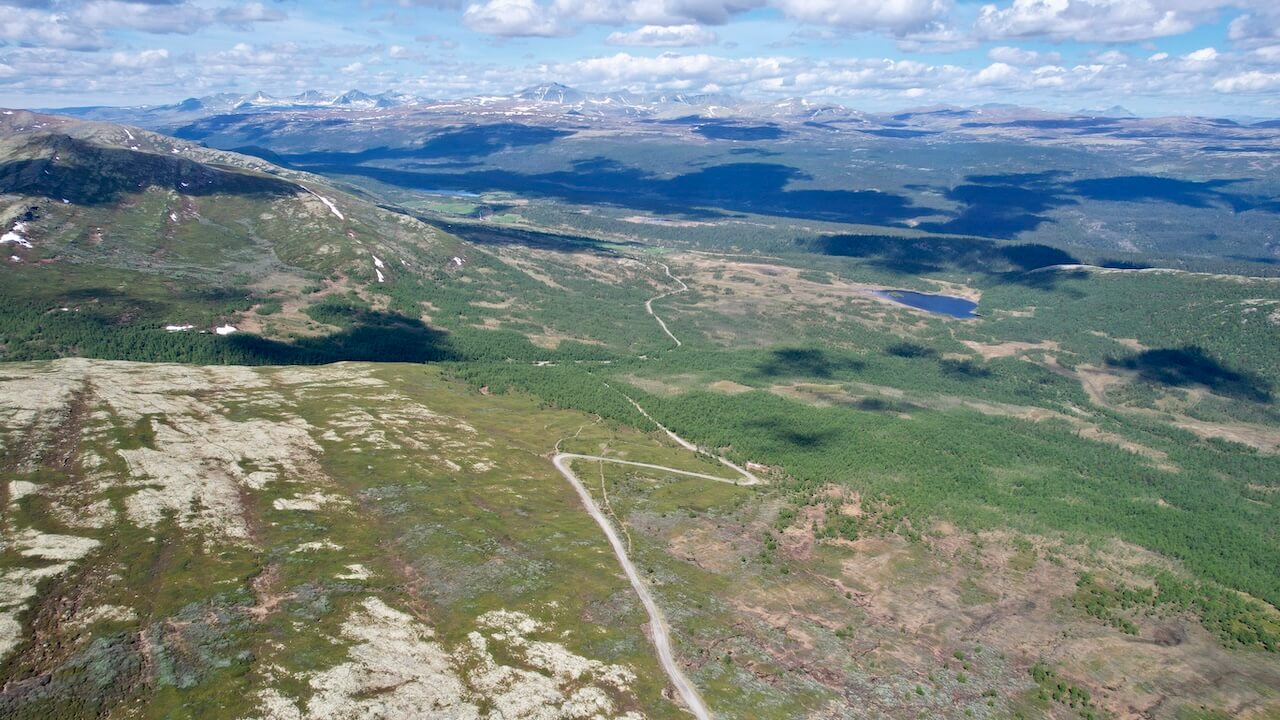
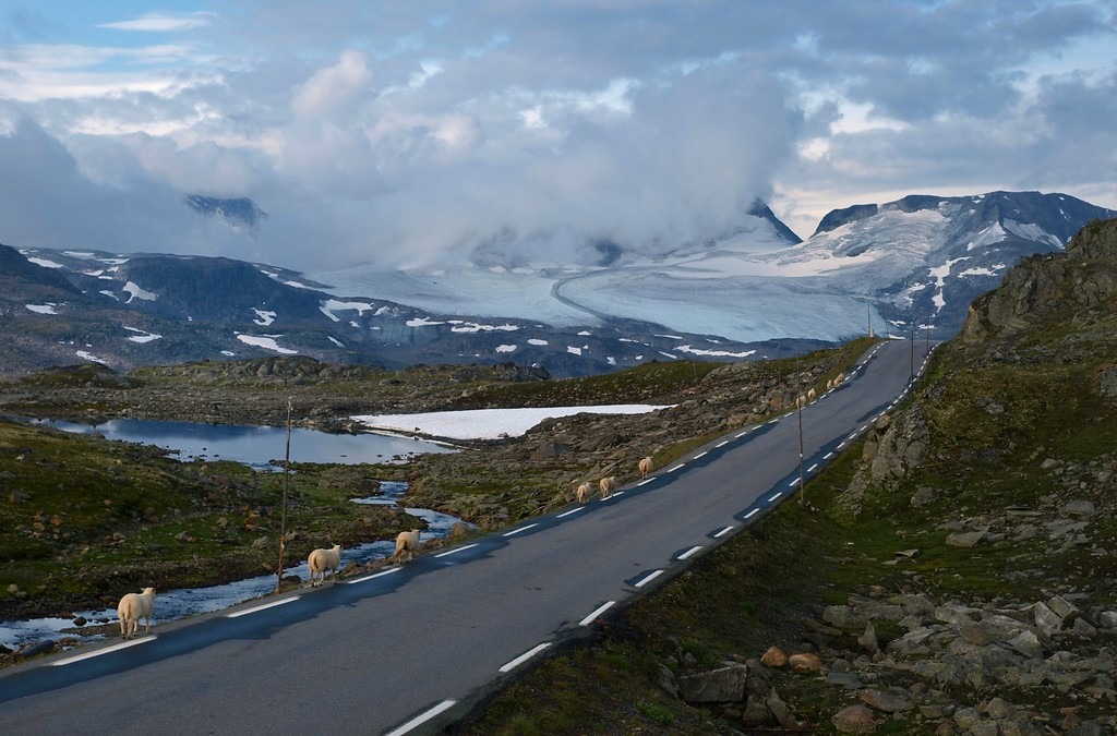
Originally an old transport route to the historic mining town of Røros, Peer Gynt Seterveg was used in the summer months to transport milk from mountain farms to Røros, where it was sold to travelers from the region. Today, the road is a popular attraction for locals, offering stunning views during the warmer months. Along the route, you can enjoy vistas of both sides of the Gudbrandsdalen Valley, including the high mountain peaks of Jotunheimen and Rondane National Parks. The area is frequented by wild reindeer from May to September, and you might even spot eagles soaring overhead.
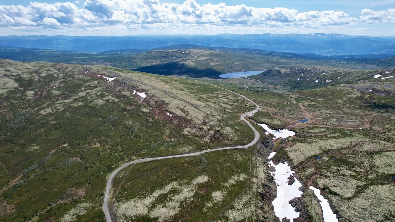
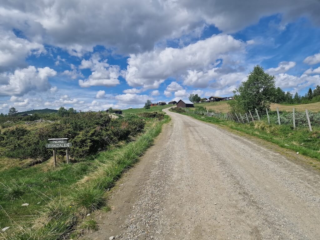
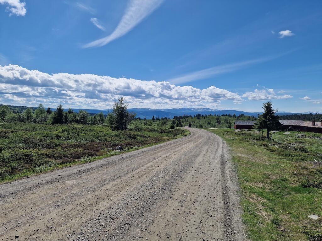
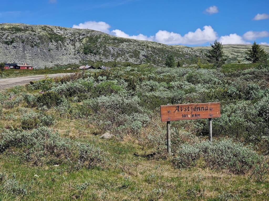
The road is well-maintained, with hard-packed gravel in most places. There are several mountain farms and a few accommodation options along the route. However, food must be brought from the towns in Gudbrandsdalen Valley, as there are no food options for many kilometers. The highest point of the loop reaches over 1100 meters, and it is more challenging if cycled counterclockwise. A reasonable level of fitness is required to complete the loop, and it can be cold at higher elevations on unsettled days. Overall, Peer Gynt Seterveg is a fantastic gravel loop that can be completed in half a day, offering beautiful views of the surrounding area.
Carte routière
Quand ?
The road is usually clear of snow in late May and stays snow-free until mid to late October.
Y arriver
You can take one of the several daily trains between Oslo and Trondheim. You start at either Vinstra or Kvam train station.
Dangers
You’ll encounter some tourist traffic along this route, but it’s generally light, and most sections are peaceful and enjoyable to ride. There are no tunnels or hazardous stretches to worry about.
Location de vélos
There are no bike rental options in Vinstra, but further down the Gudbrandalen valley, you will find several places mentioned on this page.

“Why isn’t this route better known? It’s the ideal warm-up before tackling Mjølkevegen”
Recommandations locales
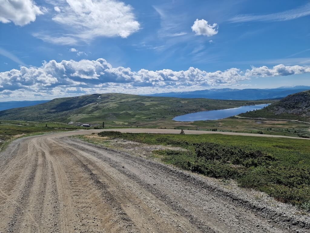
Mjølbøla Summit
As you reach the highest point, you’re spoiled for choice when it comes to views. To one side, the vast Gudbrandsdalen Valley stretches out before you; to the other, the snow-capped peaks of Rondane National Park rise in the distance. It’s a unique and spectacular viewpoint, with information boards that share insights about the terrain, local history, and wildlife.
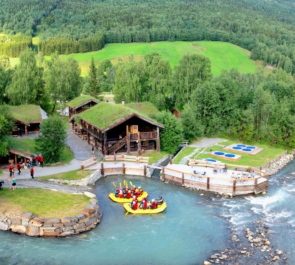
Europe’s Best White Water Rafting
This area is also known for world-class white-water rafting and makes a great add-on to your adventure. Sjoa Rafting Lodges sit along the wild Sjoa River in Heidal, surrounded by forested valleys and mountains. They offer cosy cabins and tents that blend comfort with rustic charm, plus rafting options from family-friendly trips to full-day runs. It’s a perfect mix of excitement and calm — relax in a riverside hot tub after the rapids. Affordable, authentic, and ideal for those who love real nature and adventure. See POI on the route map for the location. Easy to reach by bike.
Gudbrandsdalen Valley
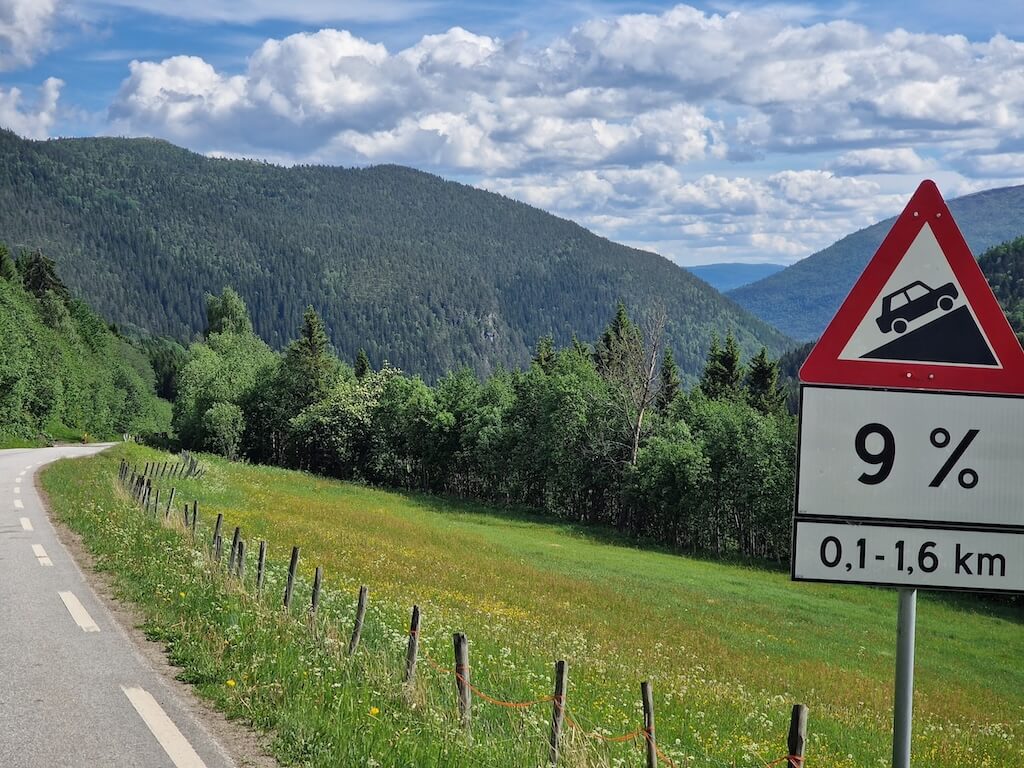
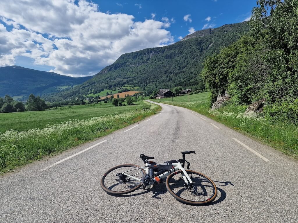
After the long climb and fast descent, you’ll roll into the town of Kvam. From here, the route follows the quiet, flat old roads through Gudbrandsdalen back to Vinstra. With most traffic diverted to the main E6, you can choose either side of the river and enjoy a peaceful, scenic ride all the way back.
Liens utiles
Booking.com – pour les options d'hébergement dans toute la Norvège
Application Entur – pour planifier des trajets en transports en commun en Norvège
Ferry – itinéraires, horaires et informations par Statens Vegvesen
Étiquette du camping sauvage important à savoir
Lectures complémentaires
Garder à l'esprit
Tous les itinéraires cyclables publiés sur CYCLENORWAY.com sont destinés à des fins de planification et d'inspiration, à utiliser en complément de vos propres recherches et de votre jugement. Les itinéraires sont créés à l'issue de recherches approfondies, mais chaque cycliste a des capacités, des attentes et une tolérance au risque qui lui sont propres. Certains itinéraires peuvent inclure des sections où il faut porter le vélo, des sentiers boueux ou humides, des terrains techniques, des montées abruptes, des descentes ou des zones isolées qui pourraient ne pas convenir à tous. Les données d'itinéraire, les logiciels de cartographie et les conditions peuvent également changer ou contenir des inexactitudes. Le cyclisme en Norvège est généralement très sûr. Néanmoins, si vous choisissez de suivre ces itinéraires, vous le faites à vos propres risques.


Laisser un commentaire