


80km
Distance
2646m
Elev. Gain
1-2
Days
60%
Unpaved
8/10
Difficulty
35-45
Ideal Types
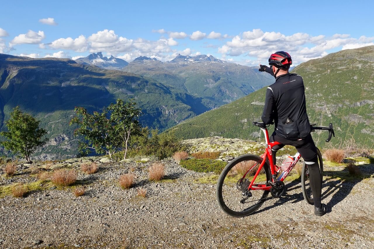
Tusenmeteren
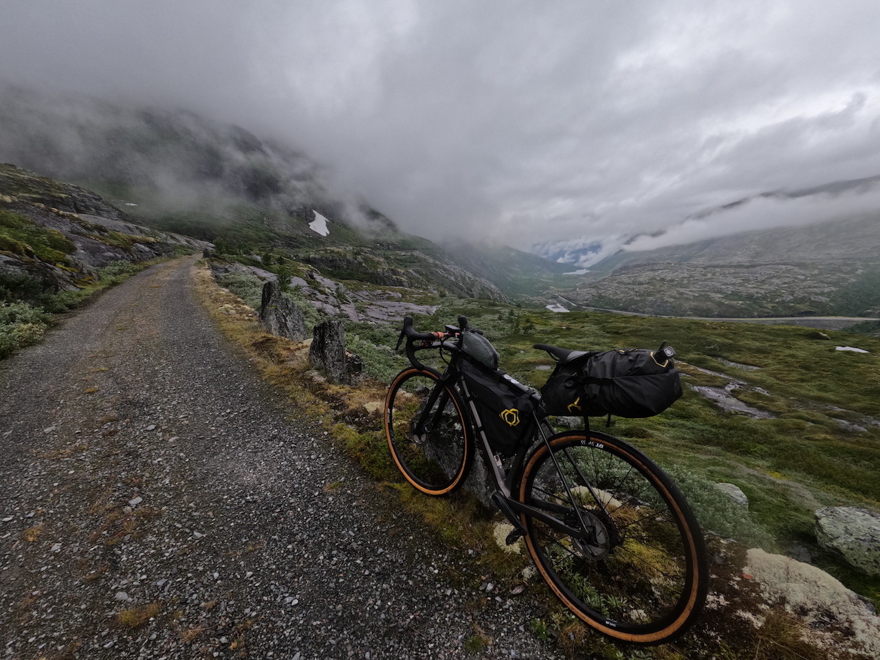
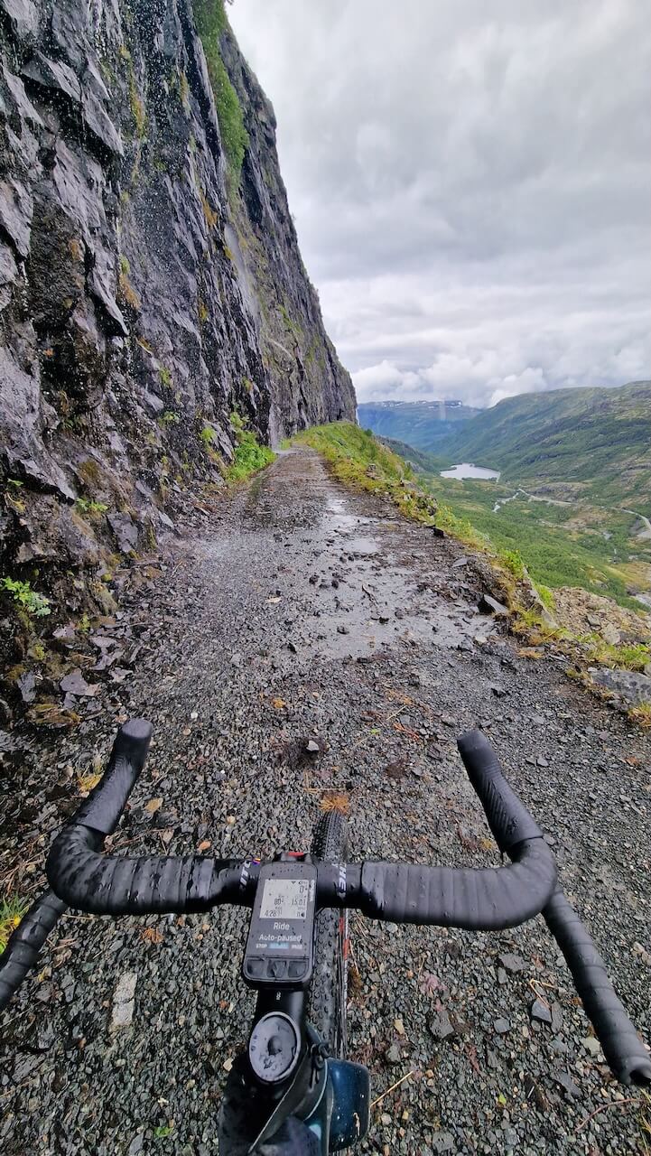
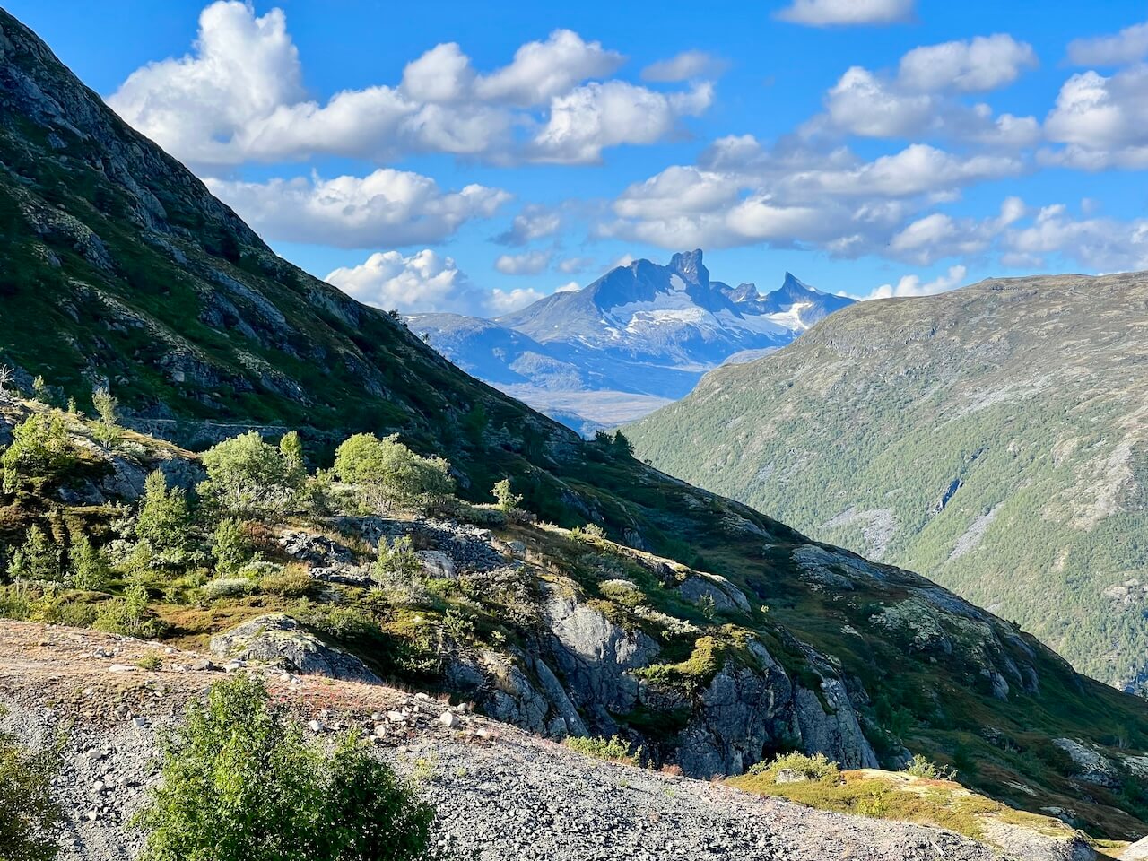
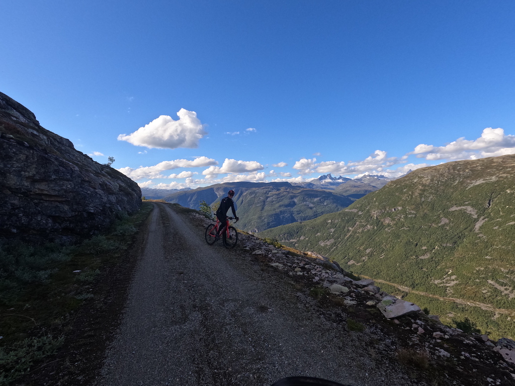
The road known as Tusenmeteren (“The Thousand Metre Road”) was originally built in the 1930s and 1940s during the great era of hydroelectric development in Årdal. Carved into the mountainside with limited machinery, it was a vital link for workers and materials heading up to the dam installations on the high plateau. Its construction was a feat of engineering, with steep gradients and exposed corners that still testify to the determination of the time. Though it began as an industrial road for hydropower, today it stands as both a historic landmark and one of the most remarkable cycling routes in the region.
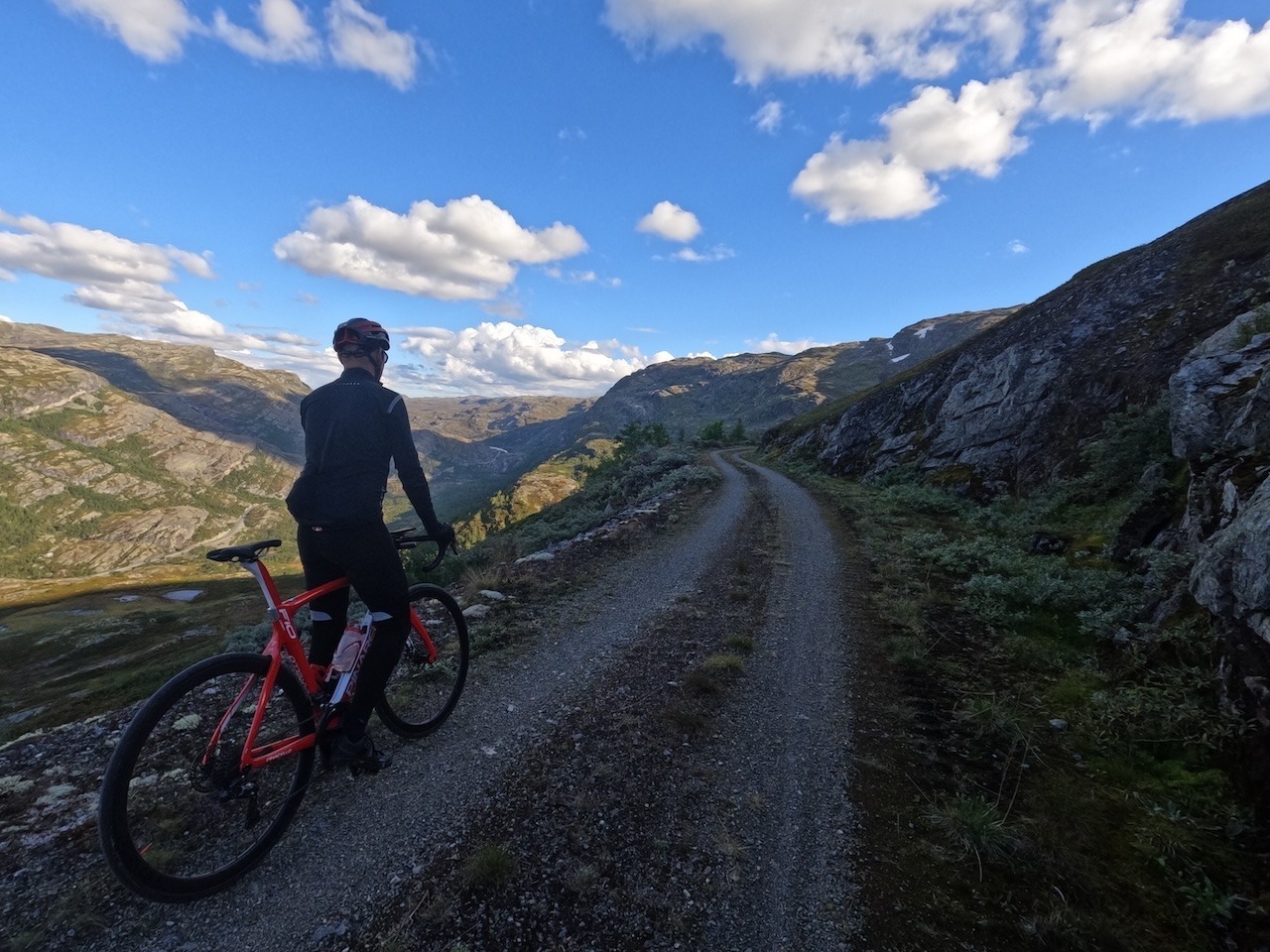
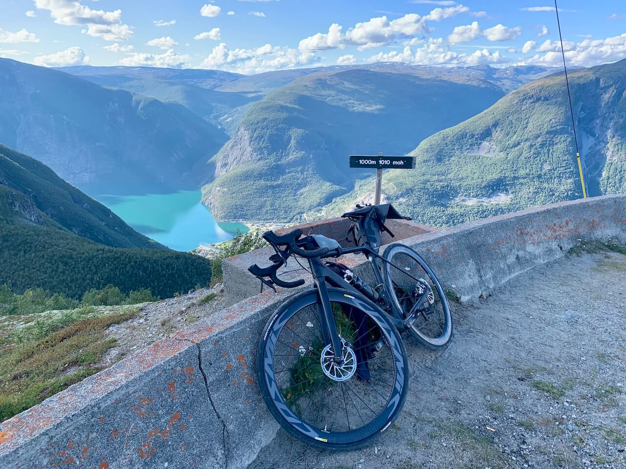
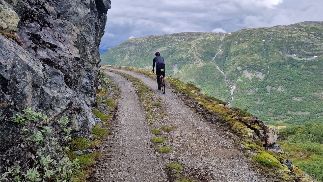
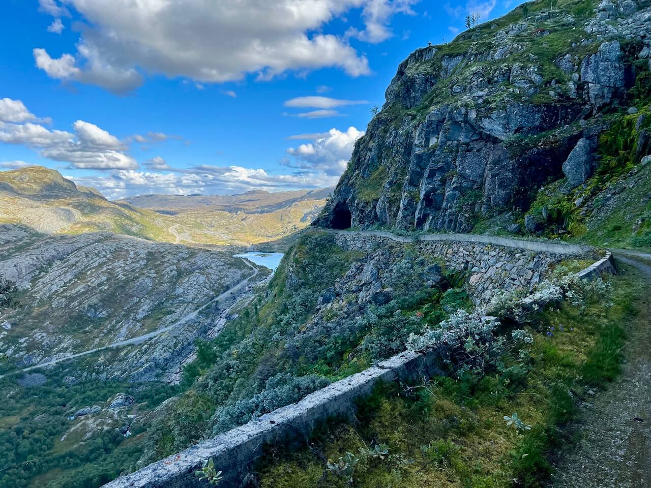
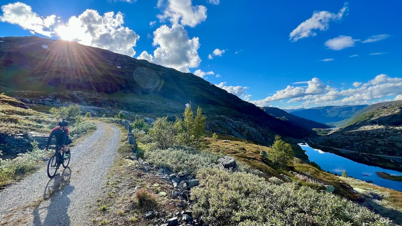
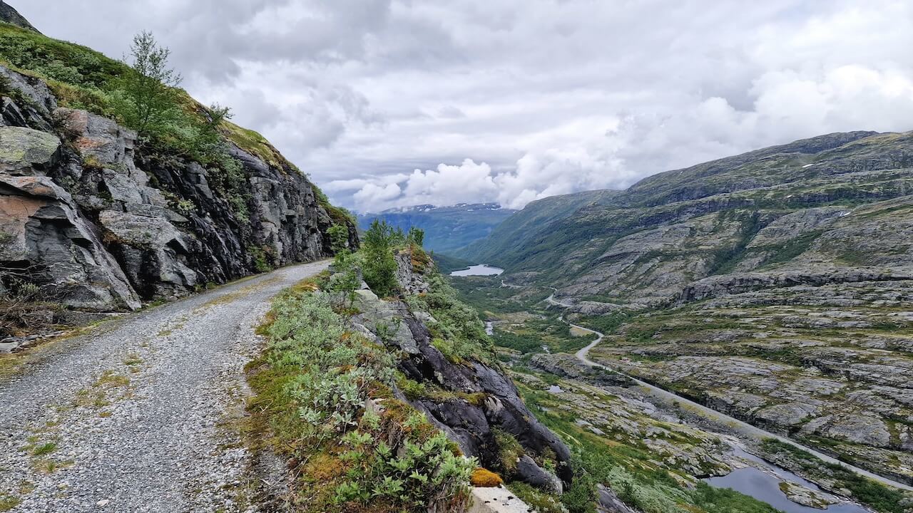
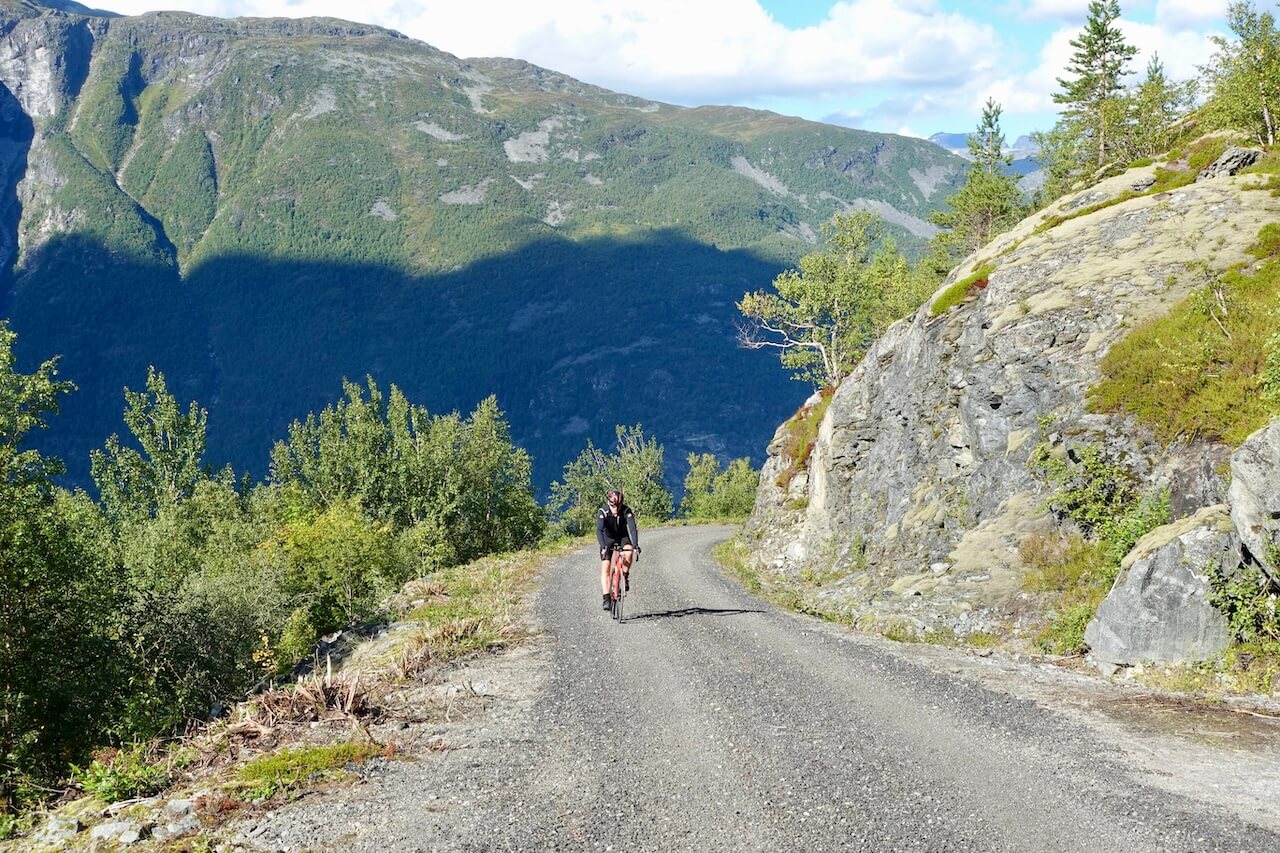
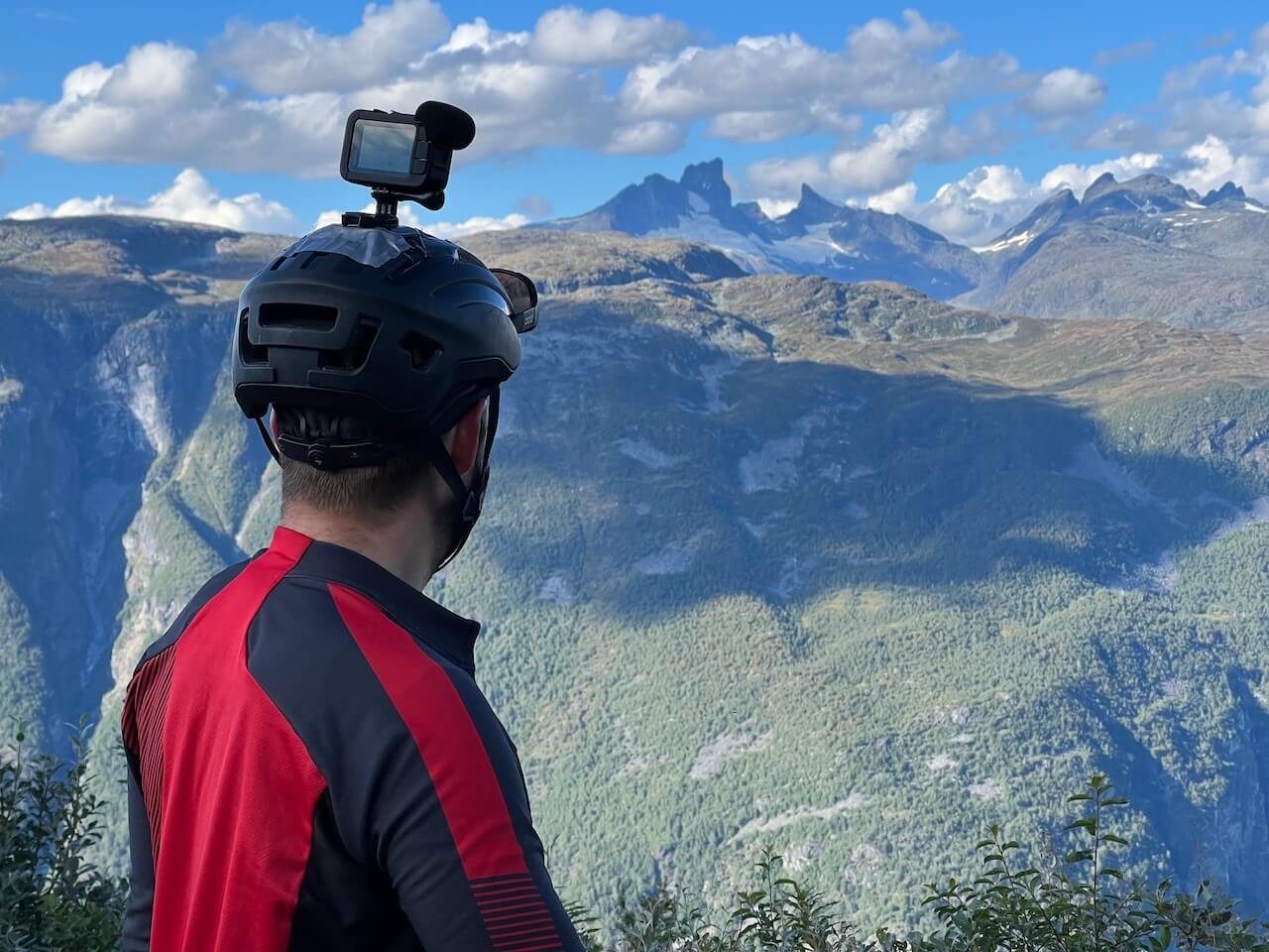
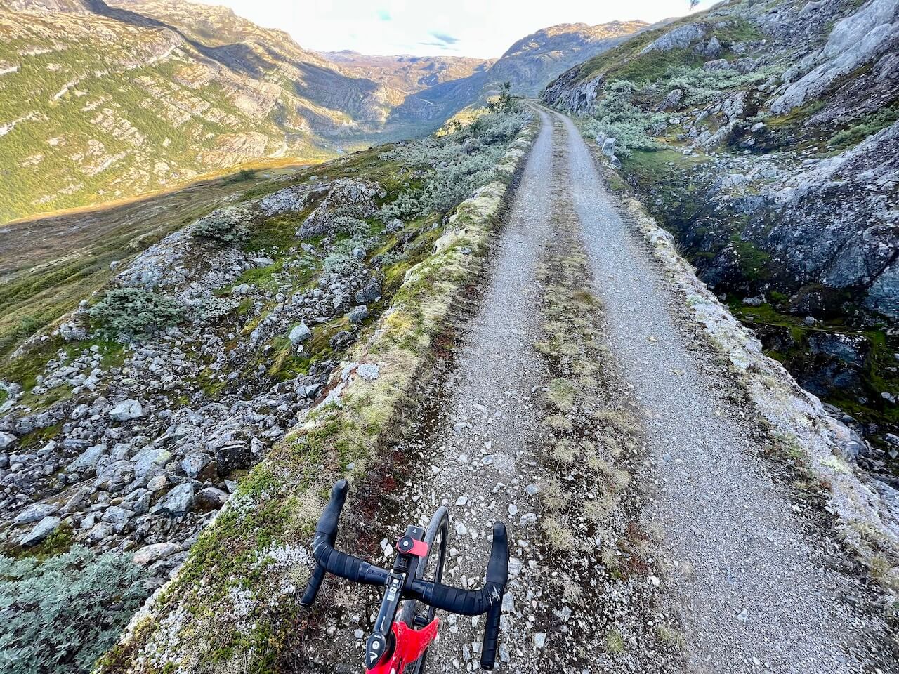
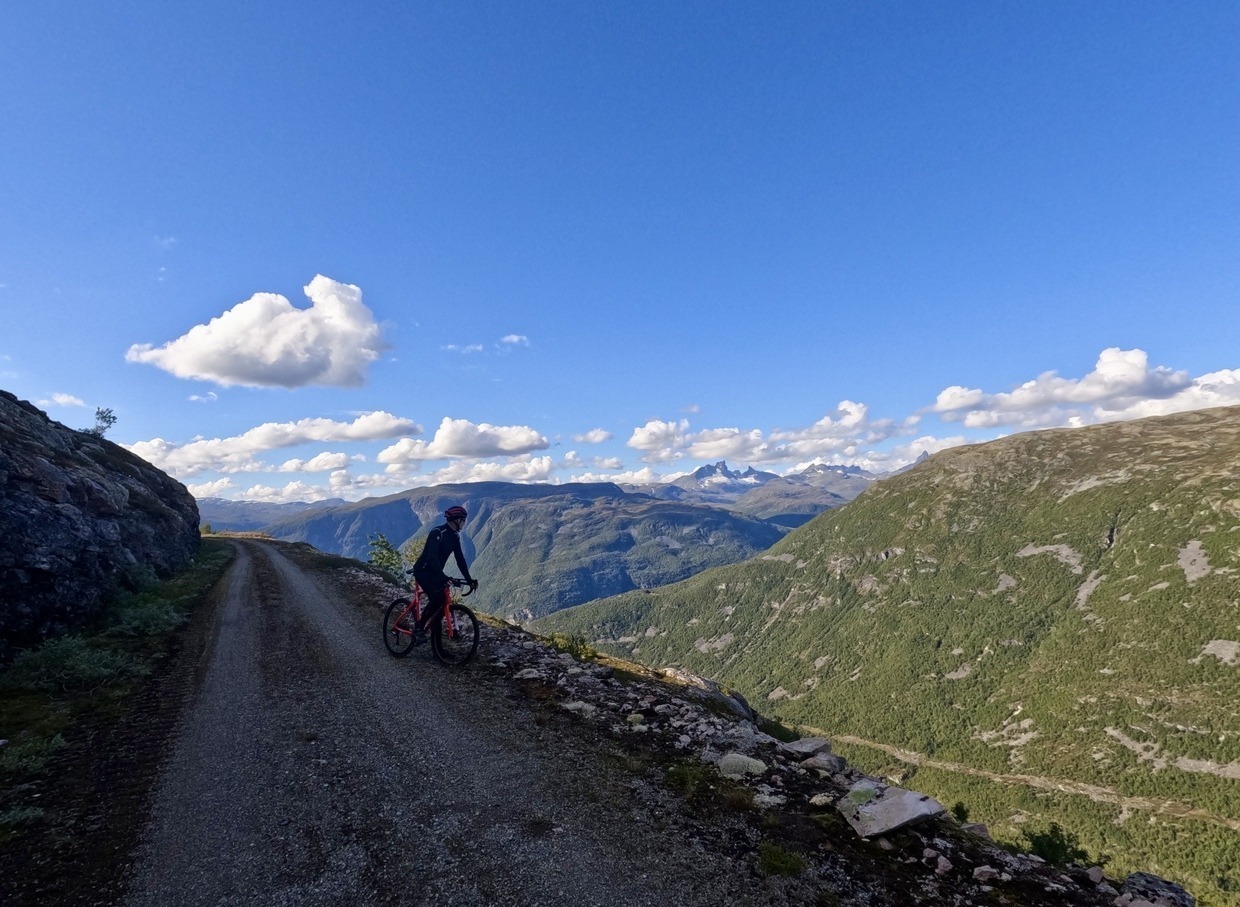
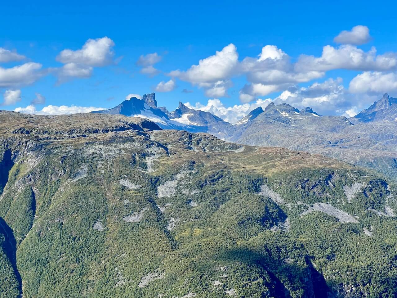
Starting near Øvre Årdal, the gravel road climbs relentlessly through 42 tight hairpin bends until it reaches roughly 1,000 meters above sea level. From the top, you’re rewarded with a dramatic view over the fjord, the village below, and the high peaks of Jotunheimen in the distance. The route then follows the edge of the mountain ridge before winding down through a remote valley to rejoin the main road, where you can either descend back to Øvre Årdal or continue eastward. With its history, scenery, and sheer sense of achievement, Tusenmeteren is often called the finest stretch of gravel in Norway, a ride that rewards every effort you put into it.
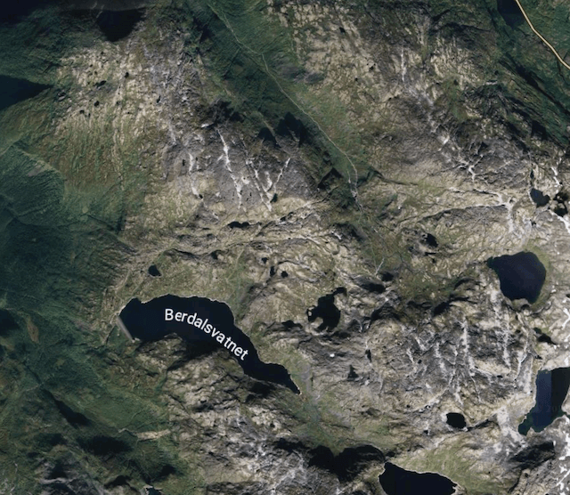
Route map
When?
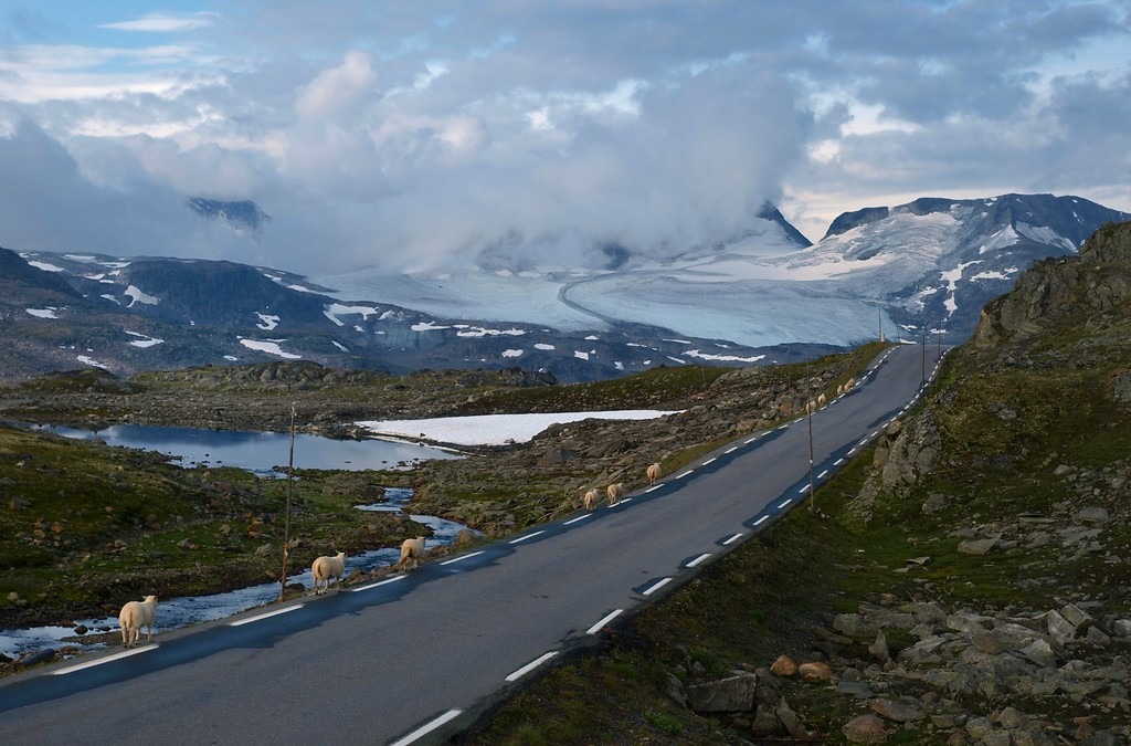
Snow conditions vary from year to year, so it’s difficult to predict exactly when the route will be clear. The safest window is usually mid-July to September. Attempting it in June often means crossing large snowfields, which can be dangerous given the steep cliffs the road follows.
Getting there
– Oslo → Tyinkrysset: Take the Valdresekspressen bus from Oslo Bus Terminal towards Fagernes/Øvre Årdal. Some departures go all the way to Øvre Årdal in summer. If not, get off at Tyinkrysset and transfer to the local bus down to Øvre Årdal. The long-distance buses (Nor-Way/Valdresekspressen) accept bikes if booked in advance. They charge a high fee, and space is limited to two bikes. Always reserve when buying your ticket.
– Bergen → Lærdal/Årdal: Take the Sognefjord Express boat (Norled) from Bergen to Sogndal (bikes allowed, but book space in advance). From Sogndal, take the local bus to Øvre Årdal (runs several times daily). Alternative: Long-distance buses also run from Bergen → Lærdal/Sogndal with connections to Øvre Årdal (bikes must be reserved).
Use Entur.no for local buses
Hazards
– The climb up to 1000 meters is tough, and the road is not in the best condition in places. If descending, take care, easy to come off your bike on the sharp corners.
– There is a pitch black tunnel on the plateau ridge, which requires good lights to navigate.
– Early in the season, snow can block the route, and crossing it may be dangerous with steep drop-offs beside the trail.
Bike rental
- Visit Årdal / Bulder & Brak – Rent Merida bikes in Øvre Årdal (NOK 700/day, helmet & lock included).
- Bulder & Brak Adventures – Mountain/hybrid bikes with option for bike transport to the 1000 masl viewpoint route.

“It takes a lot to impress a Norwegian in his own country, but this road left me speechless”
Local recommendations
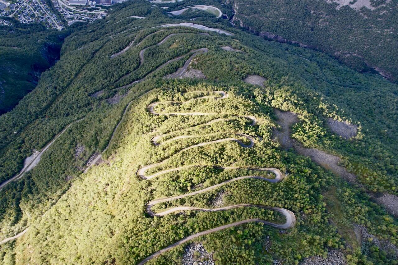
42 Hairpin corners to the top
This century-old road is tough to climb, but the reward is worth it: a small sign at the summit and a stunning view over Øvre Årdal and the fjord below
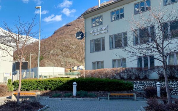
Sitla Hotel & Apartments
Accommodation in this remote area is limited. Sitla Hotel & Apartments, centrally located in Øvre Årdal, is the best choice if you want a reliable roof over your head.
Detour the Hydro Dam
If you want extra distance, take the little-used road branching right off the switch backs toward the hydro dam. It’s a remote detour, ending in a dead end, but makes for a 30 km round trip few cyclists ever ride. See the route map for details.
Useful links
Booking.com – for accommodation options across Norway
Entur app – for planning public transport trips around Norway
Ferries – routes, timetables and information by Statens Vegvesen
Wild camping etiquette – important to know
Further Reading
Keep in mind
All cycling routes published on CYCLENORWAY.com are intended as planning resources and sources of inspiration to be used alongside your own research and judgement. Routes are created using careful research, but every cyclist has different abilities, expectations, and risk tolerance. Some challenging gravel routes may include hike-a-bike sections, muddy or wet hiking paths, technical terrain, steep climbs, descents, or remote areas that may not be suitable for everyone. Route mapping software, and conditions can also change or contain inaccuracies. Cycling in Norway is generally very safe. Nevertheless, if you choose to ride these routes, you do so at your own risk. If you are unsure about a certain route leave a comment below and we’ll advise you.


Leave a Reply