


79 km
Entfernung
827m
Höhengewinn
1-2
Tage
85%
Unbefestigt
6/10
Schwierigkeit
35-45m
Idealtypen
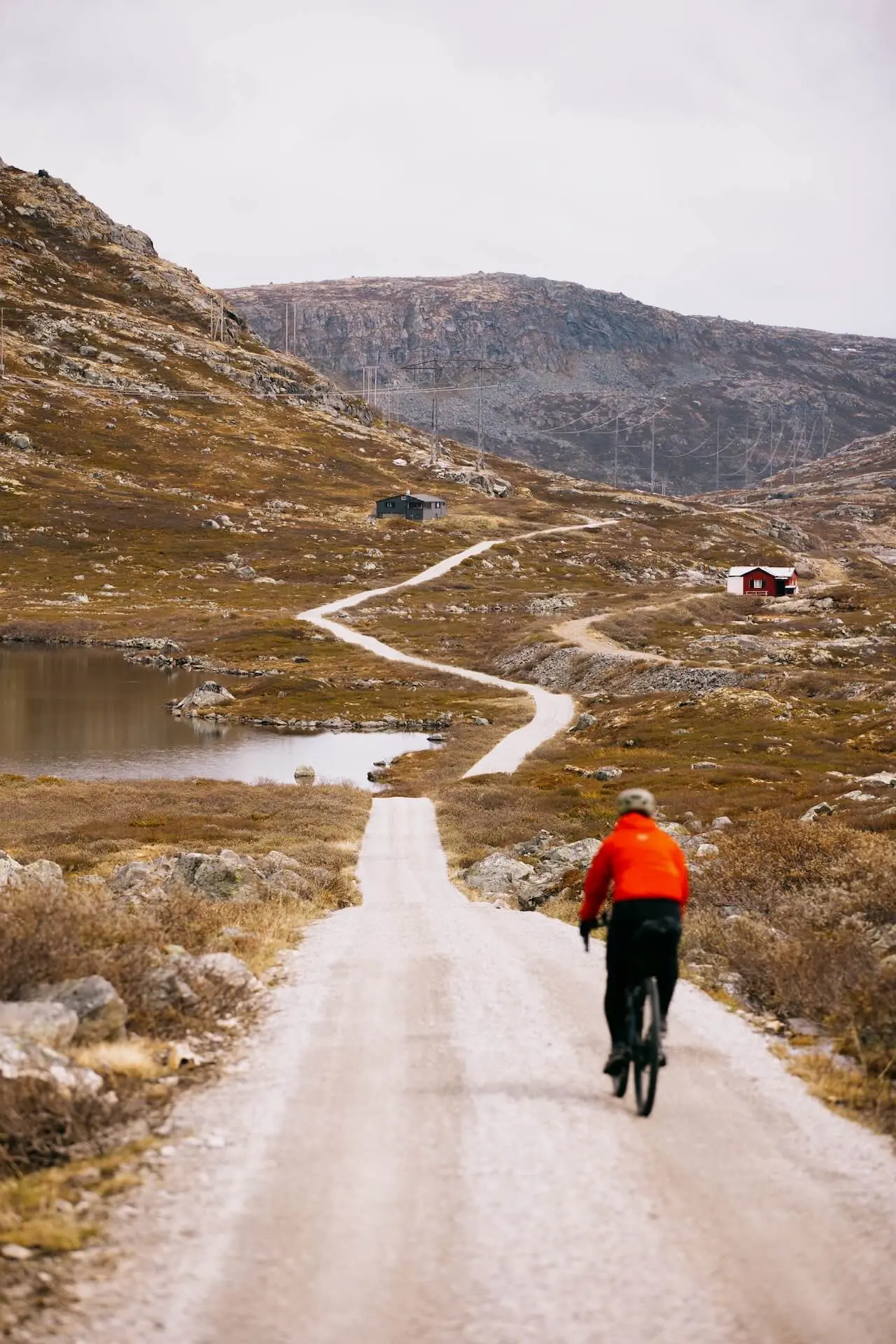
Rallarvegen
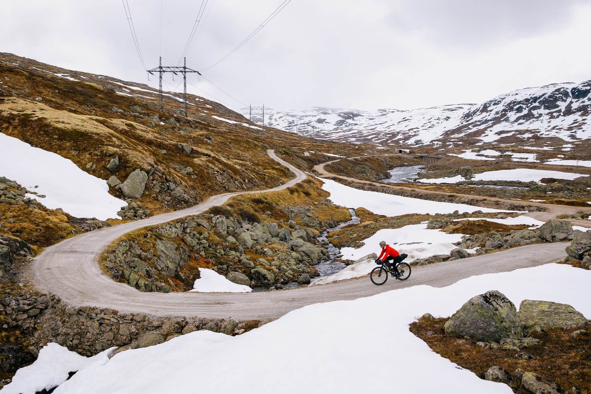
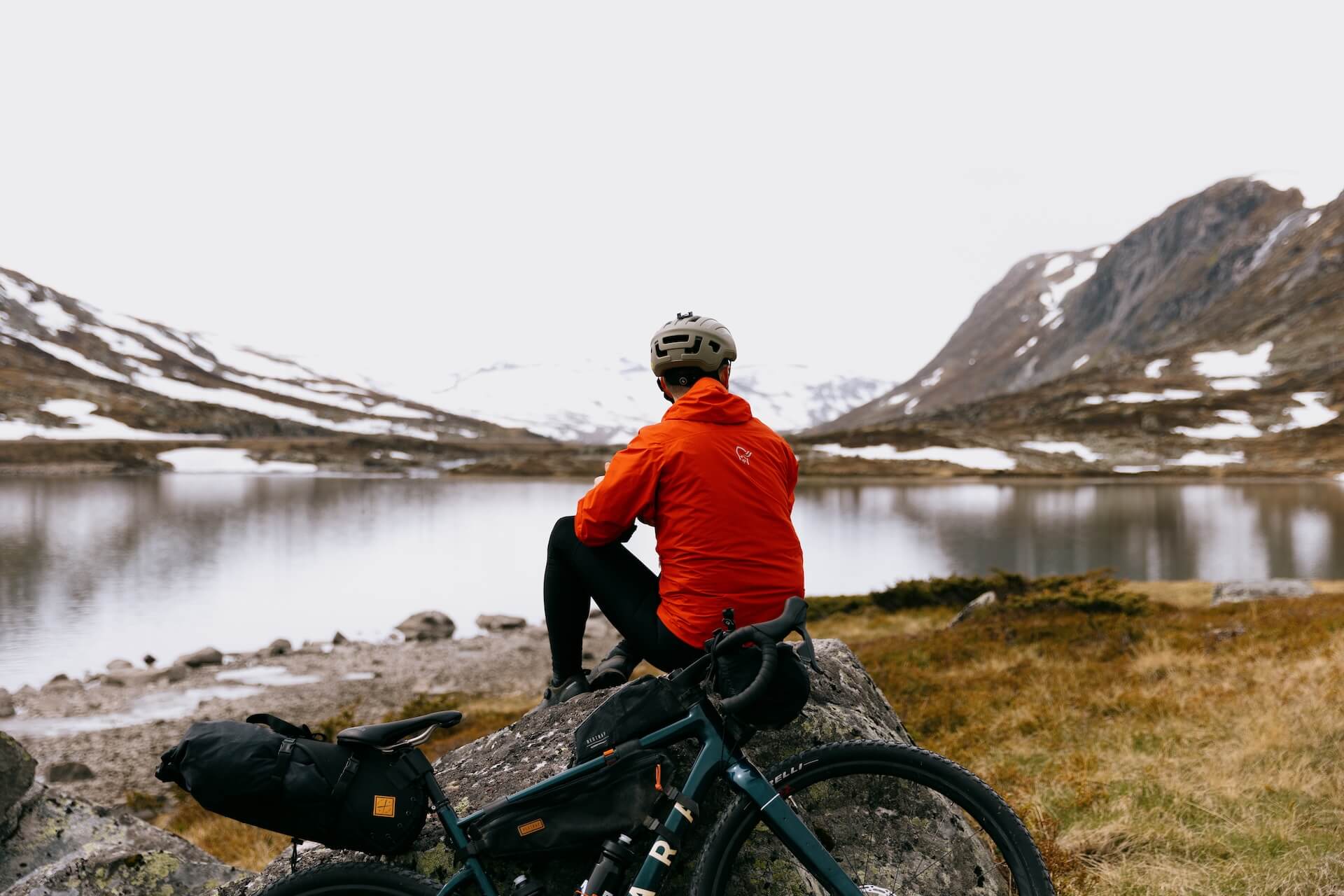
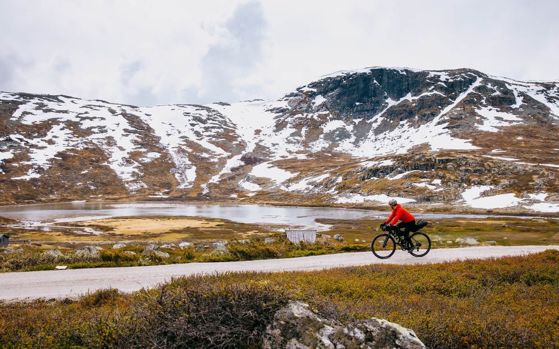
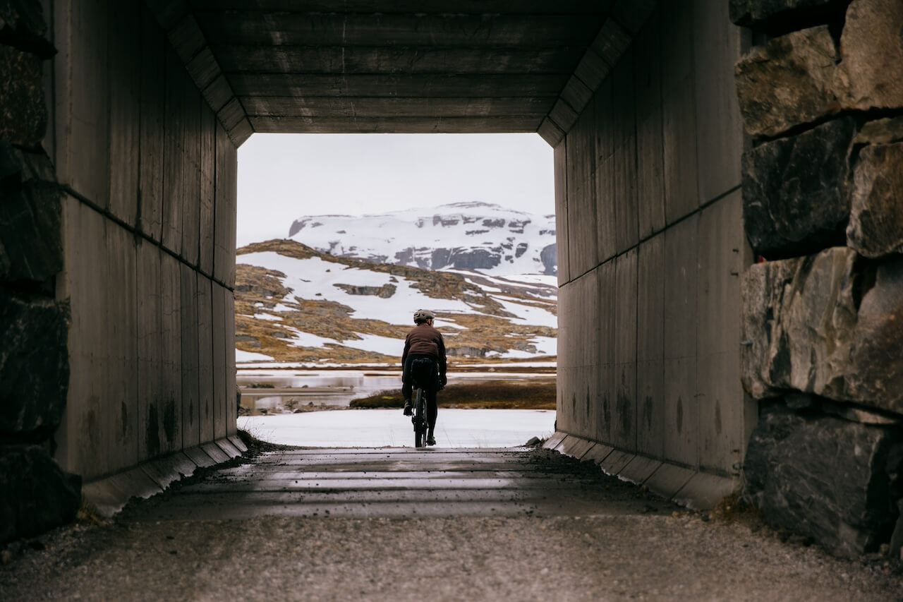
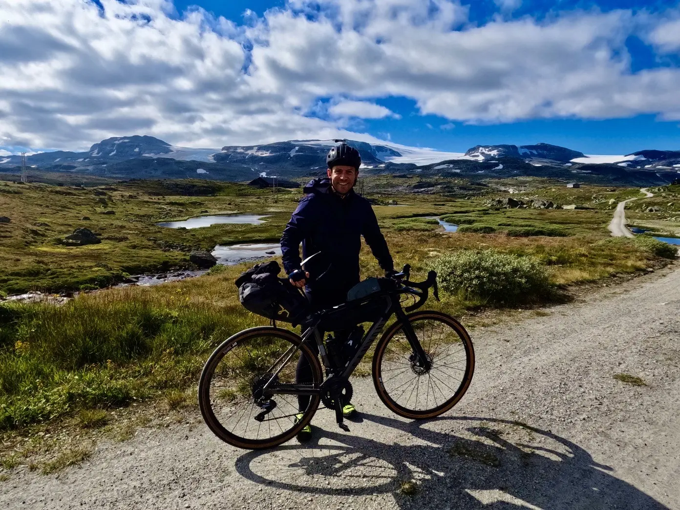
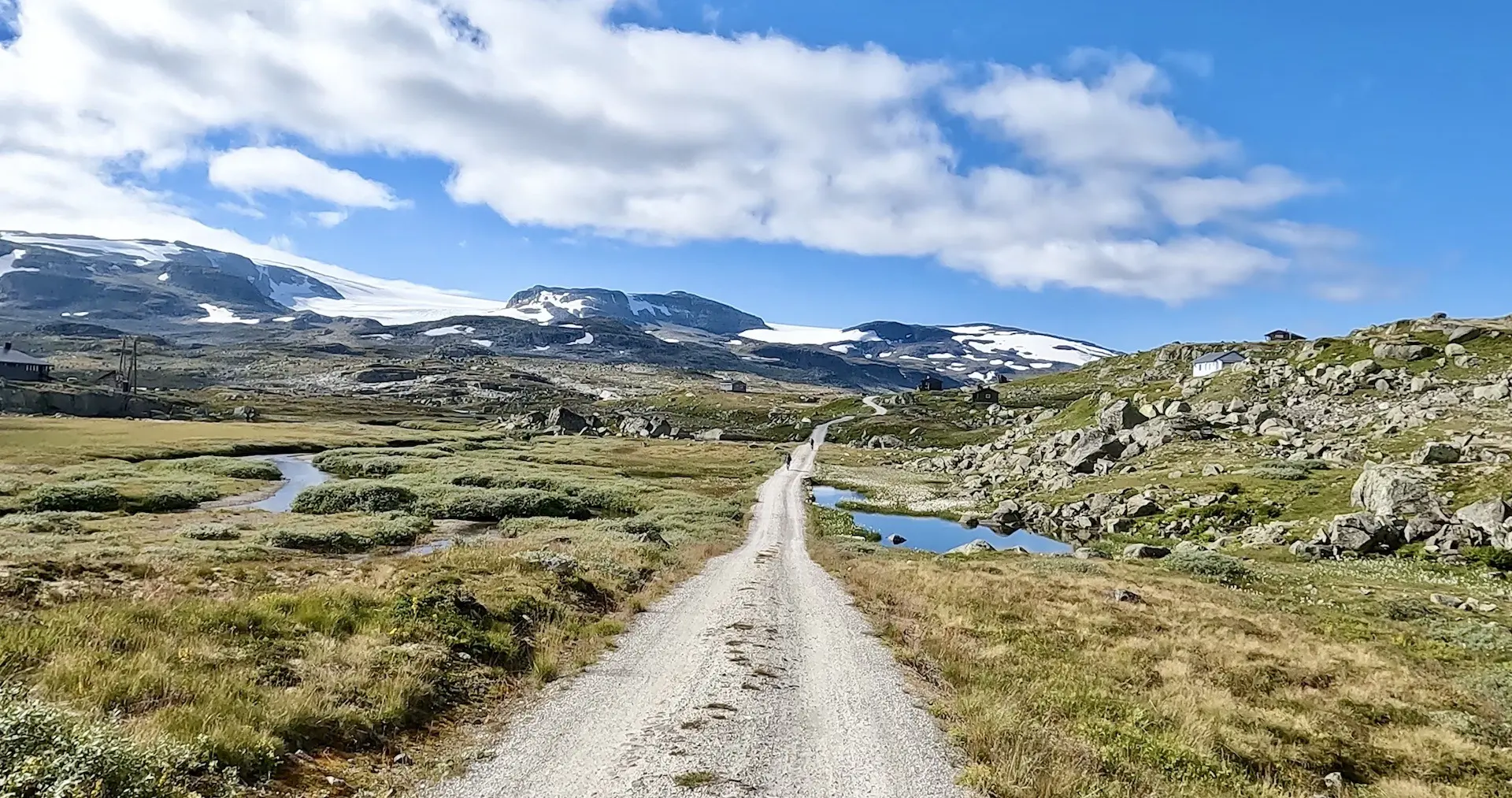
Norwegens bekannteste Radroute bietet die perfekte Gelegenheit für diejenigen, die ungezähmte Landschaften erkunden möchten, ohne sich um Sicherheit oder unerwartete Herausforderungen sorgen zu müssen. Während die Route Sie durch wilde und raue Gelände führt, bietet sie auch zahlreiche Möglichkeiten für Schutz und Hilfe, falls benötigt, was sie zur perfekten Route macht, um sich im Umgang mit dem Fahrrad in ungezähmter Natur wohlzufühlen. Ursprünglich eine Baustraße für die Bergensbahn, erstreckt sich der Rallarvegen von Haugastøl nach Flåm und führt die Fahrer über das weitläufige Hardangervidda-Plateau.
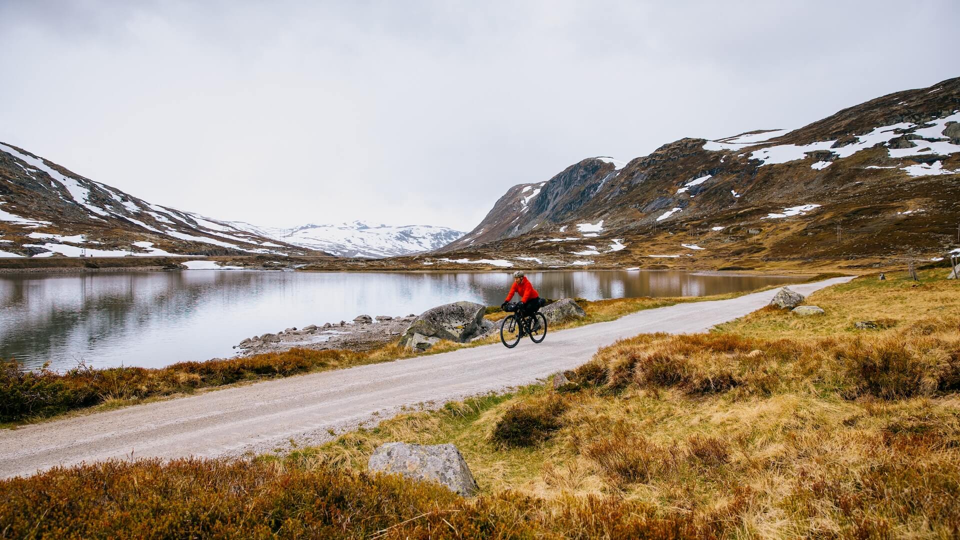
Unterwegs werden Radfahrer mit atemberaubenden Ausblicken auf majestätische Berggipfel, kristallklare Seen und prächtige Wasserfälle belohnt. Der Weg kombiniert Schotterwege, aufregende Abfahrten und gut zu bewältigende Anstiege, wodurch er sich sowohl für erfahrene als auch für unerfahrene Radfahrer eignet, die eine abenteuerliche Fahrt suchen. Zu den bemerkenswerten Höhepunkten gehören Finse, Heimat des höchsten Bahnhofs Norwegens, und die berauschende Abfahrt in das malerische Fjorddorf Flåm. Mit seiner reichen Geschichte, faszinierenden Landschaften und seinem herausfordernden, aber dennoch zugänglichen Terrain bietet der Rallarvegen ein unvergessliches Radsporterlebnis für alle.
Fragen wie “Ist die Route für Kinder geeignet?”, “Hält der Akku meines E-Bikes durch?” und “Welche Erweiterungen kann ich hinzufügen?” werden alle in unserer Premium-Mitgliedschaft beantwortet. Vollständige Geschichte Rallarvegen-Seite. Der umfassendste Leitfaden, um das Beste aus Ihrer Reise herauszuholen, geschrieben von erfahrenen Einheimischen.
Routenplan
Wann?
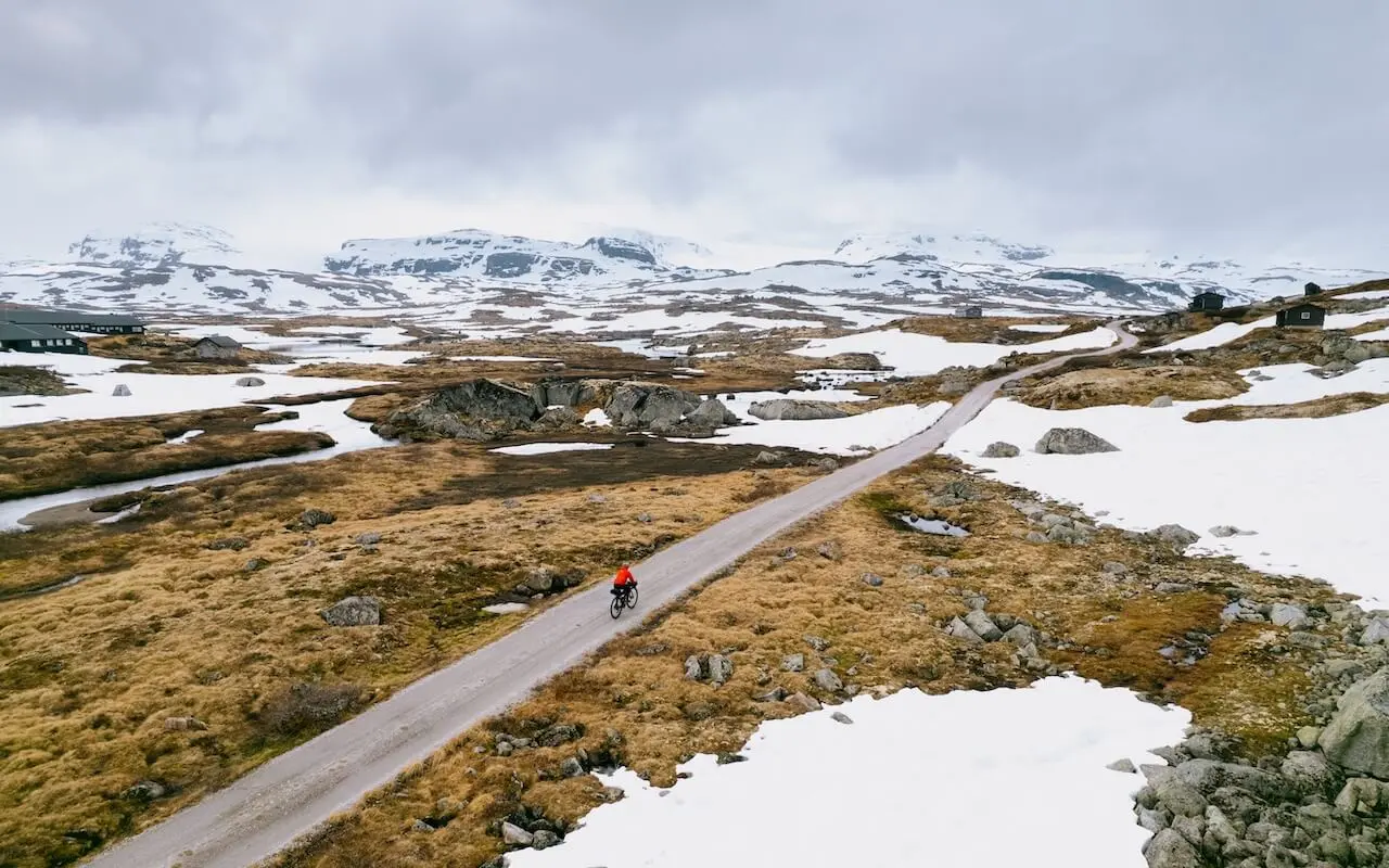
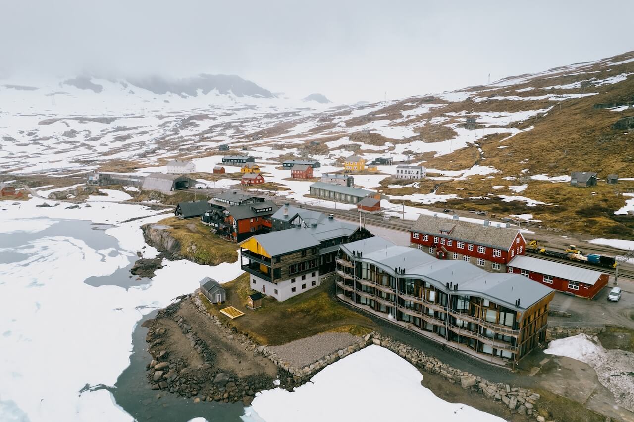
– Haugastøl – Finse (28 km)In den letzten Jahren wurde dieser Abschnitt Anfang bis Mitte Juni geöffnet und bietet eine schöne Fahrt zwischen den beiden Bahnhöfen.
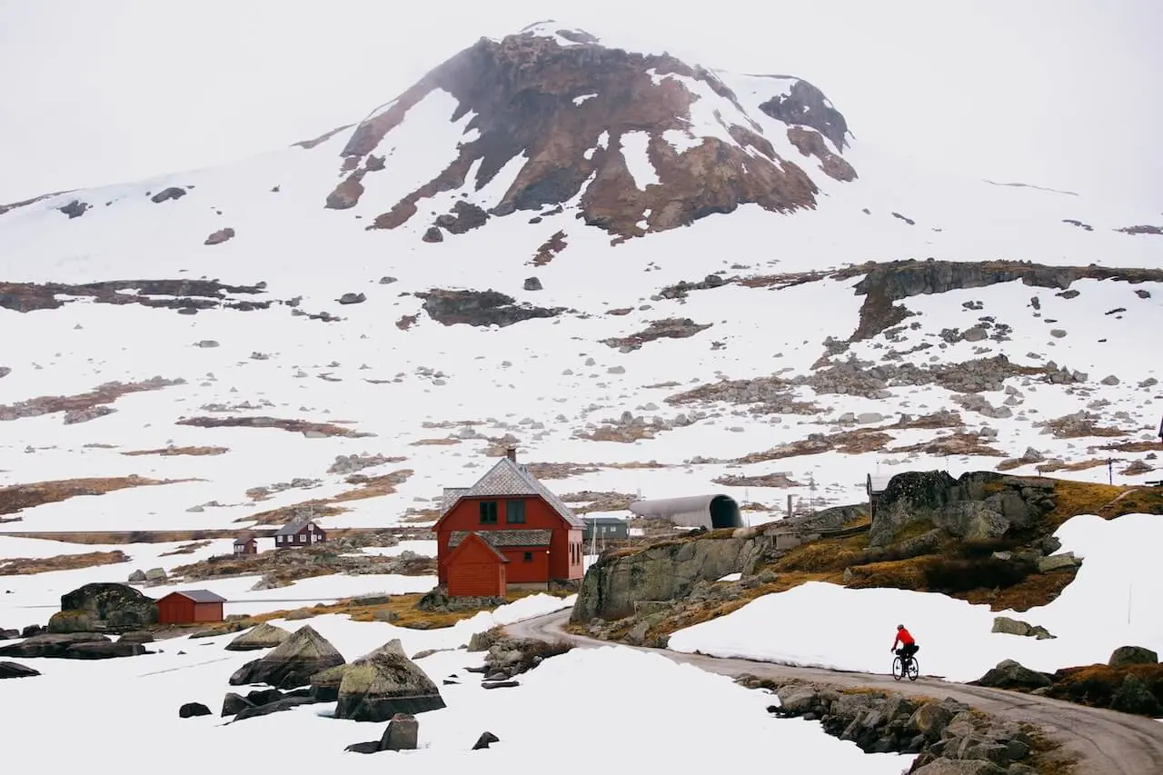
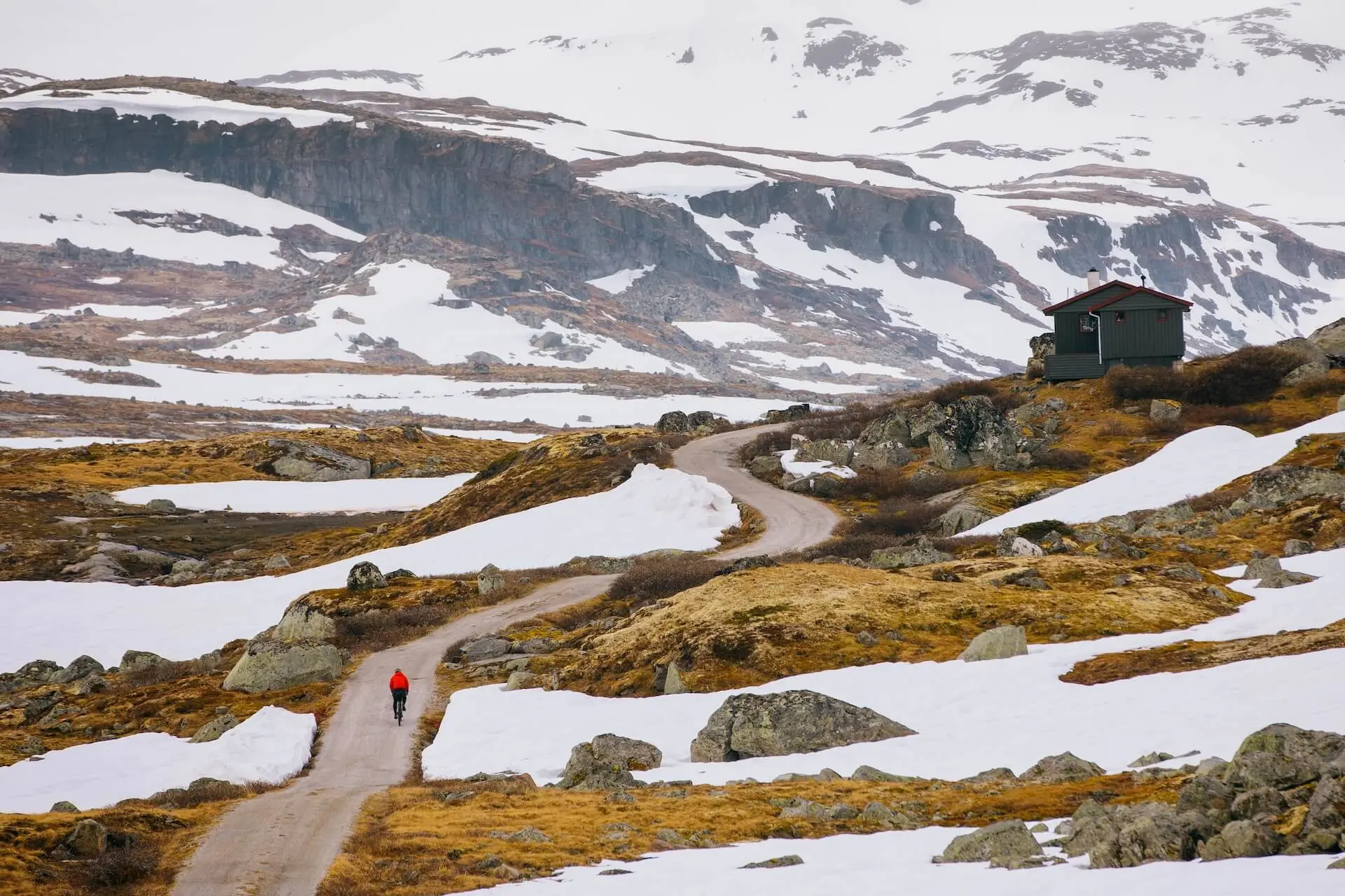
– Finse – Hallingskeid (11 km)Dies ist der höchste und schwierigste Teil. Schnee ist nicht vollständig geräumt bis Anfang bis Mitte Juli. Wenn blockiert, nehmen Sie einfach den Zug eine Haltestelle, um diesen Abschnitt zu umgehen.
– Hallingskeid – Myrdal (15 km): Normalerweise Ende Juni oder Anfang Juli klar
– Myrdal – Flåm (17 km): Anfang/Mitte Juni.
Ein Update Bericht bezüglich der Zugänglichkeit der Route hier gefunden. Wir empfehlen dringend, dies zu überprüfen, wenn Sie im Juni oder Anfang Juli fahren.
– Hinweis: Im Juni werden viele Hotels und Cafés auf der Route geschlossen sein.
Ankunft
Du kannst den Rallarvegen mit dem Zug auf der Bergenbahn erreichen, mit den Haltestellen Haugastøl, Finse und Myrdal, die direkten Zugang zur Route bieten. Oslo und Bergen haben beide häufige Züge, die direkt zu diesen Ausgangspunkten fahren, und es gibt eine spezielle Fahrradmitnahme auf der Strecke. Viele Radfahrer beginnen in Haugastøl, aber du kannst auch in Finse oder Myrdal starten, je nachdem, wie viel du von dem Weg fahren möchtest.
Gefahren
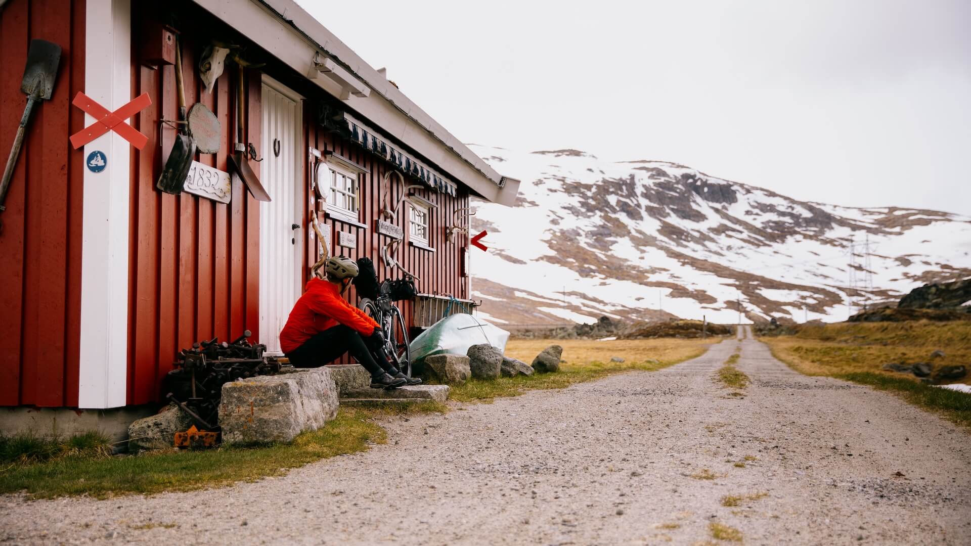
– Die Route ist nicht komplett autofrei. Der Abschnitt von Haugastøl nach Finse ist für Autos befahrbar, und Sie können auf einige Einheimische treffen, die zu ihren Hütten fahren.
– Schneefall früh in der Saison kann gefährlich sein und es wird empfohlen, vom Fahrrad abzusteigen und zu Fuß weiterzugehen.
– Der Abschnitt zwischen Finse – Hallingskeid (11km) weist einige raue, steinige und unebene Abschnitte mit einigen kurzen, aber steilen Abstiegen auf. Unerfahrene Radfahrer sollten sich für diesen Teil Zeit nehmen.
– Steiler Abstieg nach Flåm – Die letzte Abfahrt am Myrdalsberget hat 21 enge Haarnadelkurven auf einer groben Schotterstraße. Die Bremsen überhitzen schnell und viele Fahrer gehen aus Sicherheitsgründen abschnittsweise zu Fuß.
Fahrradverleih
Sie müssen kein eigenes Fahrrad mitbringen – entlang der Route gibt es Mietoptionen mit flexibler Abholung und Rückgabe.
– Haugastøl Turistsenter – Größter und etabliertester Mietservice mit speziell angefertigten Fahrrädern für den Rallarvegen. Abholung in Haugastøl, Rückgabe in Finse, Myrdal oder Flåm.
– Flåm Fahrradverleih – Ideal, wenn Sie in Flåm ankommen. Fahren Sie mit dem Zug nach Finse und dann wieder hinunter.
– Norwegens Bestes (Finse, Kårdal, Flåm) – Miete an mehreren Stellen entlang der Strecke verfügbar.
– Flåmsbana Informationen – Übersicht über Stationen und Rückgabemöglichkeiten.
Tipp: Haugastøl ist der zuverlässigste Ausgangspunkt mit den besten Fahrrädern und Unterstützung.

Mit einer Landschaft und Geschichte, die seinem Ruhm gerecht werden, ist der Rallarvegen mehr als nur eine Route – er ist ein Initiationsritus für Radfahrer
Lokale Empfehlungen
Hardangerjøkulen
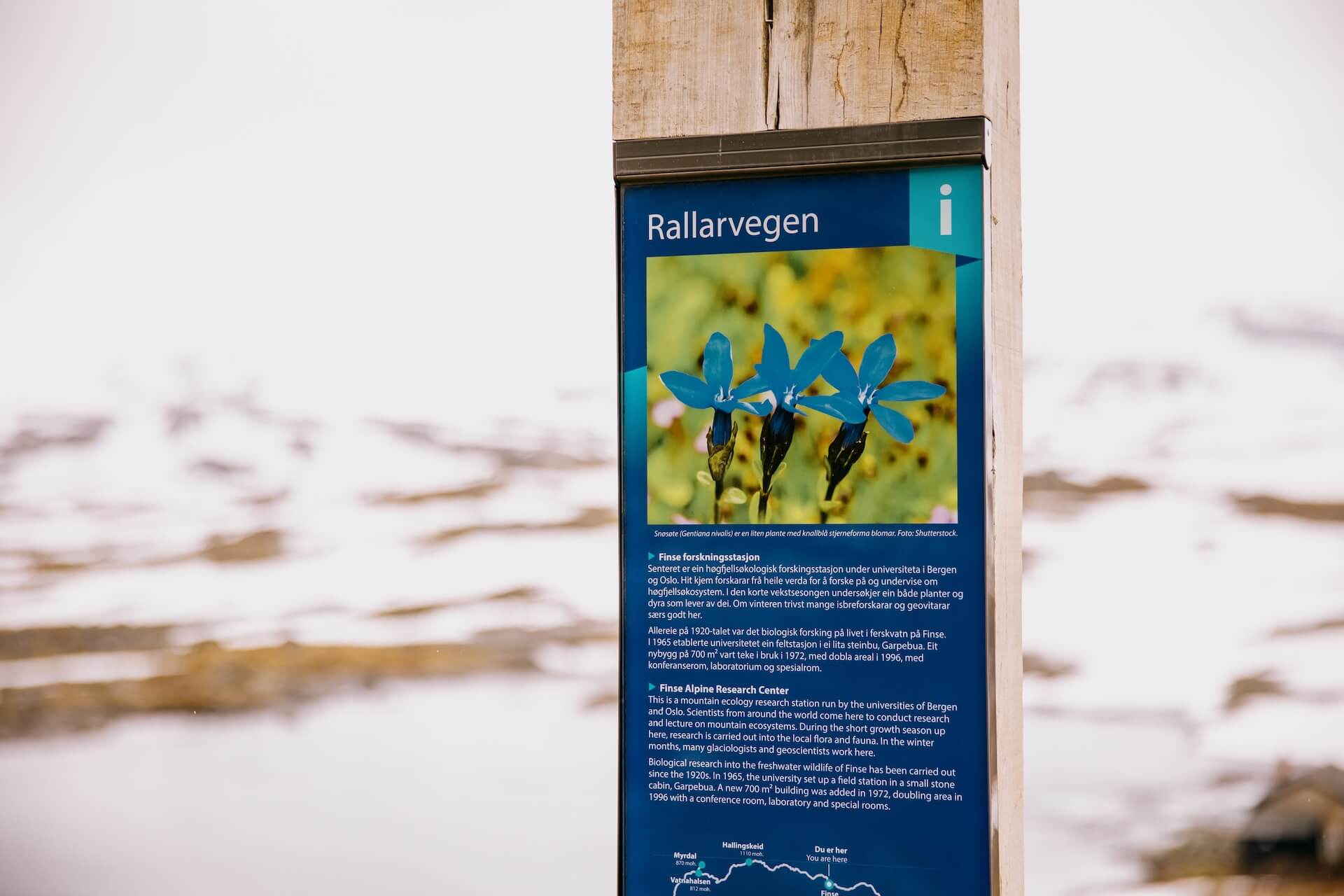
Wenn Sie sich der kleinen Siedlung Finse nähern, wird Norwegens sechstgrößter Gletscher, der Hardangerjøkulen, sichtbar. An klaren Tagen beherrscht er das Plateau und ist damit einer der wahren Höhepunkte der Fahrt.
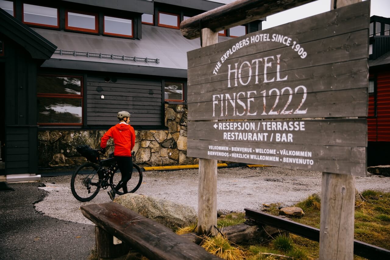
Finse 1222 Hotel & Café
Norwegens höchstes Hotel, direkt am Bahnhof. Toller Ort für Kaffee, Waffeln oder sogar eine Übernachtung mit Gletscherblick. Vollpensionsoptionen verfügbar.
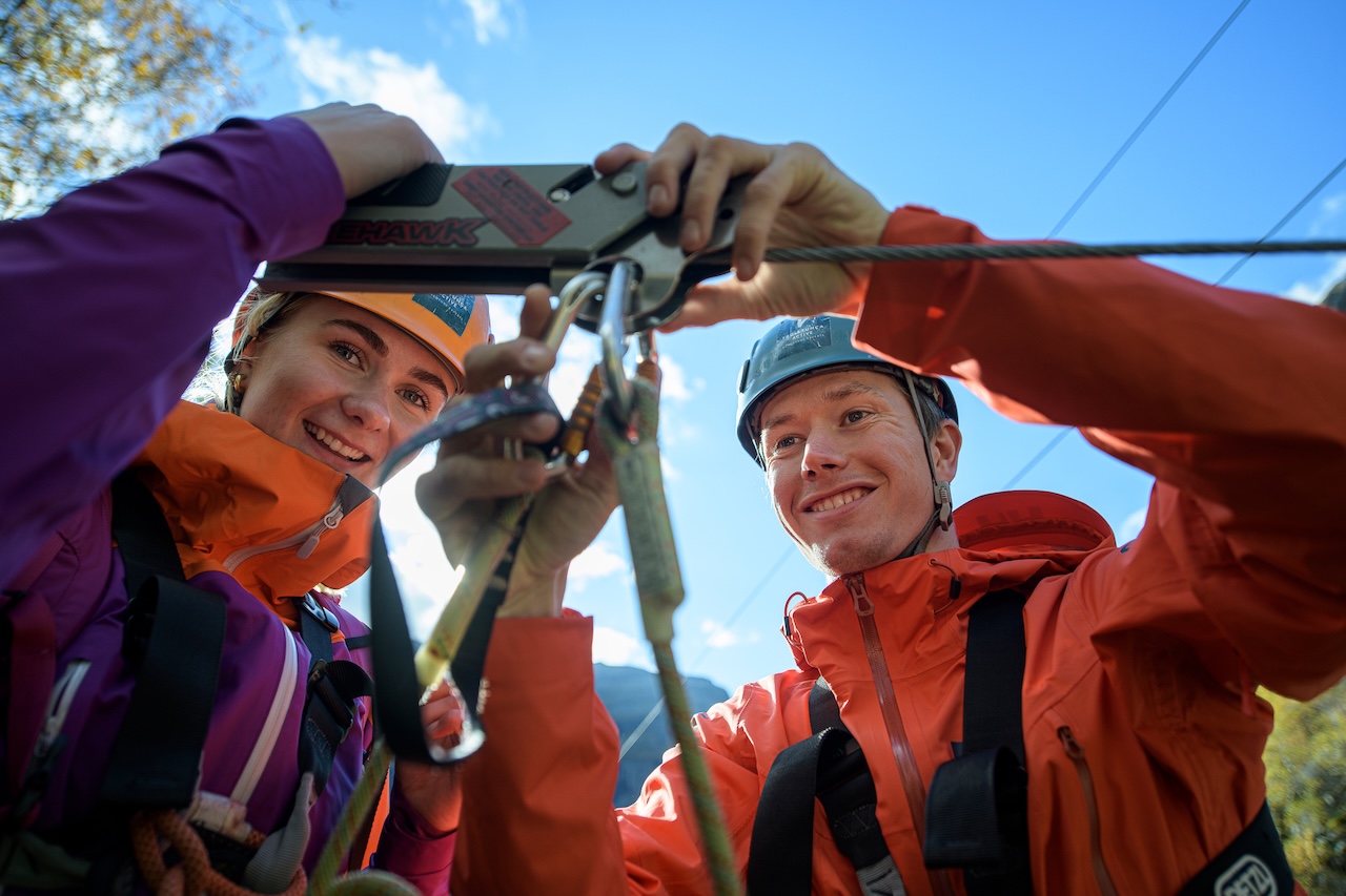
Flåm Zipline
Flåm Zipline, nahe Myrdal, ist Skandinaviens längste Seilrutsche auf 1,381 m, bis zu einer Geschwindigkeit von 100 km/h und fallen lassen 305 m durch das spektakuläre Flåm-Tal. Tickets sind NOK 850 für Erwachsene und NOK 600 für Kinder (unter 15 Jahren). Im Jahr 2025 fährt die Zipline täglich von 9:30 bis 16:30(im Juli–August bis 18:00 Uhr verlängert) zwischen 3. Mai und 11. Oktober
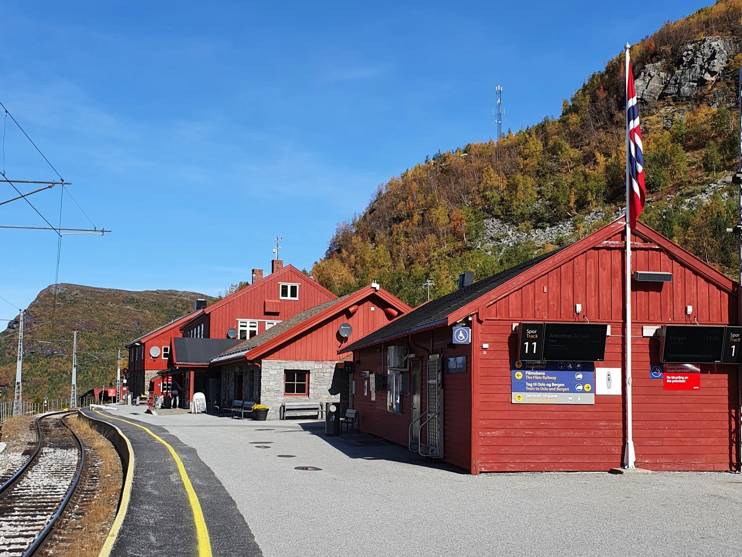
Cafe Rallaren
Das Café Rallaren an der Station Myrdal ist eine praktische Haltestelle für Essen und Kaffee. Auf dem Bahnsteig gibt es einen Fahrradservice, falls Sie Reparaturen oder Anpassungen benötigen.
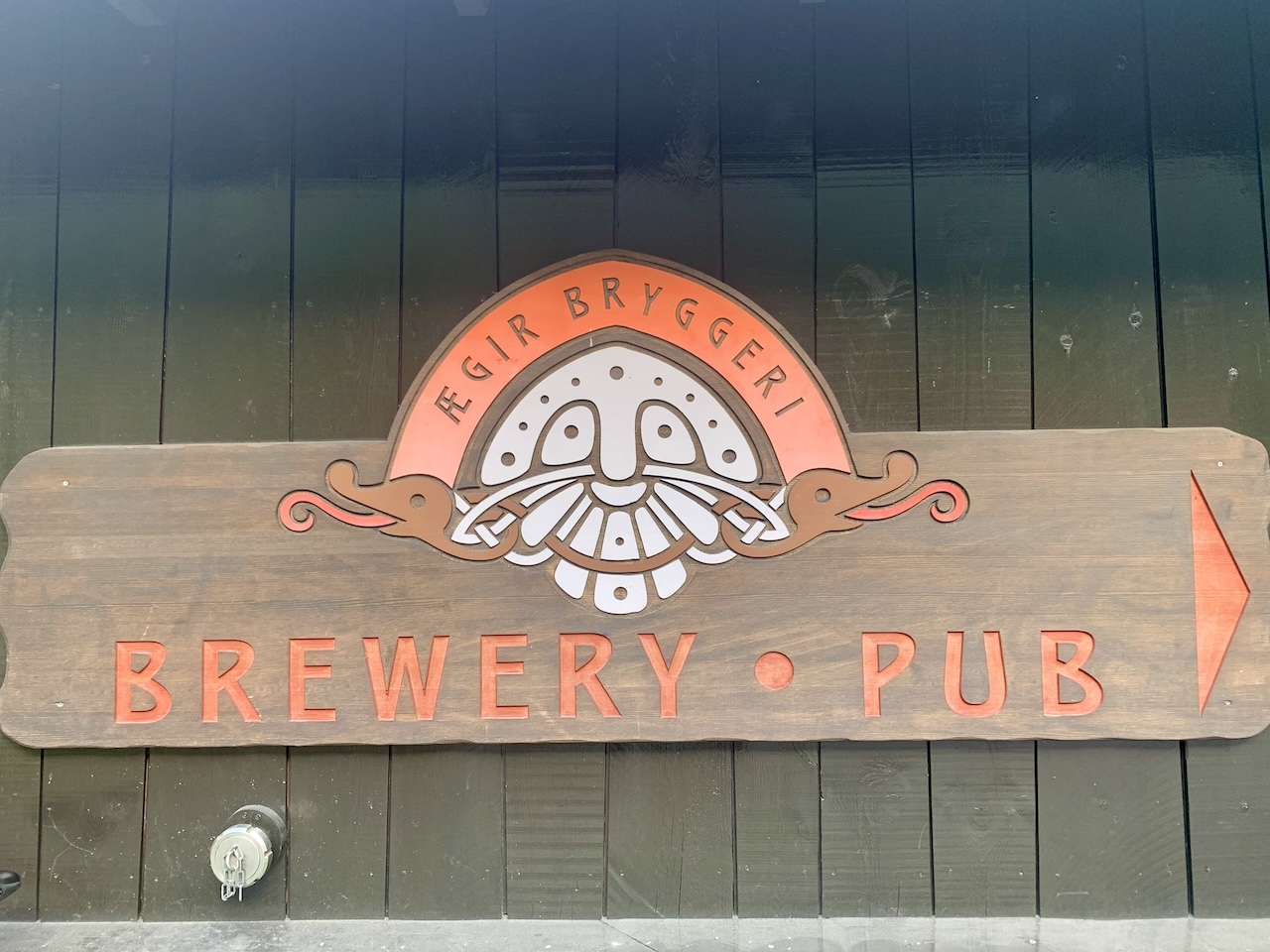
Ægir BrauereiPub
Das Ægir BryggeriPub in Flåm ist der perfekte Ort, um Ihre Rallarvegen-Fahrt ausklingen zu lassen, und bietet handwerklich gebrautes Bier direkt vor Ort. Die Halle im Wikingerstil serviert herzhafte Mahlzeiten, die nach einem langen Tag im Sattel genau das Richtige sind. Die Mischung aus Atmosphäre, lokalen Speisen und preisgekröntem Bier macht es zu einer passenden Belohnung an der Ziellinie.
Rallar-Museum
Das Rallar-Museum in Finse ist den Eisenbahnarbeitern gewidmet, die Anfang des 20. Jahrhunderts die Bergenbahn bauten. Es zeigt Werkzeuge, Fotos und Geschichten vom Bau sowohl der Eisenbahn als auch des Rallarvegen. Klein, aber faszinierend, vermittelt es Einblicke in das harte Leben der “Rallar” und verleiht Ihrer Fahrt durch die Gegend mehr Tiefe. Das Museum ist im Sommer von Anfang Juli bis Mitte September geöffnet.
Nützliche Links
Booking.com – für Unterkunftsmöglichkeiten in ganz Norwegen
Entur App – zur Planung von Fahrten mit öffentlichen Verkehrsmitteln in ganz Norwegen
Fähren – Routen, Fahrpläne und Informationen von Statens Vegvesen
Wildcamping-Etikette – wichtig zu wissen
Weiterführende Literatur
Beachten Sie
Alle auf CYCLENORWAY.com veröffentlichten Radrouten sind als Planungsressourcen und Inspirationsquellen gedacht, die neben Ihrer eigenen Recherche und Ihrem Urteilsvermögen verwendet werden sollten. Die Routen werden mit sorgfältiger Recherche erstellt, aber jeder Radfahrer hat unterschiedliche Fähigkeiten, Erwartungen und Risikobereitschaft. Einige anspruchsvolle Schotterrouten können Abschnitte mit Fahrradtragen, schlammige oder nasse Wanderwege, technisches Gelände, steile Anstiege, Abfahrten oder abgelegene Gebiete beinhalten, die nicht für jeden geeignet sind. Routenplanungssoftware und die Bedingungen können sich ebenfalls ändern oder Ungenauigkeiten enthalten. Radfahren in Norwegen ist im Allgemeinen sehr sicher. Wenn Sie sich jedoch dafür entscheiden, diese Routen zu befahren, tun Sie dies auf eigene Gefahr. Wenn Sie sich bei einer bestimmten Route unsicher sind, hinterlassen Sie unten einen Kommentar und wir werden Sie beraten.


Schreibe einen Kommentar