


Jordalen Loop
Late June – September
80km
Distance
1700m
Elev. Gain
1 -2
Days
70%
Unpaved
6/10
Difficulty
32mm +
Ideal Types
Jordalen Loop
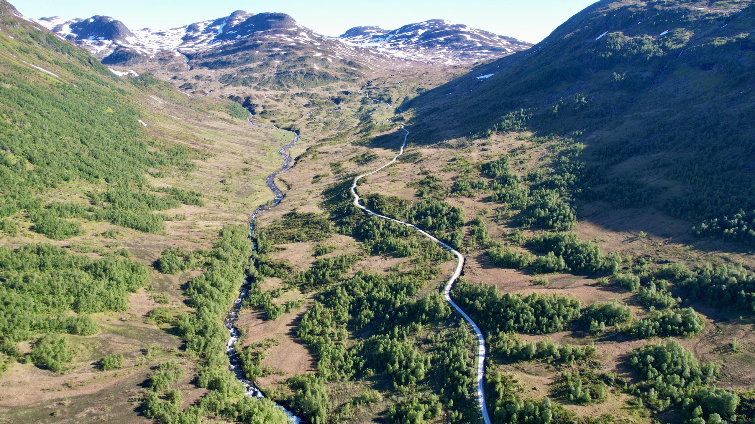
Jordalen is one of two secluded valleys nestled in the mountainous region surrounding the main valley of Nærøydalen. An excellent white gravel road leads you through majestic scenery, away from the campervan tourists in the main valley below. The ride is challenging, with climbs up to 950m, and an optional extension to a hydro plant reaching 1100m before retracing your path. Planning is essential if you’re not traveling by car, as the busy E16 road through Nærøydalen connects you to the loop and is not recommended for cycling during peak hours. Starting from the towns of Voss or Flåm is ideal, and you can also combine this route with the Rallarvegen trail from Haugastøl to Myrdal.
From Flåm, take a boat or bus (the bus is cheaper) to Gudvangen, bypassing the two long, prohibited tunnels. Gudvangen offers plenty of campsites and accommodations if you arrive late. The route ascends the magnificent Nærøydalen valley on the E16 before turning onto Jordalen, where the road becomes gravel after a 3km tunnel. The loop takes a few hours, ending at the historic Stalheim Hotel. For an additional challenge, cycle down and back up Stalheimsklevia, Norway’s steepest road, before descending back to the E16. Note that if you descend Stalheimsklevia, you must climb back up, as there are two prohibited tunnels at the bottom on the E16.
From there, follow the E16 to Voss, using side roads where possible. Avoid cycling on the E16 during peak times (11-18).
To complete a loop, cycle east from Voss to the small train station at Upsete, then take a train through a tunnel to Myrdal. From Myrdal, follow the popular gravel road down the valley to Flåm.
Jordalen Loop Route from Gudvagaen (as taken in the video)
When: Late June – September
Bike tyres: 32mm +
Route map
Useful links
Booking.com – for accommodation options across Norway
Entur app – for planning public transport trips around Norway
Ferries – routes, timetables and information by Statens Vegvesen
Wild camping etiquette – important to know
Keep in mind
All cycling routes published on CYCLENORWAY.com are intended as planning resources and sources of inspiration to be used alongside your own research and judgement. Routes are created using careful research, but every cyclist has different abilities, expectations, and risk tolerance. Some challenging gravel routes may include hike-a-bike sections, muddy or wet hiking paths, technical terrain, steep climbs, descents, or remote areas that may not be suitable for everyone. Route mapping software, and conditions can also change or contain inaccuracies. Cycling in Norway is generally very safe. Nevertheless, if you choose to ride these routes, you do so at your own risk. If you are unsure about a certain route leave a comment below and we’ll advise you.

Leave a Reply