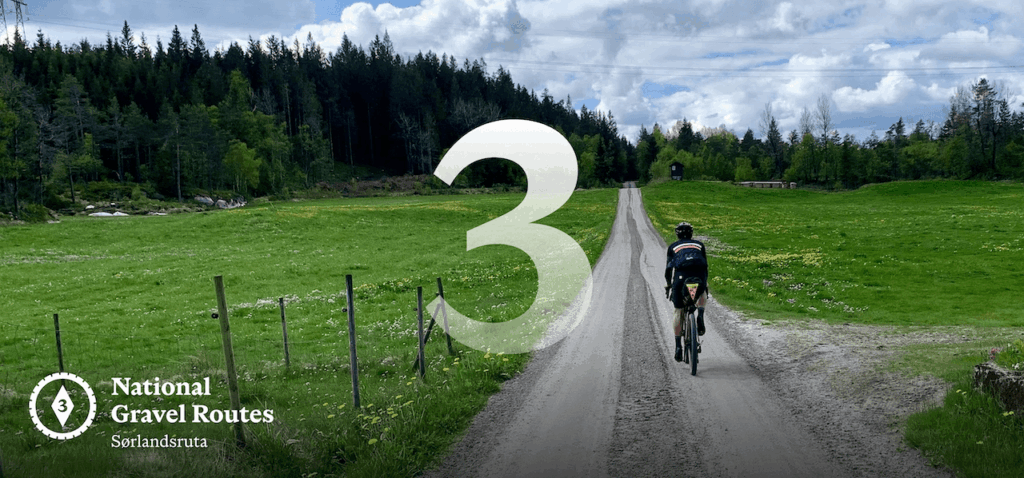
The Southern Divide
This route is remarkable for how it links together a vast network of farm and forest roads into one continuous gravel journey through a part of Norway few people ever see, or even know exists. If this is your first, second, or even tenth visit to Norway, this route likely isn’t for you. There are no dramatic fjords or postcard views here. No obvious “wow” moments. Nothing built for social media or Strava. What it offers instead is something rarer. A quiet, immersive ride through working landscapes. Long stretches of solitude. Encounters not with tourists, but with a handful of locals going about their daily lives. The kind of place you don’t arrive at by accident, and most people never reach at all. Those who do tend to fall into two camps: riders who came expecting something else, and those who deliberately chose to stay far away from everything and everyone.
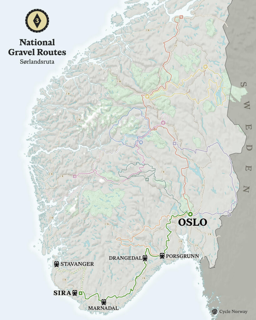
The route leaves Oslo and quickly climbs into the forests of Vestmarka, where the gravel officially begins. You follow part of National Cycle Route 2 briefly before turning towards Drammen and into Vestfold, known as Norway’s agricultural heartland. From here, the route leans heavily on old farm roads — rarely flat, often demanding — as it pushes towards Porsgrunn.
After resupply in this old industrial town, the route continues west through southern Telemark and across the full length of Agder to the edge of Rogaland. It deliberately avoids the populated coastline, staying inland in a landscape of dense forest, long valleys, and sparse settlement where distance and stillness define the ride.
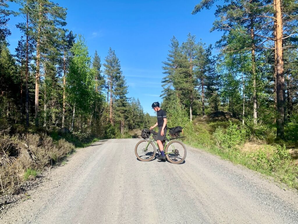
Gravel is less abundant here and has been carefully stitched together from forest roads, old access tracks, and forgotten links between paved sections. The riding is steady and demanding, with long stretches where you may not see another person for hours.
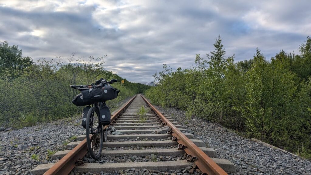
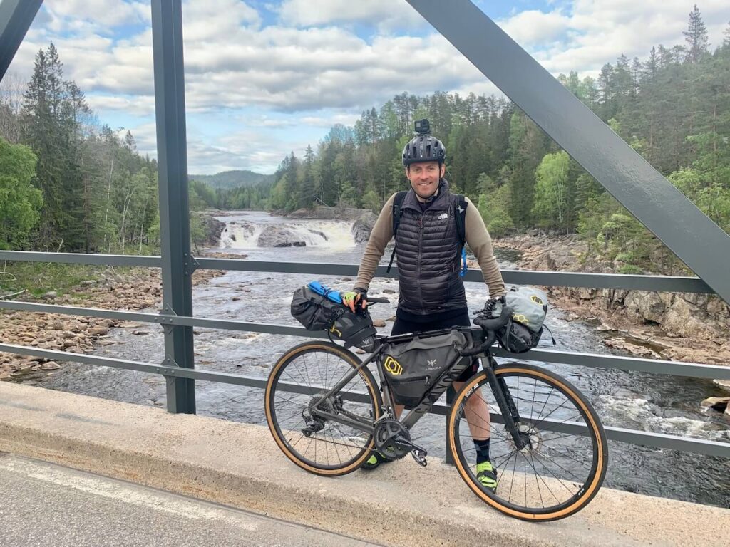
Much of the route follows river valleys that once powered southern Norway’s working life. You cross waterways such as the Sira, Mandalselva, Tovdalselva, and Nidelva, moving through landscapes shaped by timber transport and rural industry. History appears quietly: Bakke Bridge, Norway’s first suspension bridge from 1844; the Barnevandrerstien, walked by children sent inland for farm work; and remnants of timber flumes and the abandoned Setesdal Railway, including Røyknes Station.
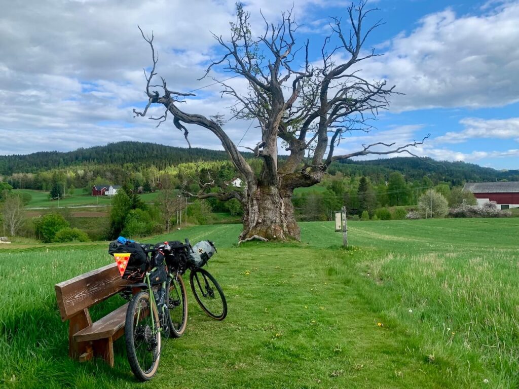
One understated highlight is Mollestadeika, Norway’s oldest living oak, estimated to be over 1,000 years old. You pass it as part of the journey, not as a destination — a quiet reminder of the timescale this region holds.
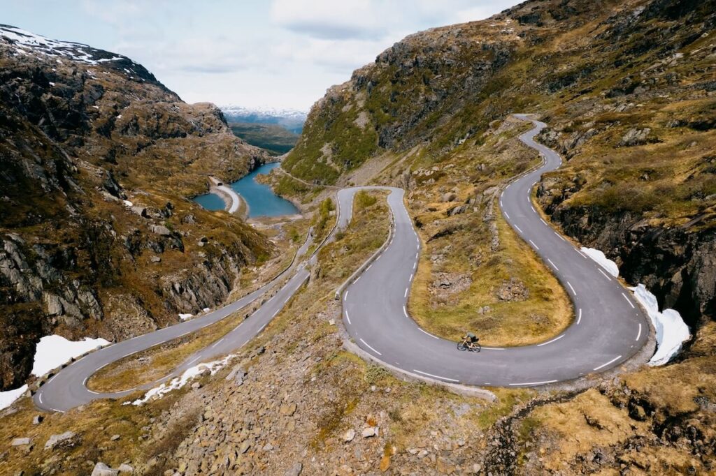
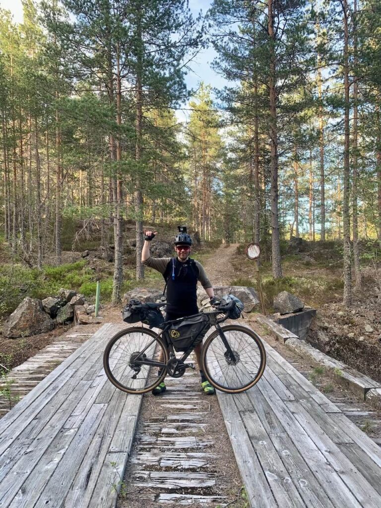
The landscape remains consistent and immersive: pine and birch forest, lakes, rivers, waterfalls, and scattered farms. Wildlife is common. There are one or two short hike-a-bike sections, but the real challenge comes from sustained distance and elevation rather than technical riding. This is a route that demands planning, steady pacing, and a willingness to move through long, lightly populated terrain.
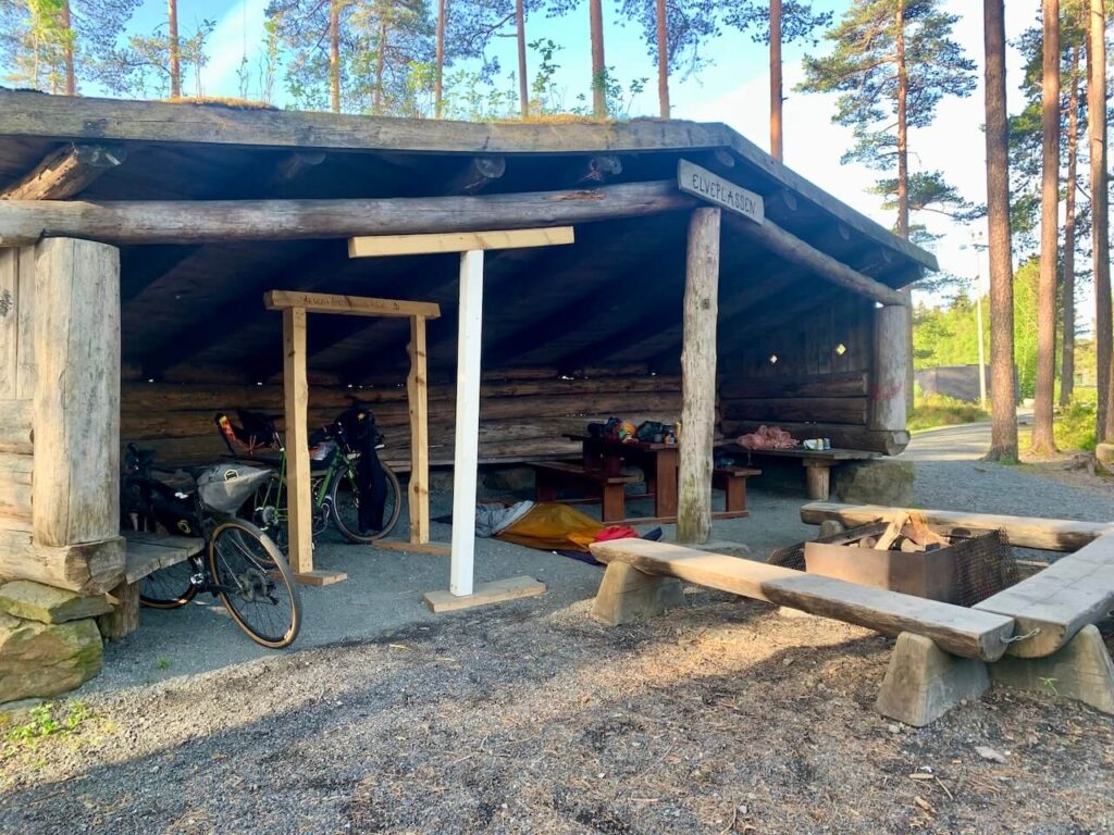
Wild camping is straightforward, with frequent shelters used for hunting, fishing, and birdwatching. Fires are generally banned between April and September, though some designated fire pits may be used. Finding dry wood can be hit or miss.
By the time you reach Sira or Oslo (if riding it in reverse), the scale of what you’ve crossed becomes clear.
I wrote this on the train home:
“This route is far away from any major tourist attraction and crosses remote wild areas of the Agder county. There is beauty all around but it’s a beauty that cannot really be capture on camera. The smell and noise of the forests, the odd red squirrel 🐿 running across the path, a moose in distance and the sound of the many rivers you cycle along give you a sense of peace and tranquility. I’m buzzing after several days in nature. It was well over due and just another reason why Norway offers so much on two wheels. Nero fjords, high mountains or wow factor scenery. Just a vast forest, gravel roads and wild camping is all you need at times 🇳🇴.“
From Sira, there is a gravel road heading north along a lake which turns into paved and from there you can ride mainly quiet, scenic paved roads all the way to Stavanger, making the route the ultimate way to travel between Oslo and Stavanger by bike.
The Route 3 GPX file can be found on our RidewithGPS Page – Please follow that page to support Cycle Norway and to be informed when updates are made. Full and overview pages will be posted on our website in the coming weeks. https://ridewithgps.com/collections/8903056