


342 km
Entfernung
7650m
Höhengewinn
2-6
Tage
55%
Unbefestigt
8.5/10
Schwierigkeit
35-45mm
Idealtypen
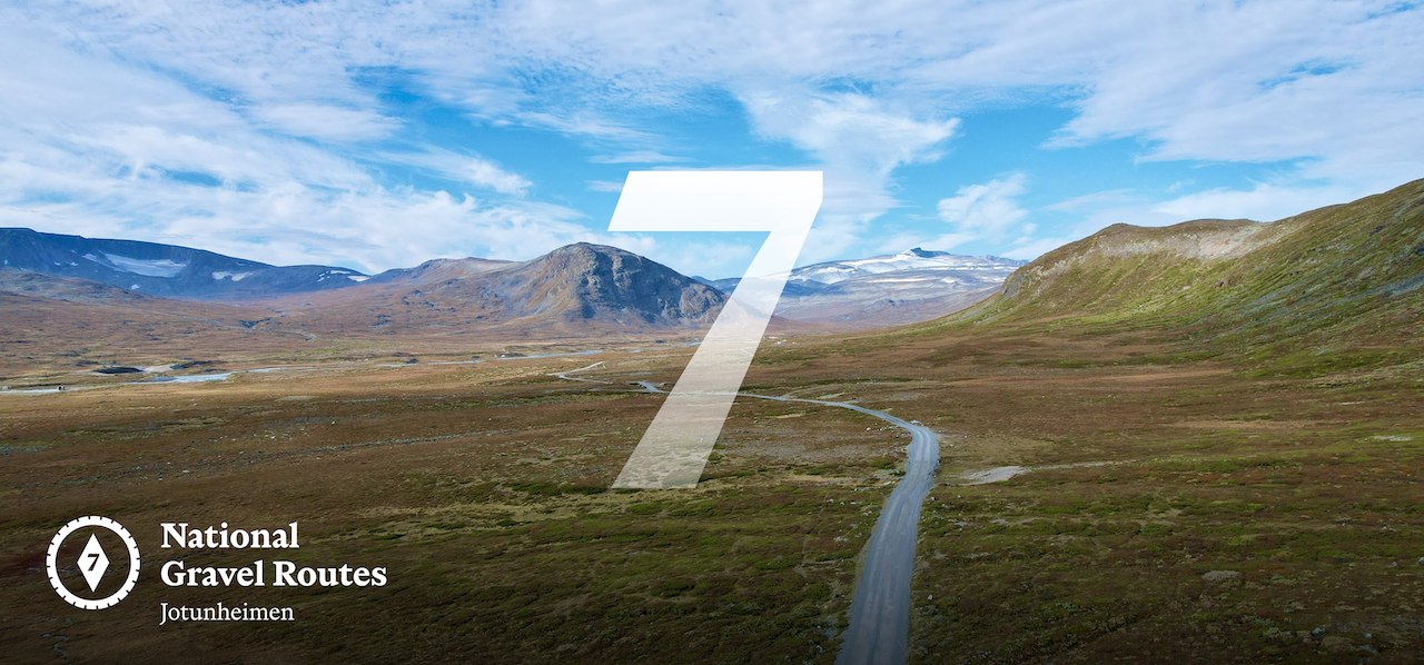
Nationale Kiesroute 7: Jotunheimen
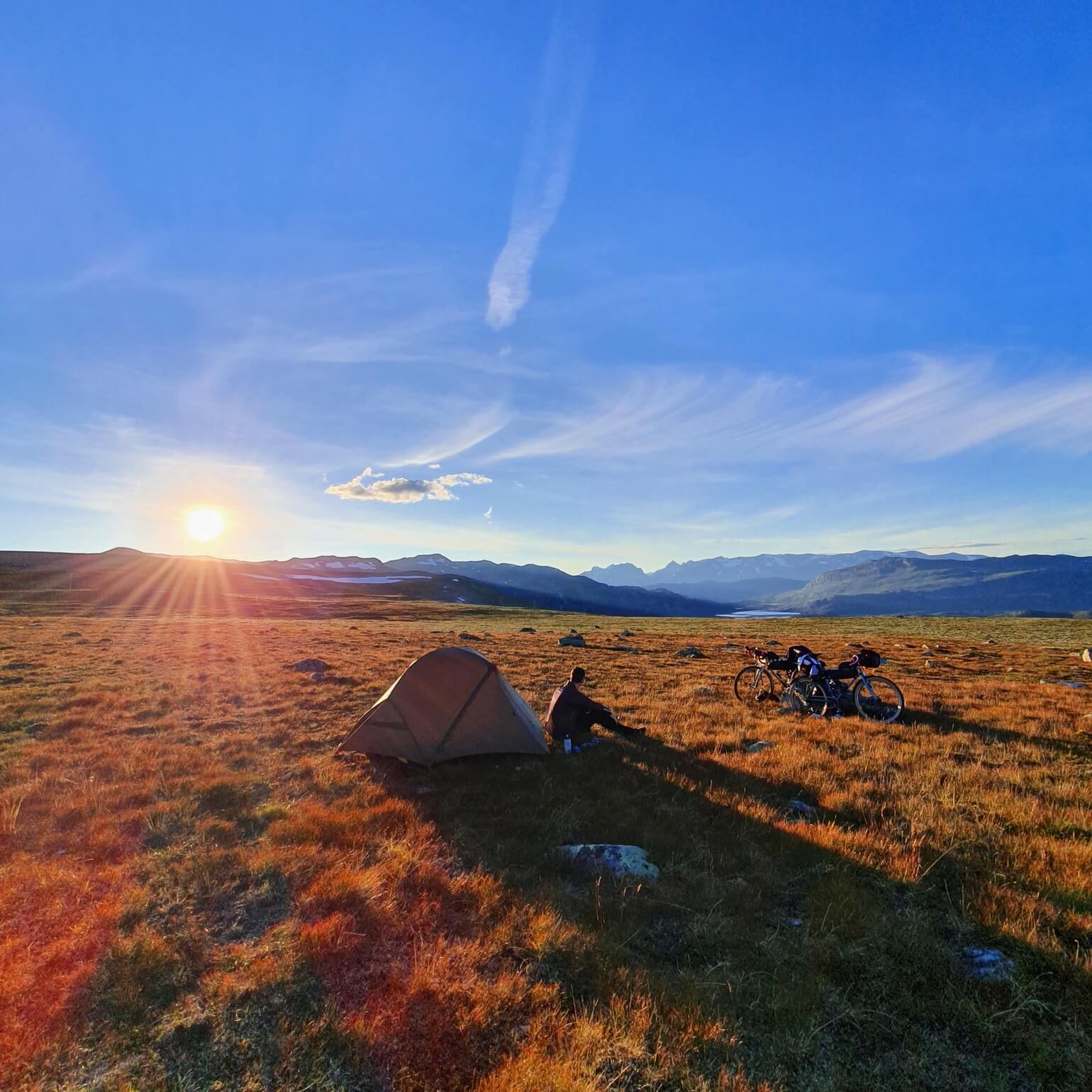
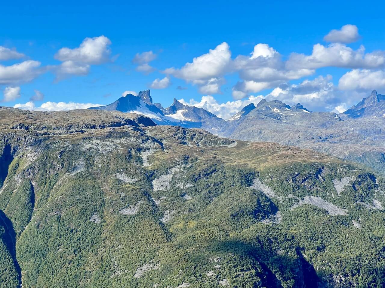
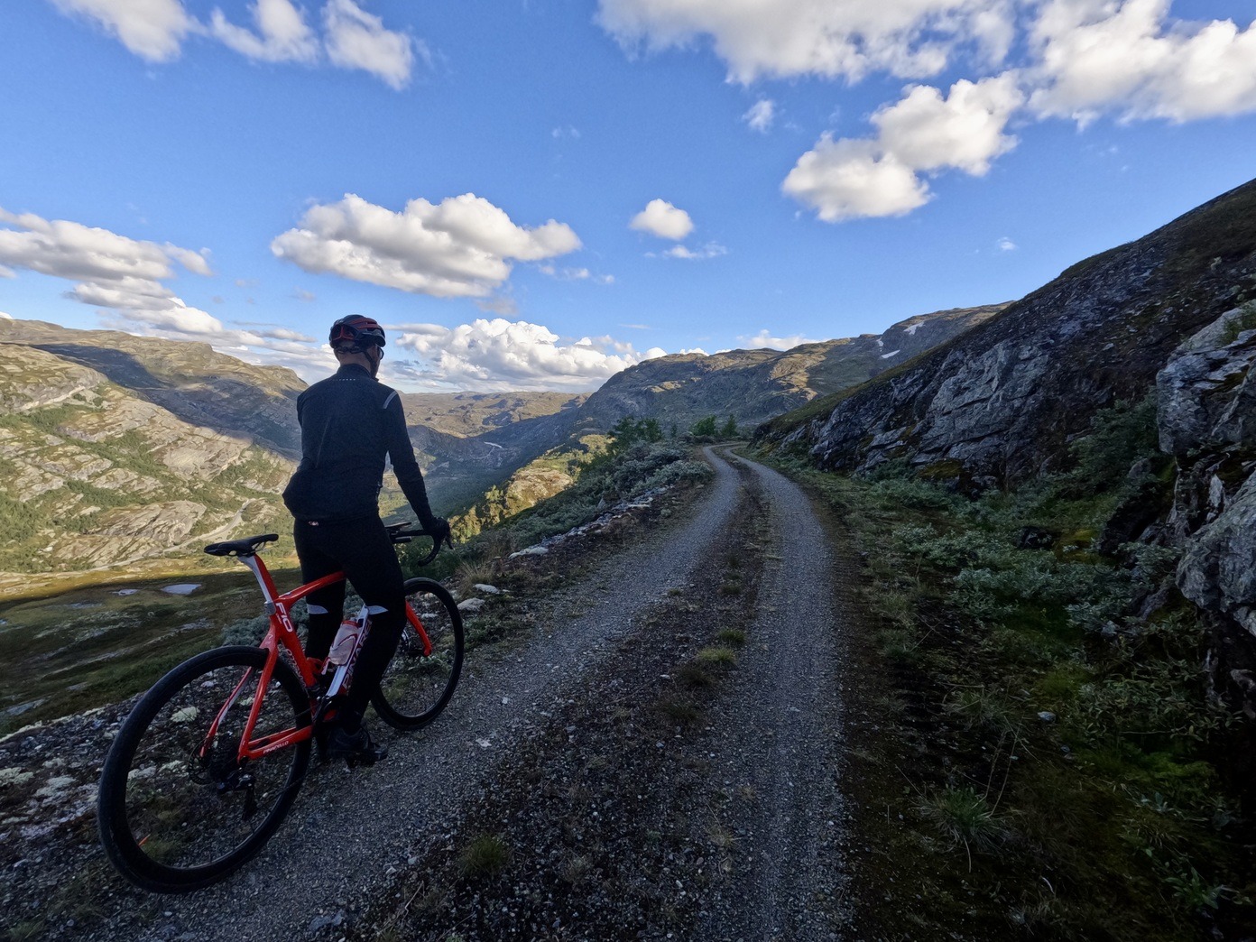
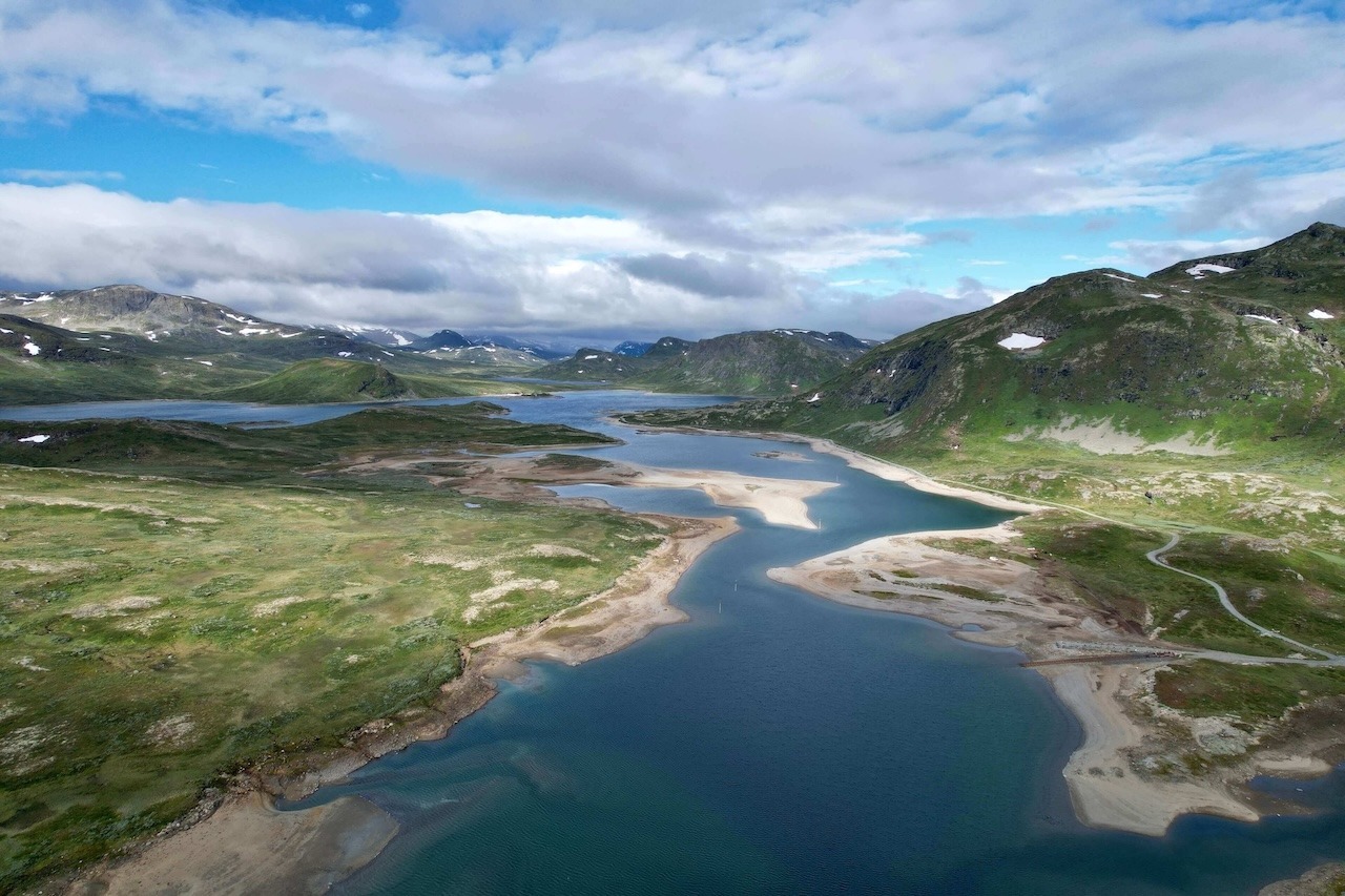
Jotunheimen — the Land of the Giants — is Norway’s most famous mountain region, known for its glaciers, high mountain lakes, and peaks rising well above 2,000 metres. Most people experience it on foot, hiking between cabins or climbing individual summits. This route offers something different: the chance to circle the national park by bike.
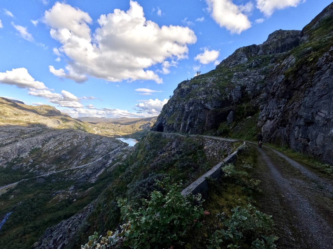
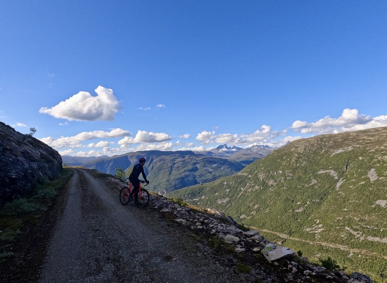
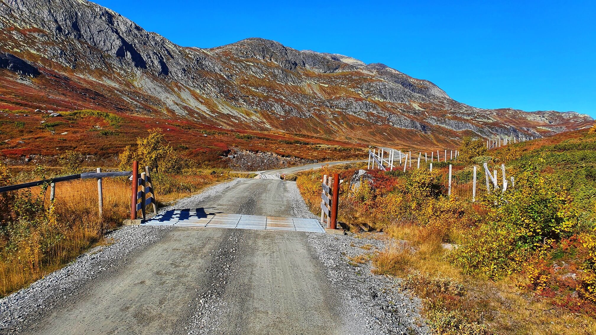
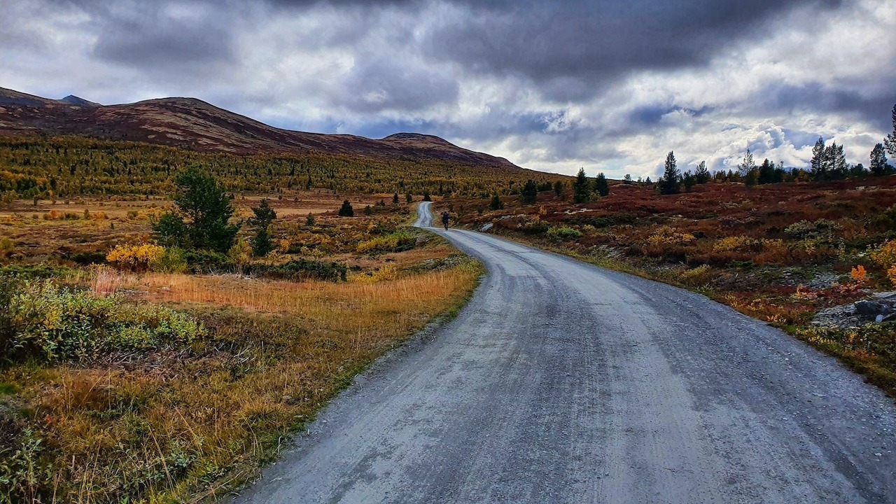
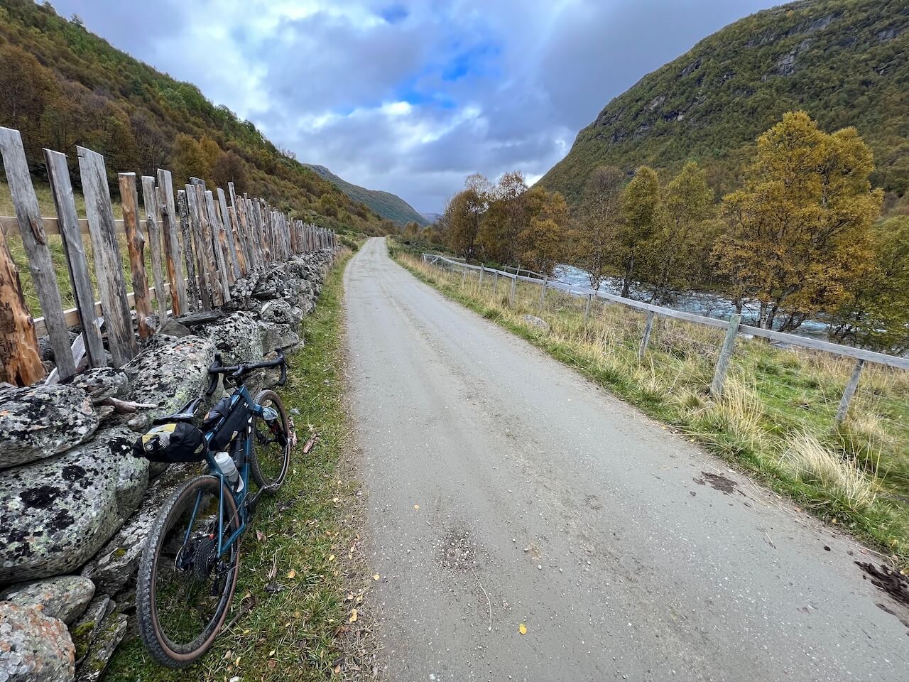
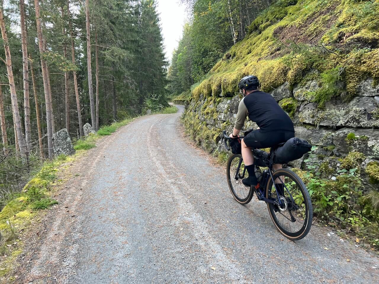
The route follows a mix of gravel roads, historic mountain passes, and quieter backroads that have connected valleys long before tourism existed. More than half of the route is gravel, with options to add quieter detours and spend even more time away from traffic and busy tourist areas.
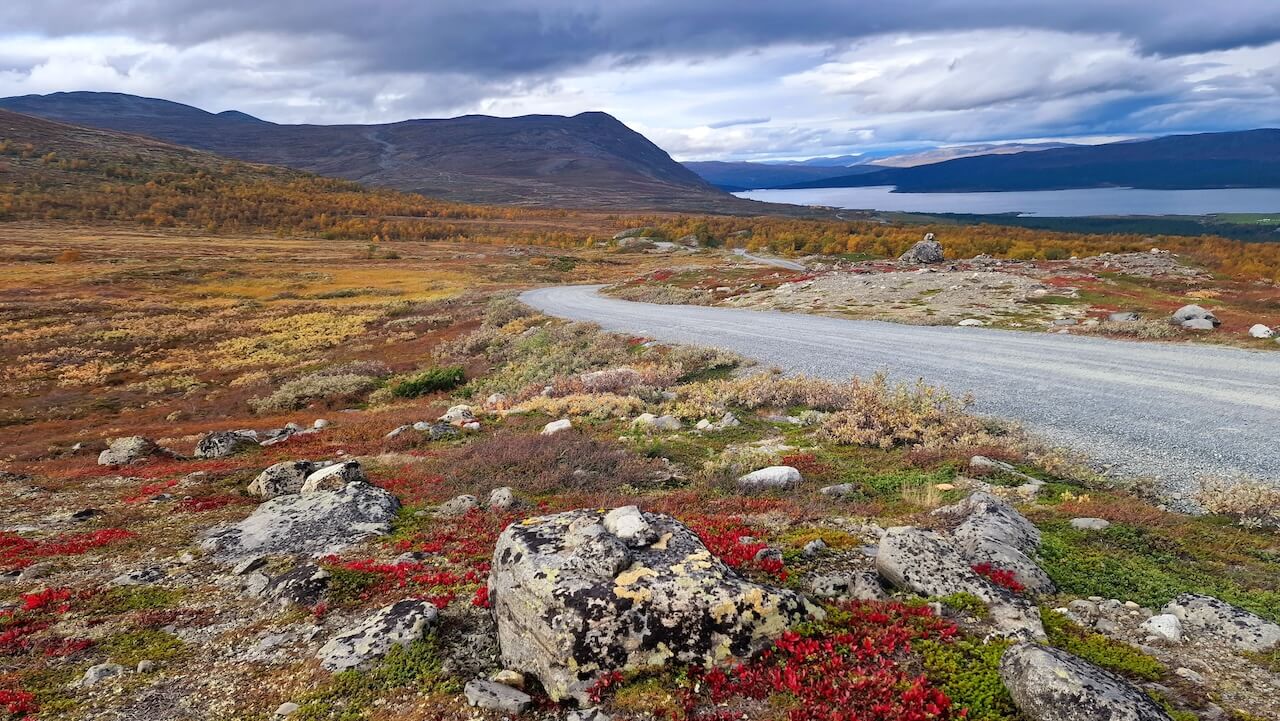
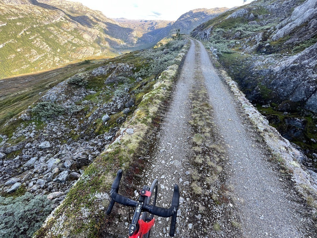
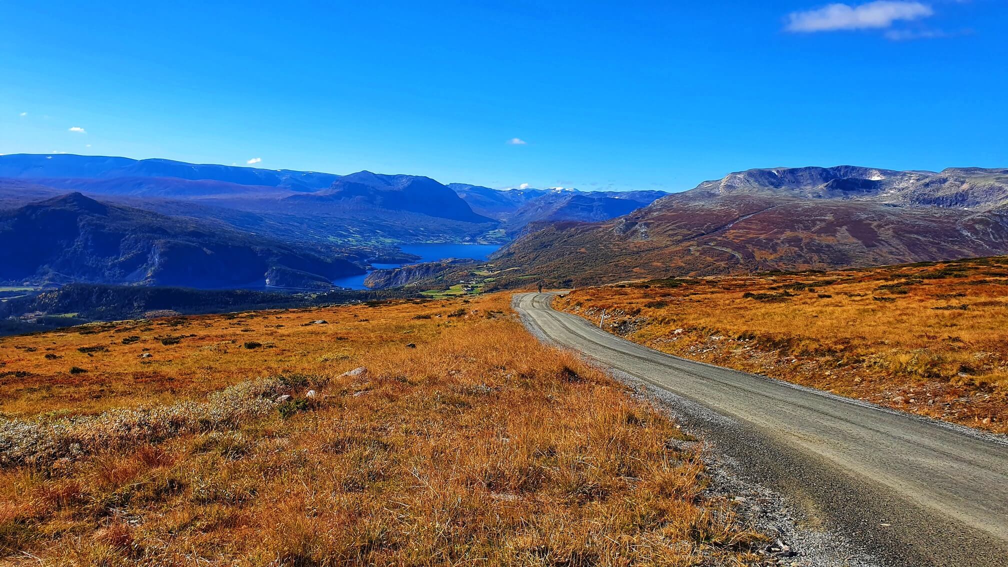
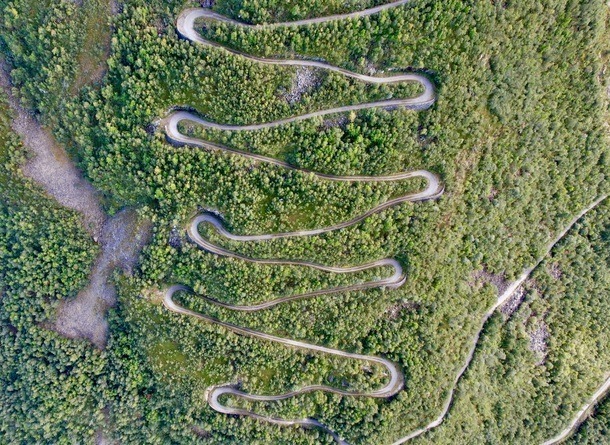
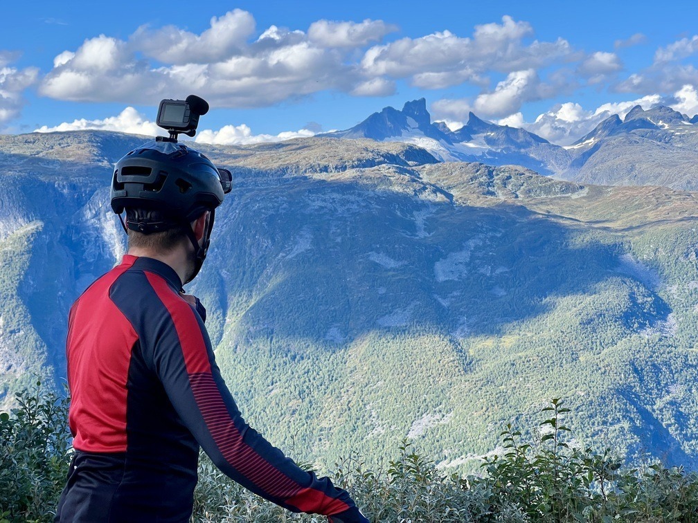
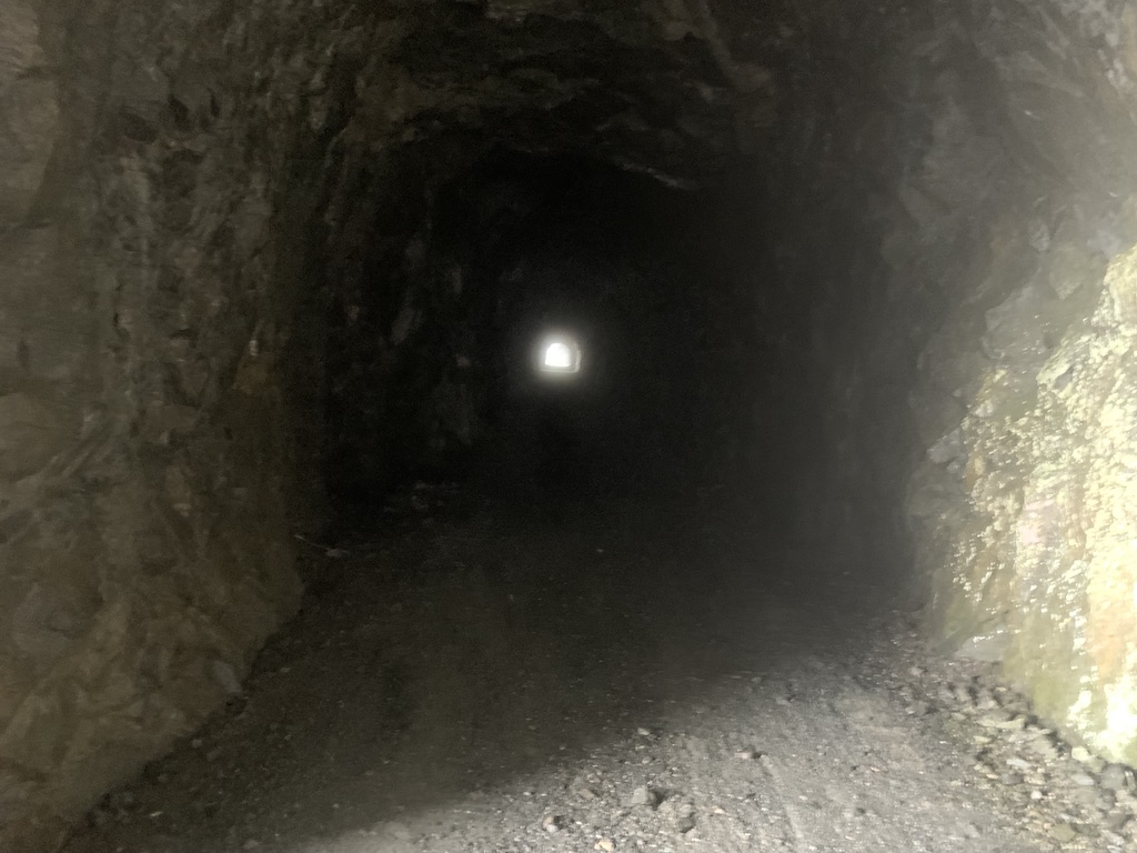
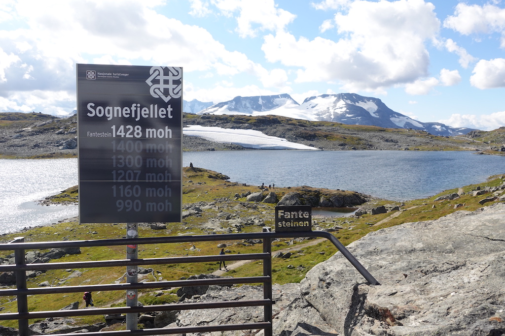
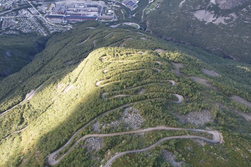
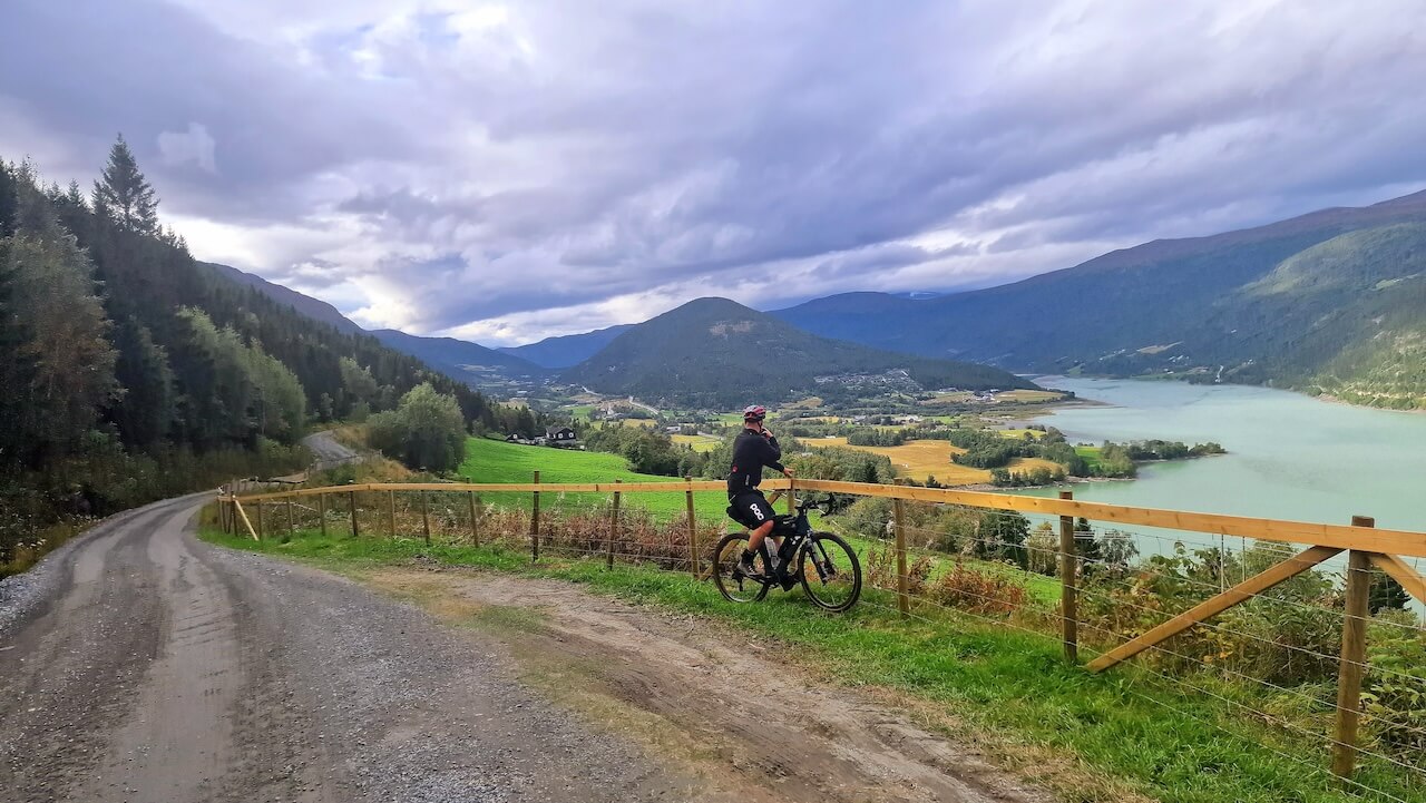
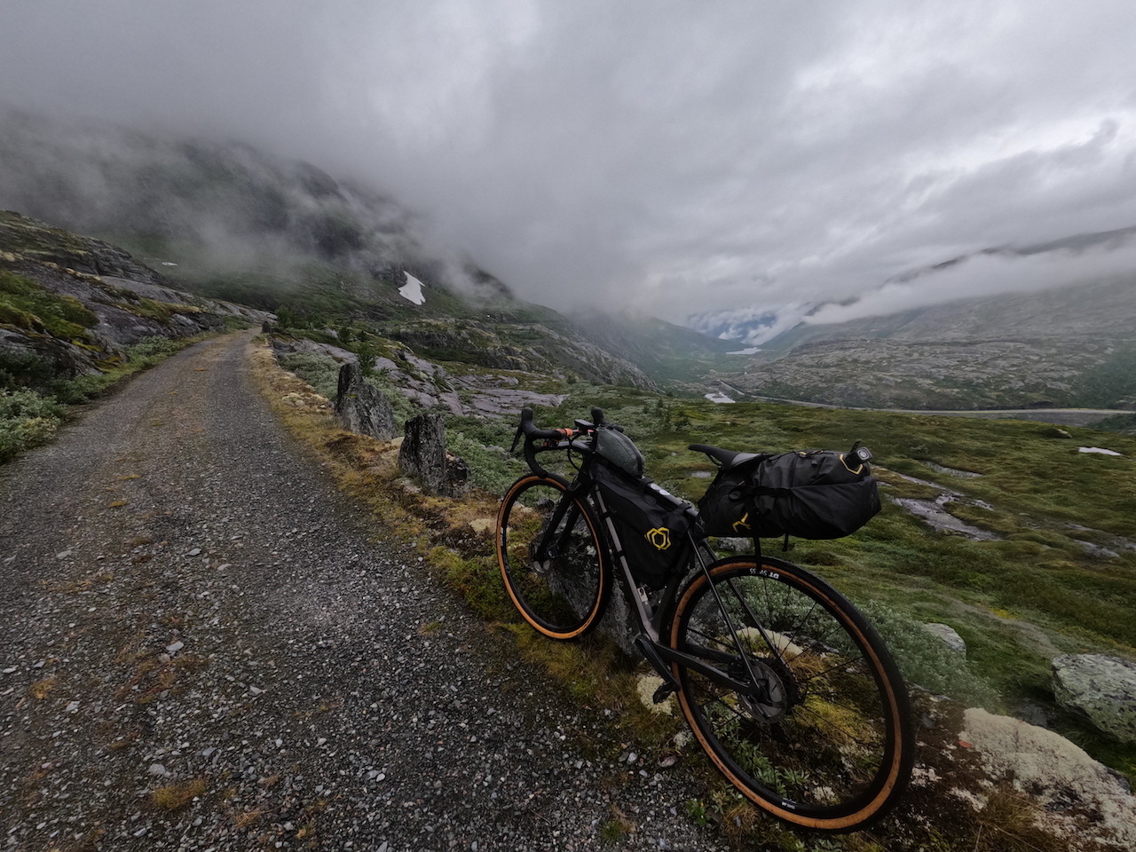
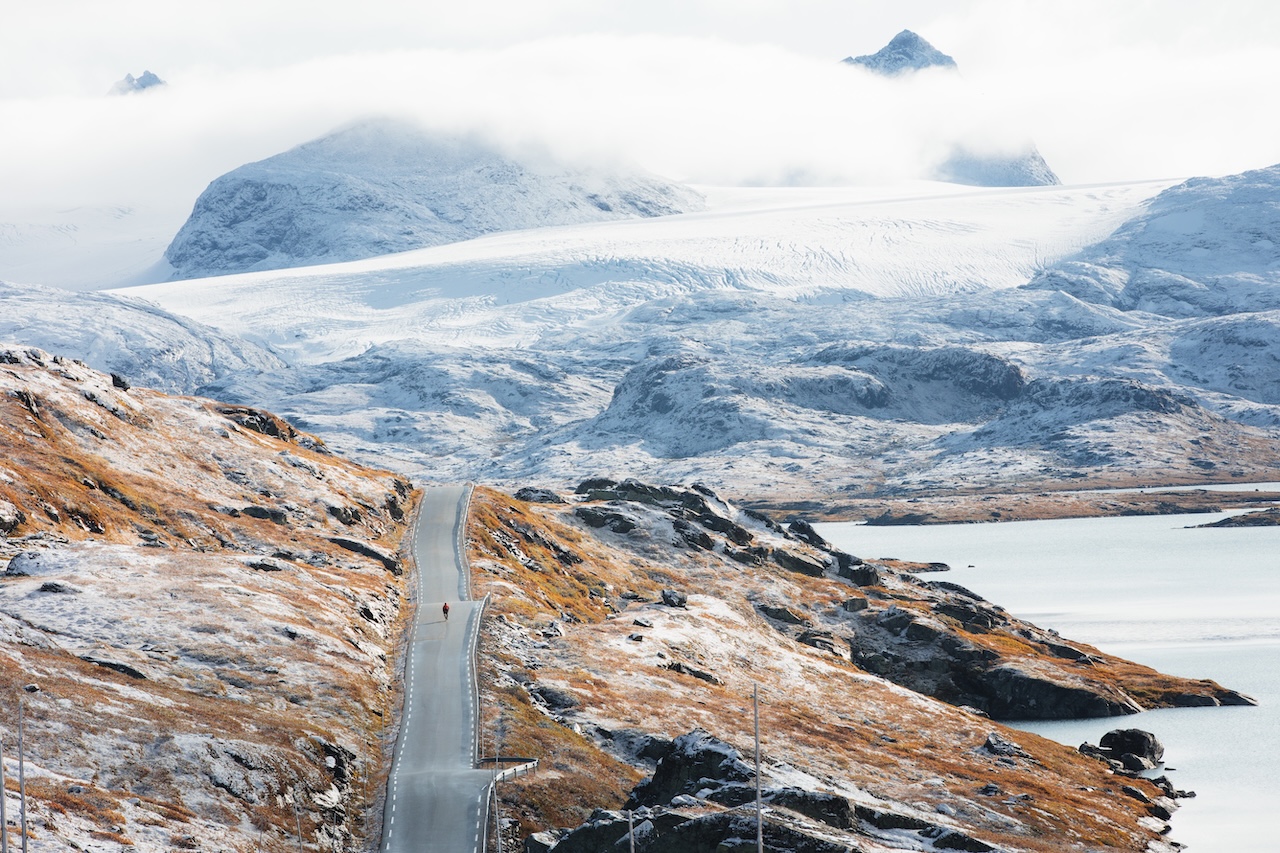
The scenery constantly changes. One moment you are riding beside turquoise lakes and ice-fed rivers, the next crossing barren plateaus or climbing above the treeline with mountains surrounding you from every direction. Highlights include famous roads such as Sognefjellet and Tindevegen, along with Tusenmeteren, a climb gaining 1,000 vertical metres through 42 switchbacks.
This is not an easy route. It is exposed, physically demanding, and the weather can quickly change. But for riders wanting to spend time in one of Norway’s wildest mountain landscapes rather than simply passing through it, few routes offer a better experience.
Routenplan
Wann?
If you want to cycle the full route, you may need to wait until late June or early July to cross Tusenmeteren. However, if you are happy to skip Tusenmeteren by taking the main paved road below, the route can usually be ridden from mid June, or potentially earlier depending on when Jotunheimvegen opens. The route will stay open until late September/early October.
Ankunft
- You can take the bus (Vardresekspressen) from Oslo to Beitostølen by NOR-WAY Bussekpress. Here it’s possible to book space for your bike. https://www.nor-way.no/en/routes/valdresekspressen/
- Another option is to take the train (vy.no) from Oslo or Oslo Airport to Vinstra. Here you can take NGR6, which will connect to this route after about 50km.
Gefahren
Some of the paved sections experience tourist traffic during peak times, and you should expect campervans along scenic roads such as Valdresflye and Sognefjellet.
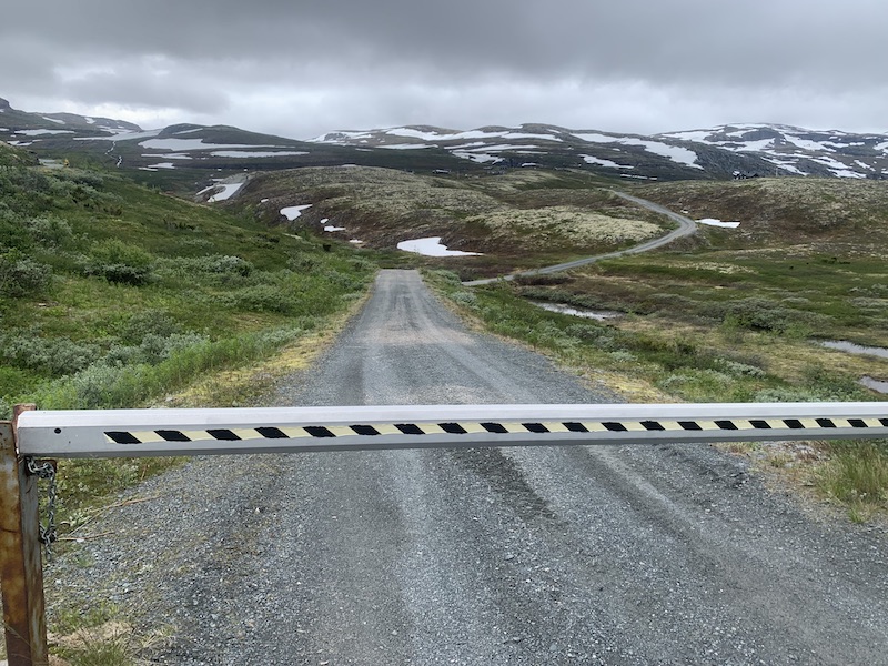
Some gravel sections are rough in places, and if you cycle the route clockwise, the descents from Tusenmeteren and Slettevegen are fast and steep, requiring good bike-handling skills to descend safely.
Fahrradverleih
You will find all bike rental options for the region Hier.

Few places in Europe offer such scale, scope, and beauty as this region of Norway!
Lokale Empfehlungen
Tausendmeter
Perhaps Norway’s most famous gravel road, with dramatic drops to the valley floor as you ride this remarkable route built over 100 years ago.
Sognefjellet
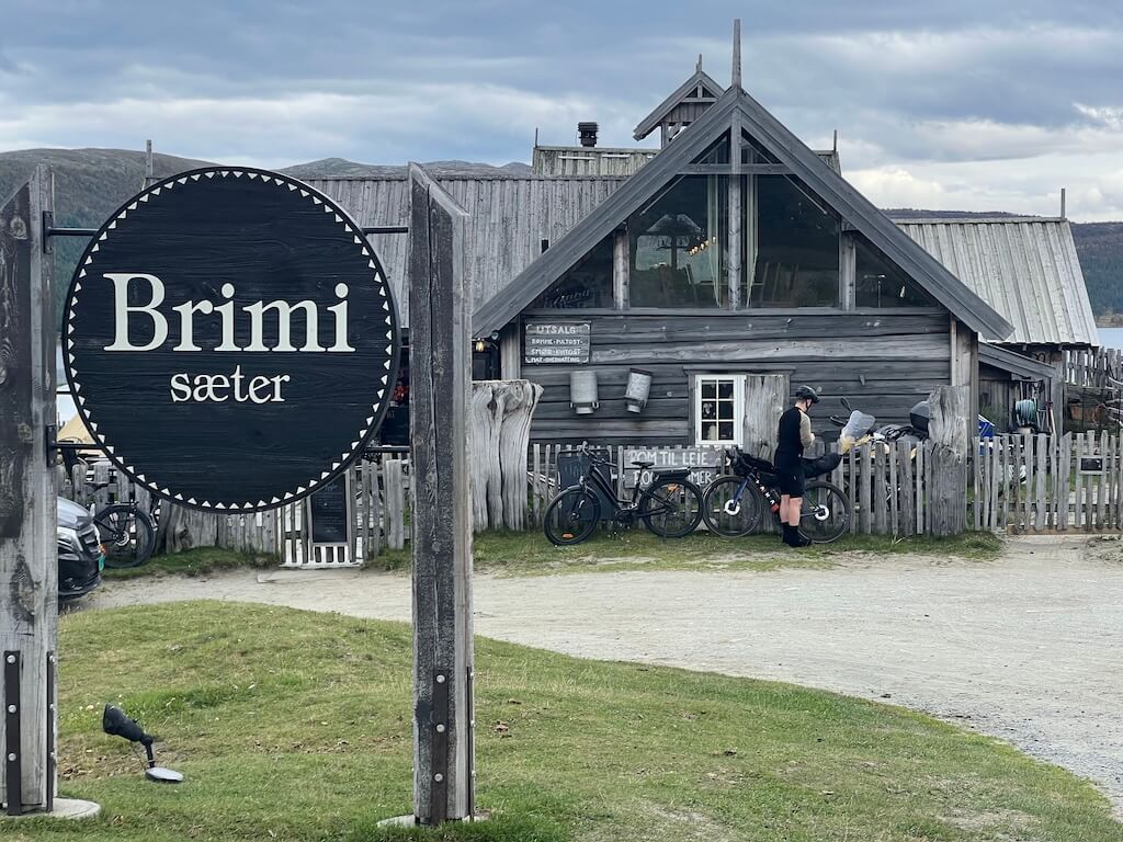
Brimi Seter
Located beside the waters of Tesse along NGR 7, Brimi Seter is one of those places many riders would simply cycle past without realising what they are missing. This traditional mountain farm offers a chance to experience a side of Norway that has changed little over generations.
Expect old timber buildings, local food, homemade cheese, grazing animals, and views towards some of Norway’s highest mountains. After a long day riding remote gravel roads and mountain passes, it is a memorable place to stop, slow down, and experience a quieter side of mountain Norway.
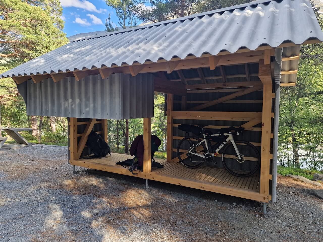
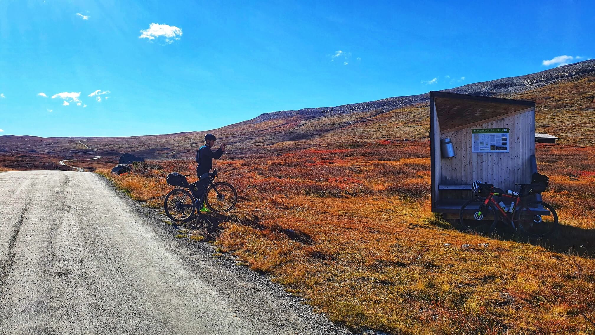
Free Bike Shelter
Along the Scenic Route Sognefjellet, before the heavy climbing begins, a quiet rest area (Liasanden) hidden within the forest sits beside a powerful glacier-fed river. Here you will find two free bike shelters that can be used for overnight stays, along with a public toilet for extra convenience.
Nützliche Links
Booking.com – für Unterkunftsmöglichkeiten in ganz Norwegen
Entur App – zur Planung von Fahrten mit öffentlichen Verkehrsmitteln in ganz Norwegen
Fähren – Routen, Fahrpläne und Informationen von Statens Vegvesen
Wildcamping-Etikette – wichtig zu wissen
Weiterführende Literatur
Beachten Sie
Alle auf CYCLENORWAY.com veröffentlichten Radrouten dienen als Planungsressource und Inspirationsquelle, die Sie in Verbindung mit Ihrer eigenen Recherche und Ihrem Urteilsvermögen nutzen sollten. Die Routen werden mit sorgfältiger Recherche erstellt, aber jeder Radfahrer hat unterschiedliche Fähigkeiten, Erwartungen und Risikobereitschaft. Einige Routen können Abschnitte mit Schiebe-/Tragepassagen, schlammige oder nasse Wanderwege, technisches Gelände, steile Anstiege, Abfahrten oder abgelegene Gebiete enthalten, die möglicherweise nicht für jeden geeignet sind. Routendaten, Kartensoftware und Bedingungen können sich auch ändern oder Ungenauigkeiten enthalten. Radfahren in Norwegen ist im Allgemeinen sehr sicher. Wenn Sie sich dennoch entscheiden, diese Routen zu befahren, tun Sie dies auf eigenes Risiko.


Schreibe einen Kommentar