Quand
Late May - September
Rédigé par
Matthew Tolley
Distance
190 km
Jours
1-3
Point culminant
918m
Difficulté
8/10
Non goudronné
0%
Montée totale
2408m
Ferries
1
Tunnels
4
Any cycling loop that includes a fjord cruise is sure to be good right? Well, that is certainly the case with Lysefjorden loop. This 150km+ ride (190km+ with fjord cruise) is a real highlight of southern Norway and a favourite among road cyclists looking for tough climbs, wild roads and smooth tarmac. It is hard to believe a day ride that begins in a populated area has wild remote roads just around the corner. This is Norway in a nutshell and why ride like this should be on any road cyclists bucklist!
The main highlight, without doubt, is the world-famous 27 switchback climb that starts at sea level and goes up to 883m within 8.7km. There are fantastic views of the fjord and surrounding waterfalls as you get higher and on top, it feels like another world compared with the green lush valley below.
You can start anywhere along the loop but I would recommend Stavanger, Sandnes, or Ålgard for a wide range of accommodation options and perhaps Lysebotn or Sirdal if you want to camp in beautiful nature. The first thing you need to decide is whether to ride Lysevegen (the 900m climb) up or down? You should also consider the weather and wind conditions as things change quickly in this mountainous area. I wanted to ride up Lysevegen so I headed clockwise. If you head counter-clockwise you begin with a steady climb through Sirdal Valley and then a much tougher section onto Suleskarvegen (famous mountain pass road).
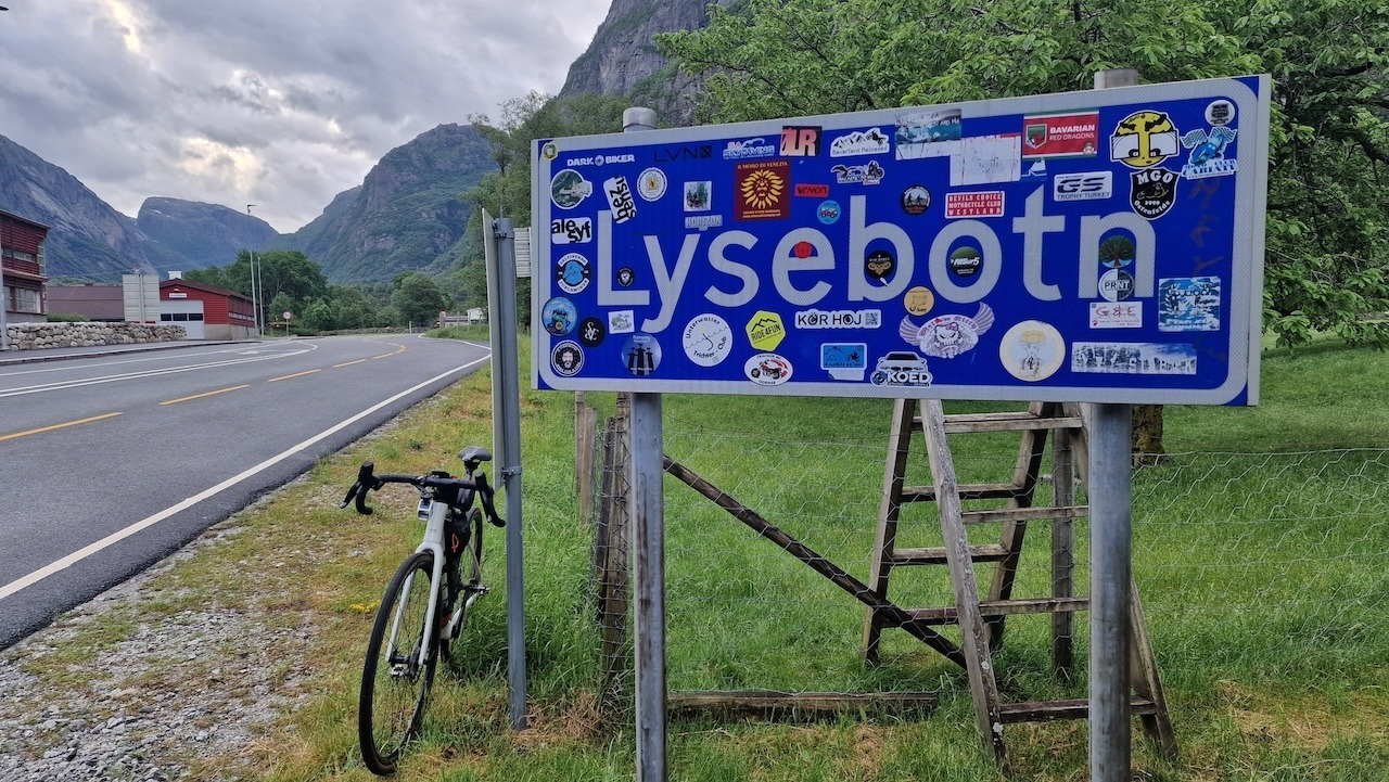
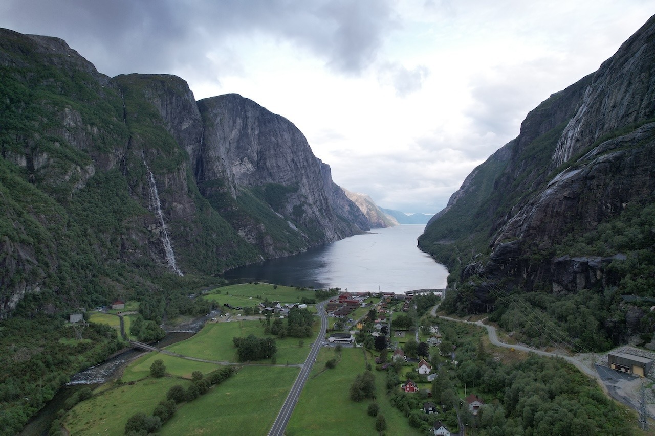
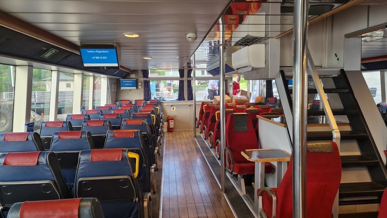
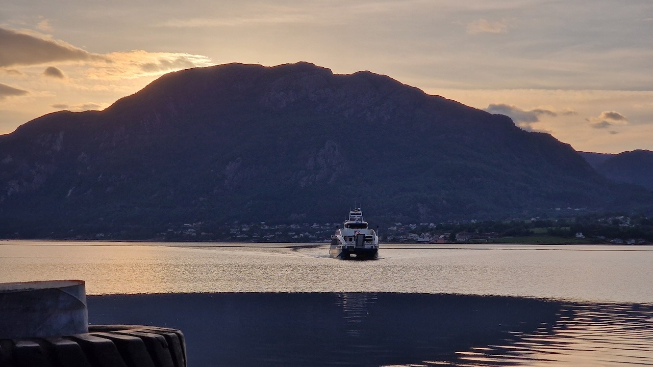
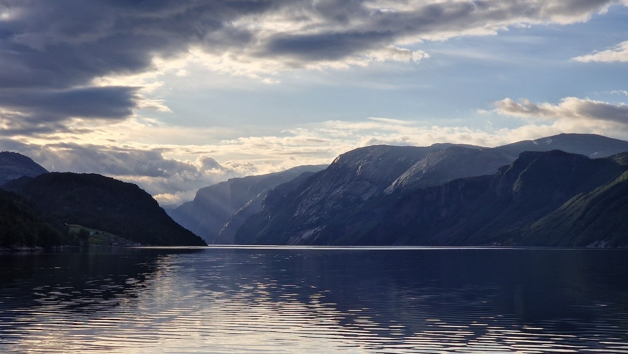
Heading clockwise the roads to the ferry port are reasonably flat with one small climb before descending to the fjord. Local and Tourist traffic can be an issue in the afternoon so consider starting early to ensure quiet roads to Lysefjorden. There are usually 2 to 3 passenger ferries a day to Lysebotn the small village that sits at the end of the fjord. From there, you have plenty of accommodation options and a few cafes to grab a drink or snack before the big climb (open around 10am).
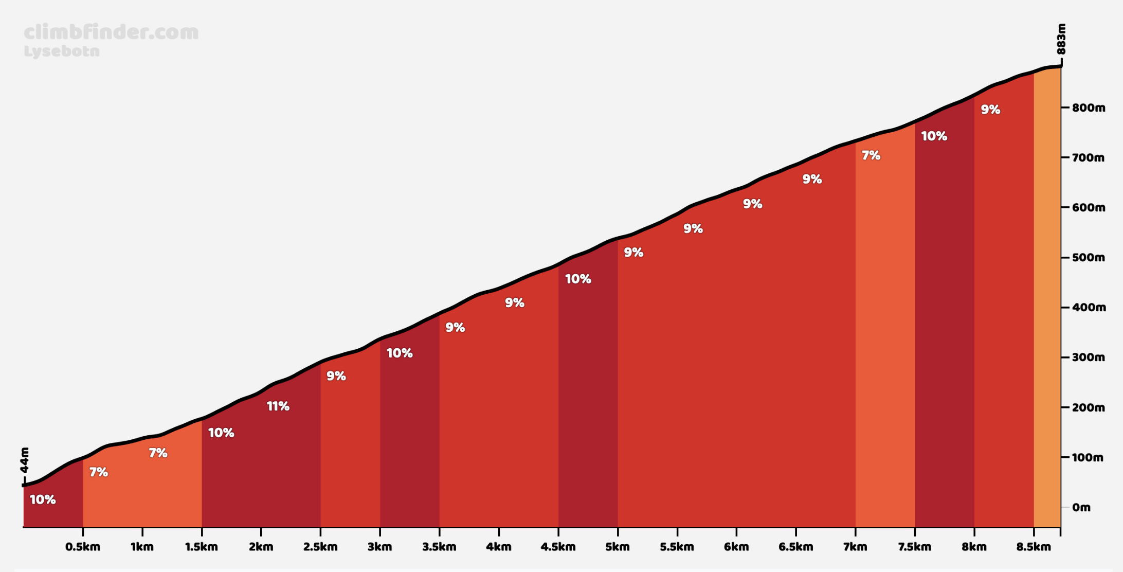
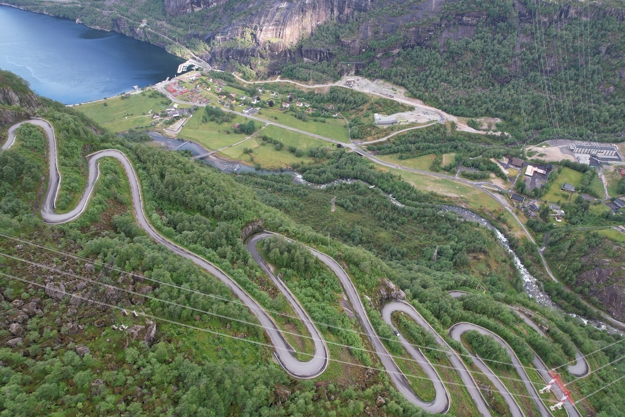
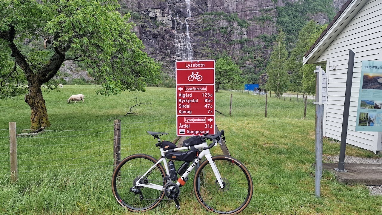
Straight out of the village is the start of Lysevegen where 27 switchbacks will take you from sea level to 883m in just 8.7km. It begins with a 1.1km single-lane tunnel with a horseshoe corner in the middle. Ensure you have lights as the tunnel is not well-lit. The climb has an average gradient of 9.6% but feels less due to the short length of each section of the road. I found it easier than other major climbs in Norway and feel it looks harder than it is.
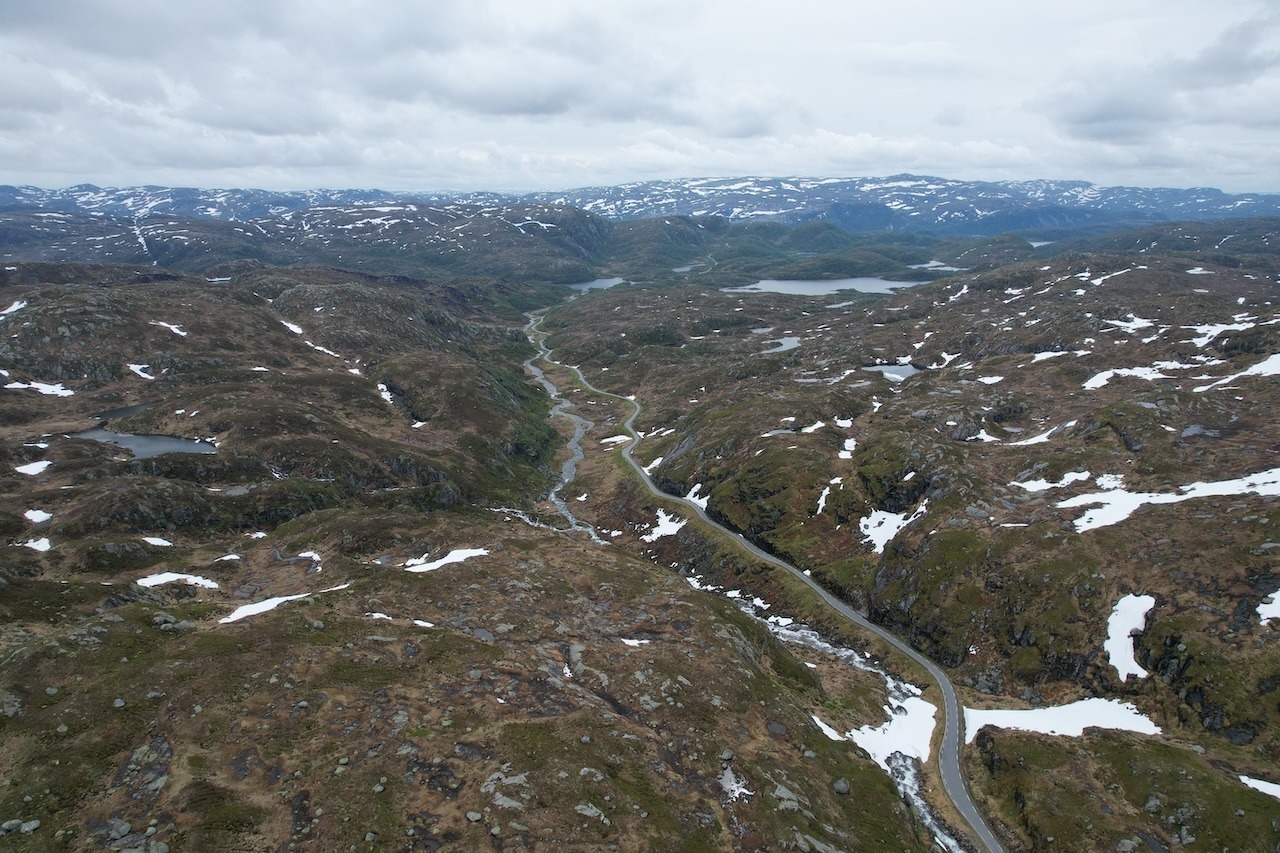
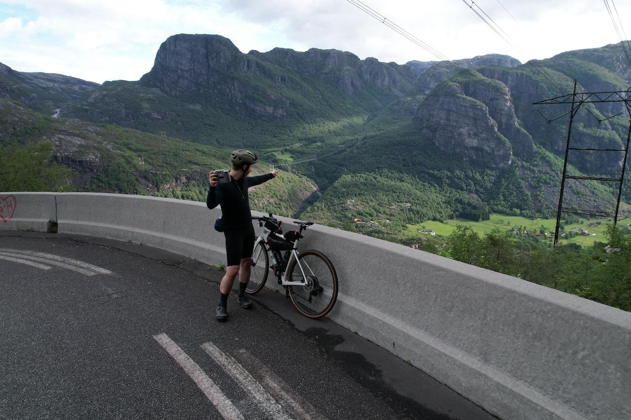
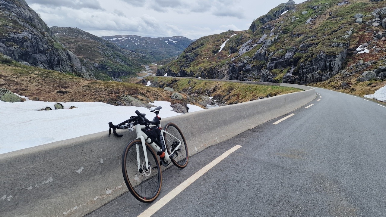
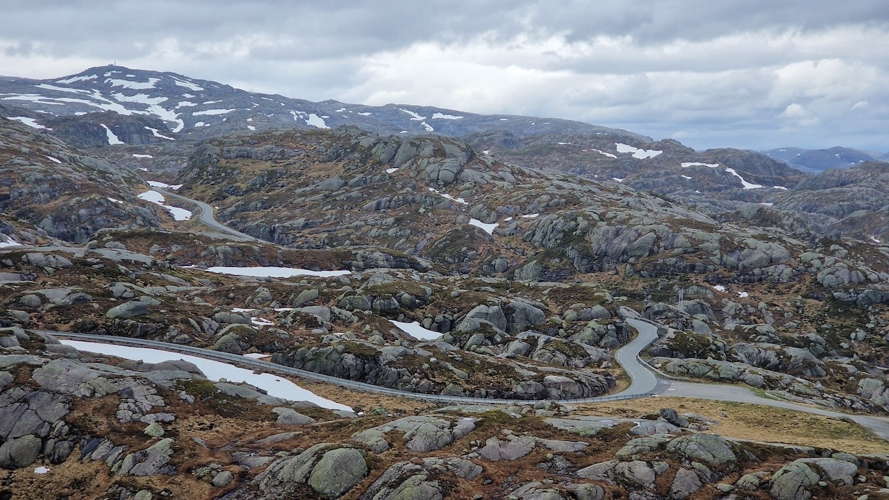
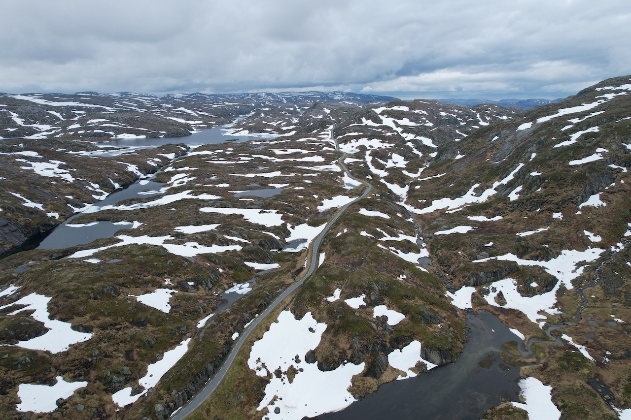
On top, you will find a tourist centre where the hike to the famous Kjerg mountain begins. The road continues to climb for several more kilometres along a difficult terrain. Expect small ups and downs and on unsettled days it will be cold and windy. After 20km of a barren rocky world, you’ll slowly descend into a greener landscape. There you’ll find a small settlement with a local shop and gas station where you can pick up supplies and enjoy a hot drink.
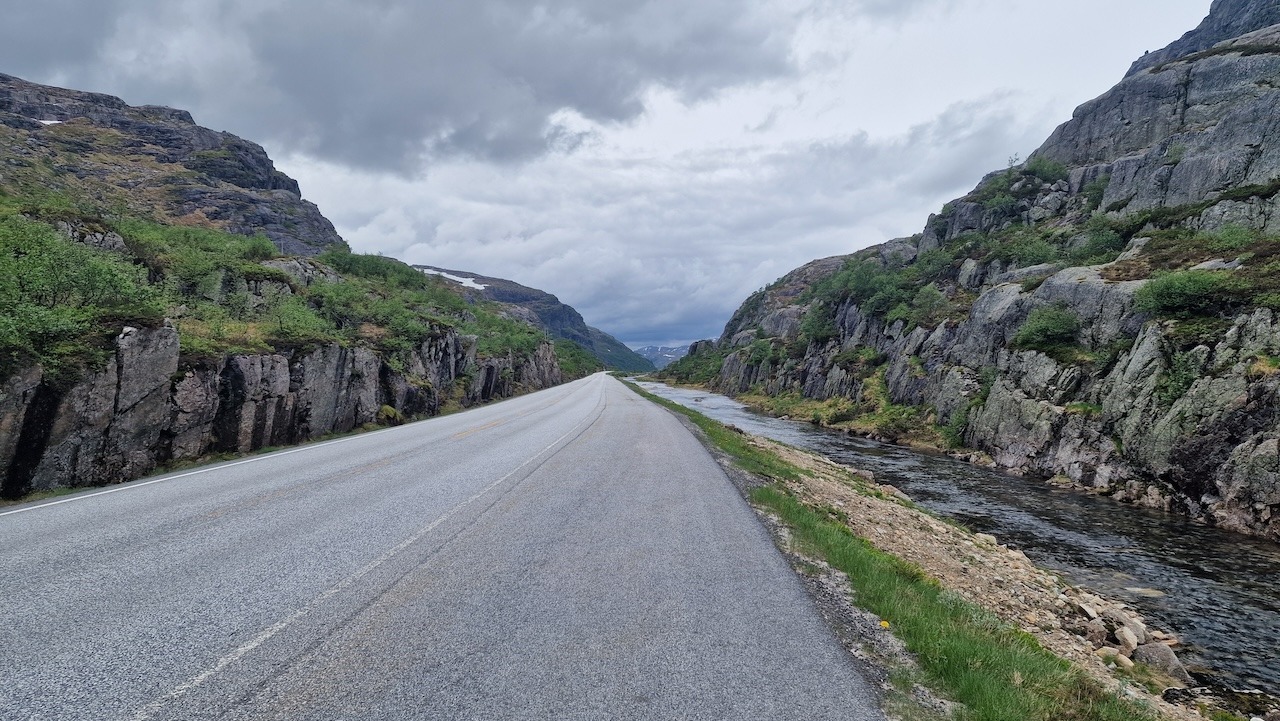
You are now heading back towards Stavanger and the road is straight and long for several kilometres. Another mountainous scene surrounds you as you drop down into Sirdal Valley. If you like you can take a small detour to Gloppedalsura Magma geopark which offers a unique rocky landscape left behind by the last ice age.
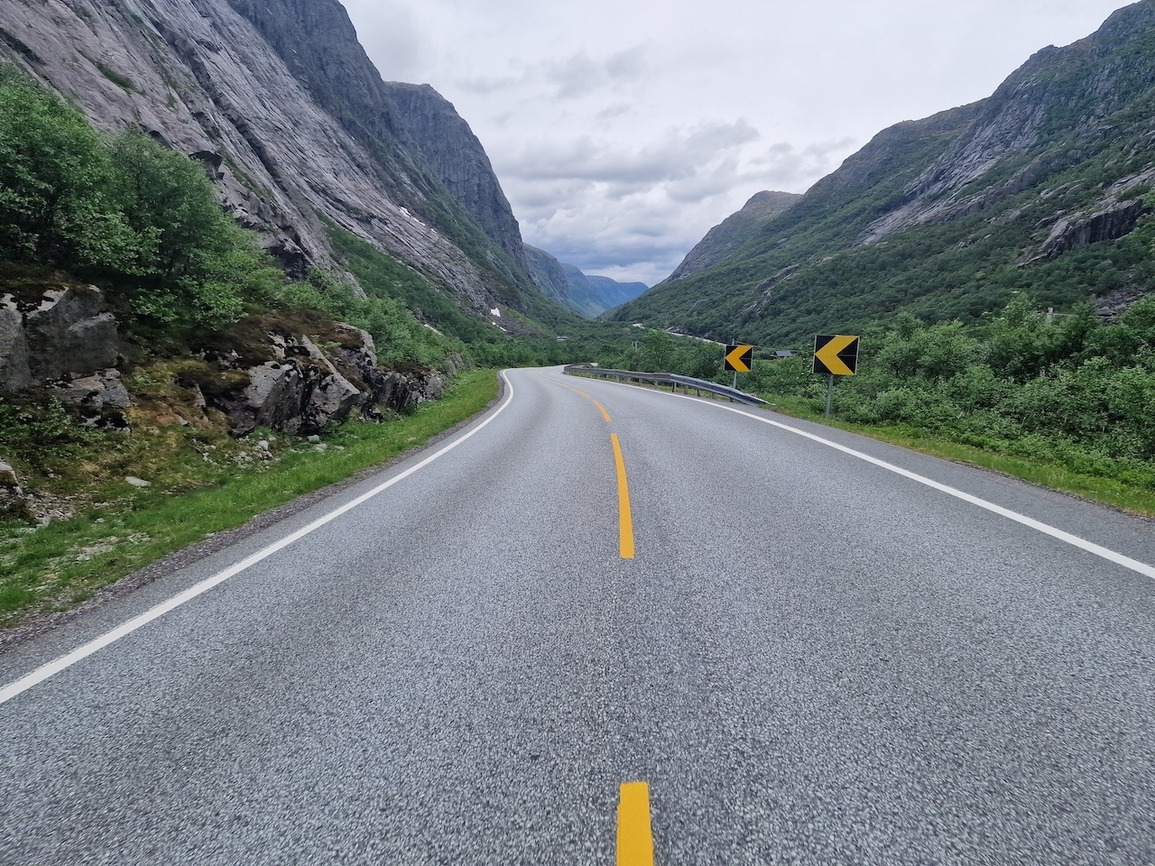
As you start to get closer towards the populated areas of the west coast there are three 600-700m tunnels to pass through. Expect some traffic as you get closer to Sandnes but cycle lanes soon appear and prevent you from cycling on the main road and make the last stretch comfortable as you enter the built-up areas around Stavanger.
If you want to add an extra 50km+ and skip some of the ferry journey down Lysefjorden you can extend the journey as explained on this map. Starting in Sandnes or Ålgard you will cycle around the back of Lysefjorden and head over a mountain road to Songesand. The Ferry must be booked in advance from Songesand kai to Lysebotn.
Similar route but starts in Stavanger where you take the passenger ferry to Tau and join the route from there.
Just off the main route is a detour to an old abandoned mountain road that leads you to Frafjord. The views are spectacular and the road car-free. It closed in 1999 to traffic.
Famous Hikes in the area (locations highlighted on map above)
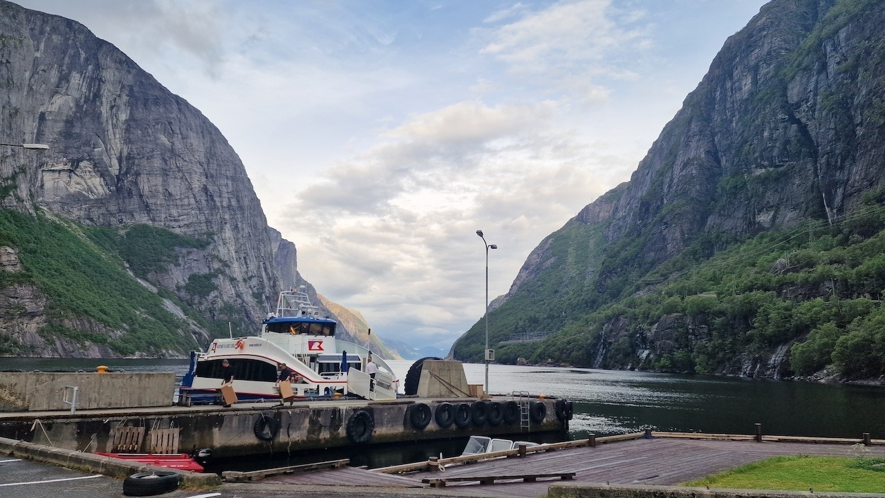
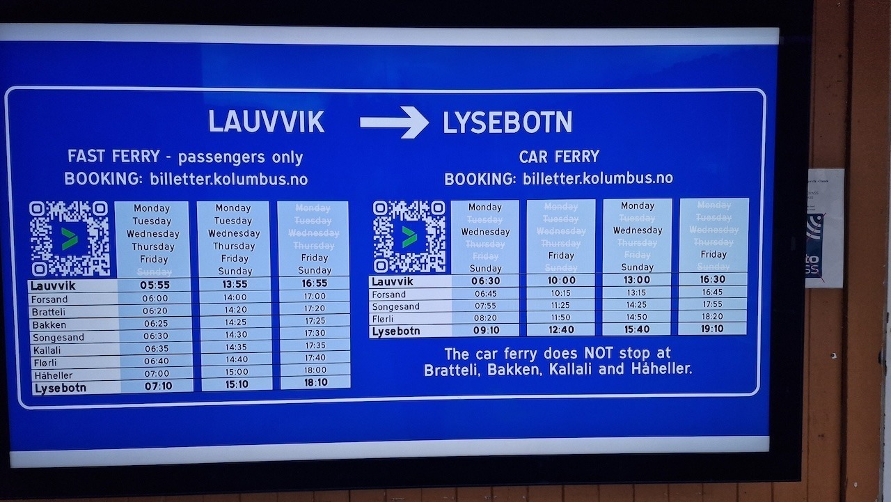
Lauuvik to Lysebotn (75mins) 180kr (17 euros) with bike (in 2024). Passenger-only ferry: 2 a day during the week and three at the weekends. The Car ferry is a bit confusing on when it travels (Monday, Wednesday, Friday & Sunday). You are welcome to take this ferry with your bike for a similar price. See the timetable below.
Stavanger – Tau: Express ferry across the fjord should you prefer to take the longer route from Stavanger centre.
There are four tunnels on the route. Good lights and a reflective vest are essential.
Remarque : There are plenty of cycle lanes connecting Stavanger – Sandnes – Ålgard making it easy to cycle in the populated areas. The Stavanger region won a prize in 2022 for its improving cycle lane infrastructure.
This is one of the wettest regions of Norway and Lysefjorden is renowned for changing weather patterns. I would not cycle this route if the forecast is very bad with a high percentage of precipitation. The mountain pass road of Suleskarvegen can be very cold and windy. Winter gloves, shoe covers, a wool base layer and wind/waterproof clothing are essential when the weather is unsettled. Even on sunny days, things can change quickly and you should be well prepared with extra clothing in your bag. Never underestimate this region’s climate better to over-prepare than left freezing at 1000m.
Le Finnmark possède lui aussi une certaine mystique. Situé à peu près à la même distance d'Oslo qu'Istanbul, c'est en quelque sorte la dernière étape avant le pôle Nord. Le point culminant du voyage est sans aucun doute le fait de parcourir à vélo les étendues sauvages de la dernière grande région sauvage d'Europe. On se sentira très seul ici, mais n'est-ce pas là une raison de faire du vélo ? Les cartes thermiques du monde sont pleines de routes bien roulantes. Ici, vous rejoindrez un petit groupe de cyclistes à la recherche de quelque chose d'extraordinaire. Passer devant des troupeaux de rennes sauvages et peut-être ne pas voir d'autres humains pendant plusieurs heures, c'est la raison pour laquelle vous êtes venu, n'est-ce pas ? La randonnée s'achève dans la ville de Kirkenes, où l'on trouve des panneaux routiers russes. Cela indique que vous avez atteint les limites du monde occidental !
Tous les itinéraires cyclables publiés sur CYCLENORWAY.com sont simplement une ressource de planification à utiliser comme point d'inspiration en conjonction avec votre propre diligence. Tous les itinéraires ont été préparés à la suite d'une recherche diligente. Cependant, nous ne pouvons jamais garantir avec certitude l'exactitude complète des itinéraires. Le cyclisme en Norvège est en général très sûr. Néanmoins, si vous décidez d'emprunter cet itinéraire, vous le faites à vos risques et périls.
Regardez cette vidéo utile pour voir comment les itinéraires peuvent être téléchargés sur votre appareil mobile et votre ordinateur de vélo.
Faire du vélo sur une longue distance est difficile, et vous ne devriez pas tenter des itinéraires qui sont au-dessus de votre niveau.
Si vous constatez des inexactitudes sur cette page, veuillez nous en faire part afin que nous puissions les corriger.
non intrusif, offrant des nouvelles informatives, des articles de blog, des vidéos et plus encore.