[gtranslate]

Those that embark on the Norwegian part of Eurovelo 1 will follow in the footsteps of countless other adventure cyclists that have for decades strapped bags to a bike and decided to cycle to the top of Europe. We have broken the long journey into five stages. Each stage is special and unique. The flattest sections are Stages 2 and 3. The most challenging sections are Stages 4 and 5 in the Arctic, and Stage 1 will offer something for everyone. If you plan to cycle only one stage, you may have a hard time selecting the right route. Our in-depth look at each stage will hopefully help you with your decisions.

The Norwegian Atlantic coast is perhaps the most beautiful on the planet. There is no end to nature’s beauty as you cycle up or down it. However, as we know, nature is in fine balance, you can not have all this beauty without some pain. Everyone I know who has cycled the full length of this journey has experienced at least one, or probably more, days of difficult weather where a mixture of headwinds, heavy rain, and cold temperatures make every kilometer a real struggle. You can of course sit days like this out but for many waiting around every time the weather turns bad is not on their adventure tick list.
Experiencing unsettled weather is the nature of the beast on the west coast of Norway. It’s a badge of honor for the intrepid cyclist. I don’t regret any tough day I’ve experienced on the road. When the sun returns it’s like a new beginning and you will appreciate every bird singing, every lake glistering, and every clear peaked mountain on the horizon. It’s only when something is gone will you truly appreciate its return. If you can start your journey with the mindset that nature is the master and we are only its servants. You’ll find peace on the windiest and wettest days and be in euphoria on the sunny ones.

If you’re not on a tight schedule there are many detours to consider. Few people know about the incredible roads to Hoddevik or Vestkapp between Bergen and Ålesund. The world heritage island of Vega just south of the Arctic Circle or the picture-perfect island of Rødøy has one of the best views of the Atlantic Coast. There are small side roads on Lofoten that no one takes and above Tromsø is an undiscovered wonder of the North that can be reached by local and sometimes unknown ferries. It’s taken years of research and explorations to know about these areas and in the membership area, you will get the what, where, why, and how to add extra spices to your epic journey.

I have a running joke there are no flat roads in Norway but actually, there are and they are mostly situated on this route! The highest climb is only 500m and is located just north of Bergen. There are 5 more at an elevation of 300-400m. All things considered, this is very little for a 2000+ km route. It is hilly or bumpy in places and for those not used to Norwegian terrain, it can feel tough during the first week. However, the long section from Brønnøysund to Senja is remarkably flat. Indeed on Lofoten, there is only one point where the road reaches 100m. The wind on the other hand is perhaps the toughest challenge for those that head south against the prevailing winds. Many areas are sheltered but some places are not and on unsettled days it will take a few kilometers off your average speed.
For those considering using an e-bike and perhaps concerned about their fitness ability. I think you’ll find it more comfortable than you think. Not one section has a rating higher than 5/10 and thus it should be accessible to many people. I’ve had letters from people with severe physical disabilities that managed to cycle 30km a day and reached the top before the end of September. You can read about one of these stories in our membership section.
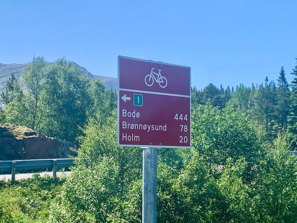
This route is part of the larger Eurovelo 1 that runs from Norway, the UK, Ireland, France, and Spain and ends on the coast of Portugal. Most of the route is signposted but unfortunately, there are still areas missing signs. The signs are reddish-brown with route 1 highlighted in a green box. On some signs in the south, you will also see the European Flag indicating Eurvelo 1. More signs will go up as the Norwegian government continues its cooperation with the Eurovelo network but don’t rely on them just yet. Ensure you have the route loaded on your phone or cycle computer.
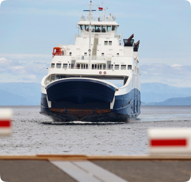
With nearly 30 ferry crossing requirements you will rely heavily on public transport. Norway’s ferry system is very efficient and modern and timetables usually work like clockwork. If you only want to experience certain sections of the route it’s very easy to use Norway’s vast array of cruiseliners and local express boats to take you up or down the coast with your bike. There are also local buses connecting the small towns and villages and they have come to my rescue before when mechanical problems left me stranded. We should note there are no train tracks between Bergen and Trondheim. From Trondheim to Bodø the train line follows the E6 main road and is not ideal to use when 50km+ away on the coast.
Lastly, there are airports all the way along the coast, and local domestic flights can be used especially when figuring out how to get home again after reaching the end. Information about getting to and from the start and finish points is found on the specific route pages.
Cycle Norway is dedicated to making Norway, safer and more enjoyable to experience by bike and to inspire and inform a growing audience of the opportunities available.
© Copyright 2023 CYCLENORWAY.com / all designs, text, photos (unless stated), & articles are property of CYCLENORWAY.com
© Copyright 2023 CYCLENORWAY.com / all designs, text, photos (unless stated), & articles are property of CYCLENORWAY.com
Subscribe To Our Monthly Newsletter